|
|
|
0 members (),
2,324
guests, and
25
robots. |
|
Key:
Admin,
Global Mod,
Mod
|
|
S |
M |
T |
W |
T |
F |
S |
|
1
|
2
|
3
|
4
|
5
|
6
|
7
|
|
8
|
9
|
10
|
11
|
12
|
13
|
14
|
|
15
|
16
|
17
|
18
|
19
|
20
|
21
|
|
22
|
23
|
24
|
25
|
26
|
27
|
28
|
|
29
|
30
|
|
|
|
|
|
|
There are no members with birthdays on this day. |
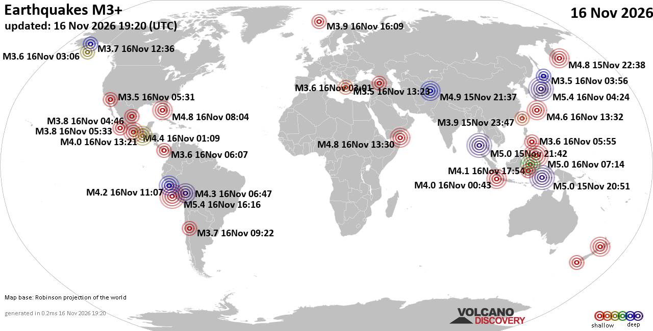
World Earthquake Report for Monday, 16 November 2026
• Moderate mag. 4.5 earthquake - 160 km northwest of Kavieng, New Ireland Pro...
• M 4.4 - off the coast of Oregon
• M 2.3 - 14 km ESE of Clam Gulch, Alaska
• M 3.9 - Rat Islands, Aleutian Islands, Alaska
• M 1.8 - 8 km NW of Round Valley, CA
• M 0.7 - 9 km S of Idyllwild, CA
|
|
|
Joined: Feb 2001
Posts: 800,656
Launch Director
|
|
Launch Director
Joined: Feb 2001
Posts: 800,656 |
SPC Nov 15, 2026 0830 UTC Day 3 Severe Thunderstorm OutlookSPC 0830Z Day 3 Outlook 
Day 3 Convective Outlook
NWS Storm Prediction Center Norman OK
0228 AM CST Sun Nov 15 2026

Valid 171200Z - 181200Z

...NO SEVERE THUNDERSTORM AREAS FORECAST...

...SUMMARY...
Severe thunderstorms are unlikely Tuesday.

...Synopsis...
The upper trough over the West Coast is forecast to move eastward
across the Southwest and into the Rockies Tuesday. An associated
surface low will deepen over the central/northern High Plains
supporting increasing southerly flow over the Southwest. While still
quite limited, some increase in surface moisture is expected ahead
of the trough and cold front. The increasing ascent and cooler
mid-level temperatures should be sufficient for weak destabilization
and isolated thunderstorms Tuesday afternoon into early Wednesday
across the Four Corners and Western Slope. Given the expected very
weak buoyancy, severe storms are not anticipated.

Late Tuesday into early Wednesday a second upper low and associated
cold front will approach the West Coast. Weak buoyancy is again
forecast across northern CA and OR, which may be sufficient to
support occasional lightning.

To the east, strong high pressure will remain entrenched across the
Midwest with offshore flow and dry/stable conditions dominating much
of the US. The exception will be across the southern and eastern
peninsula of Florida. Here, onshore flow may allow for modest
destabilization with a few thunderstorms possible along the sea
breeze through the afternoon. Severe storms are unlikely.

..Lyons.. 11/15/2026
Read morehttps://www.spc.noaa.gov/products/outlook/day3otlk_0830.html
|
|



CMS The Best Conveyancing solicitors conveyancing quotes throughout the UK
For any webhosting enquiries please email webmaster@aus-city.com
|
|
Entire Thread
|

 SPC Nov 15, 2026 0830 UTC Day 3 Severe Thunderstorm Outlook |
Webmaster
|
Yesterday at 08:29 AM
|
|
Forums60
Topics930,716
Posts965,513
Members2,960
| |
Most Online102,106
Jul 10th, 2026
|
|
|
|
|

|









































