|
|
|
0 members (),
2,668
guests, and
24
robots. |
|
Key:
Admin,
Global Mod,
Mod
|
|
S |
M |
T |
W |
T |
F |
S |
|
1
|
2
|
3
|
4
|
5
|
6
|
7
|
|
8
|
9
|
10
|
11
|
12
|
13
|
14
|
|
15
|
16
|
17
|
18
|
19
|
20
|
21
|
|
22
|
23
|
24
|
25
|
26
|
27
|
28
|
|
29
|
30
|
|
|
|
|
|
|
There are no members with birthdays on this day. |
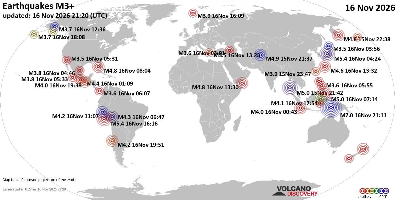
World Earthquake Report for Monday, 16 November 2026
• M 6.6 - 151 km WSW of Tual, Indonesia
• M 0.6 - 18 km ESE of Anza, CA
• M 1.3 - 23 km ENE of San Ardo, CA
• M 2.1 - 17 km SE of Leilani Estates, Hawaii
• M 1.9 - 96 km N of Yakutat, Alaska
• M 1.7 - 17 km SSW of Newport Beach, CA
|
|
|
Joined: Feb 2001
Posts: 800,656
Launch Director
|
|
Launch Director
Joined: Feb 2001
Posts: 800,656 |
SPC Nov 16, 2026 1930 UTC Day 3 Severe Thunderstorm OutlookSPC 1930Z Day 3 Outlook 
Day 3 Convective Outlook
NWS Storm Prediction Center Norman OK
0117 PM CST Mon Nov 16 2026

Valid 181200Z - 191200Z

...NO SEVERE THUNDERSTORM AREAS FORECAST...

...SUMMARY...
Severe storms are not expected Wednesday.

...Synopsis...
Cool and stable conditions will preclude thunderstorm activity for
much of the country on Wednesday. An upper wave currently moving
into the northern Gulf will stall to the west of the FL peninsula
through mid-week. South/southwesterly flow within the warm advection
branch of the cyclone will promote northward moisture flux along the
peninsula and support scattered to widespread showers and
thunderstorms through the day. Weakening mid-level winds through the
period will limit deep-layer shear and the potential for organized
convection.

Across the Plains, a surface low will intensify in tandem with the
passage of an upper wave. Very modest moisture return ahead of a
tightening surface trough/dryline, coupled with cool mid-level
temperatures aloft, may support adequate buoyancy for shallow
convection. While confidence in thunderstorm potential is limited,
the QPF signal along the surface boundary was sufficient to maintain
thunder probabilities (refined to where guidance depicts the
greatest overlap of buoyancy and an appreciable QPF signal).

Along the West Coast, an upper wave will begin impinging on the
OR/northern CA coast early Wednesday morning. Cold temperatures
aloft will likely support isolated to scattered thunderstorms along
and just off the coast - especially within plume of higher theta-e
air that is forecast to move onto the northern CA coast through
mid-day. Strongly sheared wind profiles may support a few stronger
cells off the coast, but it is unclear whether these storms will
maintain intensity as they move onshore where surface-based buoyancy
should diminish precipitously.

..Moore.. 11/16/2026
Read morehttps://www.spc.noaa.gov/products/outlook/day3otlk_1930.html
|
|



CMS The Best Conveyancing solicitors conveyancing quotes throughout the UK
For any webhosting enquiries please email webmaster@aus-city.com
|
|
Entire Thread
|

 SPC Nov 16, 2026 1930 UTC Day 3 Severe Thunderstorm Outlook |
Webmaster
|
Yesterday at 07:18 PM
|
|
Forums60
Topics930,953
Posts965,750
Members2,960
| |
Most Online102,106
Jul 10th, 2026
|
|
|
|
|

|









































