|
|
|
0 members (),
1,936
guests, and
27
robots. |
|
Key:
Admin,
Global Mod,
Mod
|
|
S |
M |
T |
W |
T |
F |
S |
|
1
|
2
|
3
|
4
|
5
|
6
|
7
|
|
8
|
9
|
10
|
11
|
12
|
13
|
14
|
|
15
|
16
|
17
|
18
|
19
|
20
|
21
|
|
22
|
23
|
24
|
25
|
26
|
27
|
28
|
|
29
|
30
|
|
|
|
|
|
|
There are no members with birthdays on this day. |
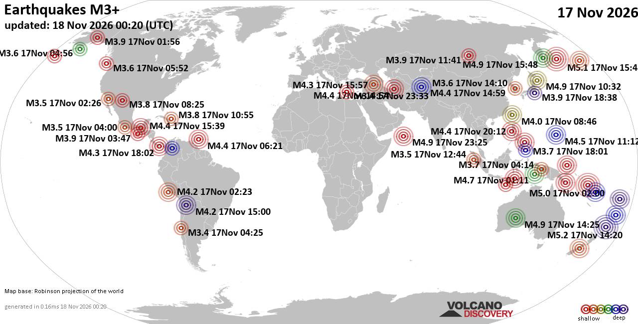
World Earthquake Report for Tuesday, 17 November 2026
• M 2.7 - 89 km ENE of Ouzinkie, Alaska
• M 2.4 - 4 km SW of Madera Acres, CA
• M 2.9 - 13 km SSW of Susitna, Alaska
• M 2.0 - 23 km WSW of Tyonek, Alaska
• M 0.4 - 7 km NW of The Geysers, CA
|
|
|
Joined: Feb 2001
Posts: 800,656
Launch Director
|
|
Launch Director
Joined: Feb 2001
Posts: 800,656 |
SPC Nov 18, 2026 0100 UTC Day 1 Convective OutlookSPC 0100Z Day 1 Outlook 
Day 1 Convective Outlook
NWS Storm Prediction Center Norman OK
0649 PM CST Tue Nov 17 2026

Valid 180100Z - 181200Z

...NO SEVERE THUNDERSTORM AREAS FORECAST...

...SUMMARY...
Severe thunderstorms are not forecast across the U.S. through
tonight.

...DISCUSSION...
At mid-levels, the latest water vapor imagery shows a ridge over the
mid Mississippi Valley and Great Lakes with a trough moving through
the Gulf. A large cluster of thunderstorms is ongoing ahead of the
trough to the west and southwest of the Florida Peninsula. This
cluster will continue to remain mostly offshore, although a few
storms could form over the southern or central Florida Peninsula
tonight.

In the western U.S., water vapor imagery shows a mid-level trough
moving through the Intermountain West. Ahead of this trough,
thunderstorms will be possible tonight from the Desert Southwest and
Four Corners northward into western Wyoming. Thunderstorms will also
be possible from the coast of northern California into far southwest
Oregon, along the eastern edge of an upper-level low pressure system
moving through the far eastern Pacific.

No severe threat is forecast across the continental U.S. tonight.

..Broyles.. 11/18/2026
Read morehttps://www.spc.noaa.gov/products/outlook/day1otlk_0100.html
|
|



CMS The Best Conveyancing solicitors conveyancing quotes throughout the UK
For any webhosting enquiries please email webmaster@aus-city.com
|
|
Entire Thread
|

 SPC Nov 18, 2026 0100 UTC Day 1 Convective Outlook |
Webmaster
|
2 hours ago
|
|
Forums60
Topics932,985
Posts967,782
Members2,960
| |
Most Online102,106
Jul 10th, 2026
|
|
|
|
|

|









































