|
|
|
0 members (),
1,780
guests, and
27
robots. |
|
Key:
Admin,
Global Mod,
Mod
|
|
S |
M |
T |
W |
T |
F |
S |
|
1
|
2
|
3
|
4
|
5
|
6
|
7
|
|
8
|
9
|
10
|
11
|
12
|
13
|
14
|
|
15
|
16
|
17
|
18
|
19
|
20
|
21
|
|
22
|
23
|
24
|
25
|
26
|
27
|
28
|
|
29
|
30
|
|
|
|
|
|
|
There are no members with birthdays on this day. |
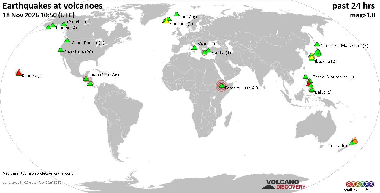
Volcano earthquake report for Wednesday, 18 November 2026
• M 2.4 - 6 km W of Cleveland, North Carolina
• M 4.9 - 43 km NW of Oxford, New Zealand
• M 5.3 - 16 km ESE of Comandău, Romania
• M 4.4 - 6 km ENE of Bachajón, Mexico
• M 1.8 - 8 km S of Pāhala, Hawaii
|
|
|
Joined: Feb 2001
Posts: 800,656
Launch Director
|
|
Launch Director
Joined: Feb 2001
Posts: 800,656 |
SPC Day 2 Fire Weather OutlookSPC Day 2 Fire Weather Outlook 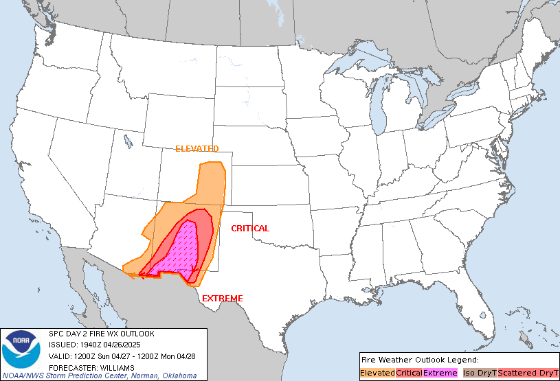
Day 2 Fire Weather Outlook
NWS Storm Prediction Center Norman OK
1151 PM CST Tue Nov 17 2026

Valid 191200Z - 201200Z

...NO CRITICAL AREAS...

...Synopsis...
The upper trough over the central plains on D1/Wednesday will
quickly move northeastward into the Great Lakes by D2/Thursday while
another trough enters the western U.S. A very dry boundary layer
will persist across the central High Plains as southerly winds
return in the presence of lee surface troughing. South winds of
10-15 mph (locally 20 mph) combined with RH as low as 10% during
peak heating are expected in isolated areas, but widespread fire
weather concerns will remain limited with an attenuated fuelscape
across the region.

Fuels will continue to deteriorate within the Appalachians as high
pressure remains over the eastern U.S., although the light wind
regime will continue to limit fire weather concerns for D2/Thursday.

..Williams.. 11/18/2026

...Please see www.spc.noaa.gov/fire for graphic product...
Read morehttps://www.spc.noaa.gov/products/fire_wx/fwdy2.html
|
|



CMS The Best Conveyancing solicitors conveyancing quotes throughout the UK
For any webhosting enquiries please email webmaster@aus-city.com
|
|
Entire Thread
|

 SPC Day 2 Fire Weather Outlook |
Webmaster
|
7 hours ago
|
|
Forums60
Topics933,619
Posts968,416
Members2,960
| |
Most Online102,106
Jul 10th, 2026
|
|
|
|
|

|









































