|
|
|
0 members (),
1,780
guests, and
27
robots. |
|
Key:
Admin,
Global Mod,
Mod
|
|
S |
M |
T |
W |
T |
F |
S |
|
1
|
2
|
3
|
4
|
5
|
6
|
7
|
|
8
|
9
|
10
|
11
|
12
|
13
|
14
|
|
15
|
16
|
17
|
18
|
19
|
20
|
21
|
|
22
|
23
|
24
|
25
|
26
|
27
|
28
|
|
29
|
30
|
|
|
|
|
|
|
There are no members with birthdays on this day. |
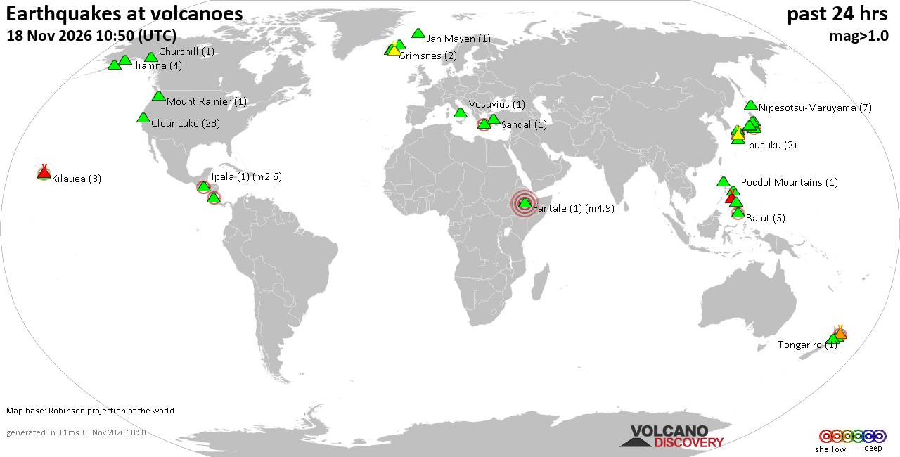
Volcano earthquake report for Wednesday, 18 November 2026
• M 2.4 - 6 km W of Cleveland, North Carolina
• M 4.9 - 43 km NW of Oxford, New Zealand
• M 5.3 - 16 km ESE of Comandău, Romania
• M 4.4 - 6 km ENE of Bachajón, Mexico
• M 1.8 - 8 km S of Pāhala, Hawaii
|
|
|
Joined: Feb 2001
Posts: 800,656
Launch Director
|
|
Launch Director
Joined: Feb 2001
Posts: 800,656 |
SPC Nov 18, 2026 0830 UTC Day 3 Severe Thunderstorm OutlookSPC 0830Z Day 3 Outlook 
Day 3 Convective Outlook
NWS Storm Prediction Center Norman OK
0230 AM CST Wed Nov 18 2026

Valid 201200Z - 211200Z

...NO SEVERE THUNDERSTORM AREAS FORECAST...

...SUMMARY...
Severe storms are unlikely Friday.

...Central/Northern Rockies and Plains States...
An upper trough over the Great basin is forecast to eject eastward
across the Rockies and into the northern/central Plains as it merges
with a second weaker perturbation emanating from southern Canada.
Strong southwesterly flow aloft will overspread the Plains states
deepening a lee cyclone across eastern CO/WY. This will draw modest
surface moisture northward ahead of a cold front/lee trough tied to
the low. Strong ascent ahead of the aforementioned trough and
boundaries, along with the modest moisture return may support
isolated thunderstorms across the Plains late Friday afternoon into
early Saturday. While deep-layer flow will strengthen through the
day, relatively cool surface temperatures and overall modest
buoyancy suggests severe potential will be quite limited. Additional
isolated storms are possible under the core of the upper trough
throughout the higher terrain.

...Gulf and Atlantic Coasts...
A weak upper trough will move from the eastern Gulf across the FL
peninsula Friday. A broad low over open waters farther west should
gradually fill while a compact secondary surface low is forecast to
deepen along the Atlantic coast. Weak ascent fro the upper trough
will support scattered thunderstorms within a moist and broad yet
weakly unstable environment from the middle Gulf Coast to FL. Poor
lapse rates and generally weak upper-level flow should preclude much
in the way of storm organization. However, given scattered storm
coverage, sporadic damaging gusts is possible.

..Lyons.. 11/18/2026
Read morehttps://www.spc.noaa.gov/products/outlook/day3otlk_0830.html
|
|



CMS The Best Conveyancing solicitors conveyancing quotes throughout the UK
For any webhosting enquiries please email webmaster@aus-city.com
|
|
Entire Thread
|

 SPC Nov 18, 2026 0830 UTC Day 3 Severe Thunderstorm Outlook |
Webmaster
|
4 hours ago
|
|
Forums60
Topics933,619
Posts968,416
Members2,960
| |
Most Online102,106
Jul 10th, 2026
|
|
|
|
|

|









































