|
|
|
0 members (),
1,780
guests, and
27
robots. |
|
Key:
Admin,
Global Mod,
Mod
|
|
S |
M |
T |
W |
T |
F |
S |
|
1
|
2
|
3
|
4
|
5
|
6
|
7
|
|
8
|
9
|
10
|
11
|
12
|
13
|
14
|
|
15
|
16
|
17
|
18
|
19
|
20
|
21
|
|
22
|
23
|
24
|
25
|
26
|
27
|
28
|
|
29
|
30
|
|
|
|
|
|
|
There are no members with birthdays on this day. |
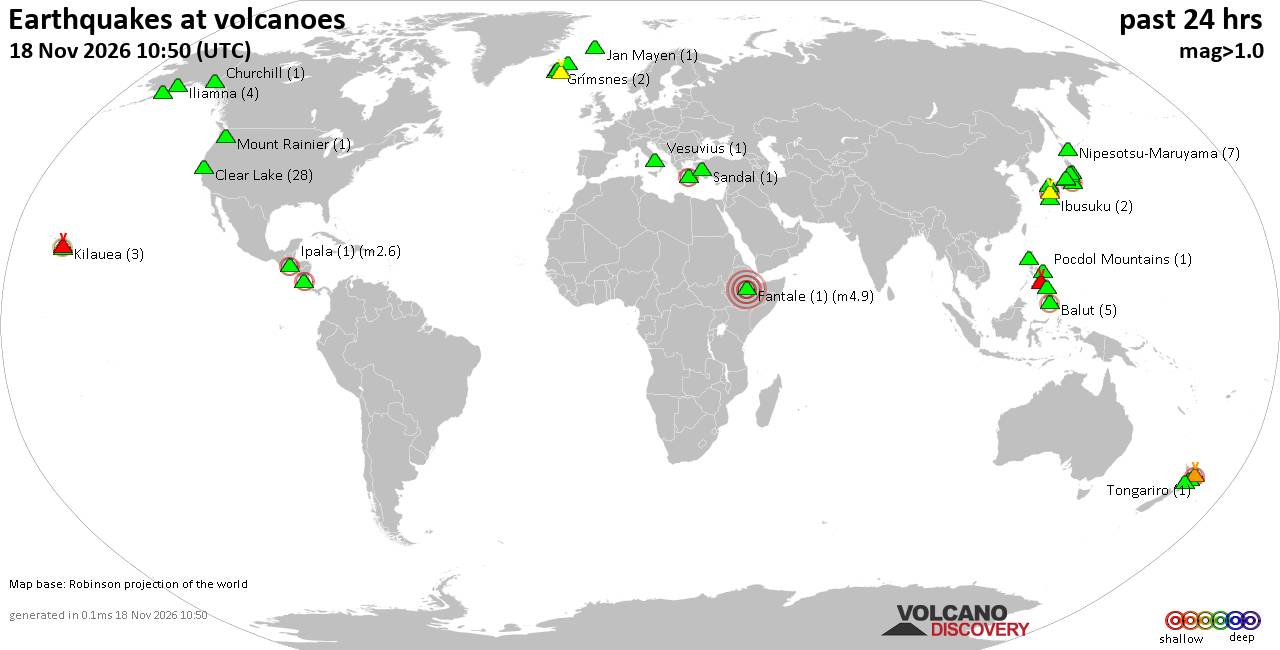
Volcano earthquake report for Wednesday, 18 November 2026
• M 2.4 - 6 km W of Cleveland, North Carolina
• M 4.9 - 43 km NW of Oxford, New Zealand
• M 5.3 - 16 km ESE of Comandău, Romania
• M 4.4 - 6 km ENE of Bachajón, Mexico
• M 1.8 - 8 km S of Pāhala, Hawaii
|
|
|
Joined: Feb 2001
Posts: 800,656
Launch Director
|
|
Launch Director
Joined: Feb 2001
Posts: 800,656 |
SPC Nov 18, 2026 Day 4-8 Severe Weather OutlookDay 4-8 Outlook 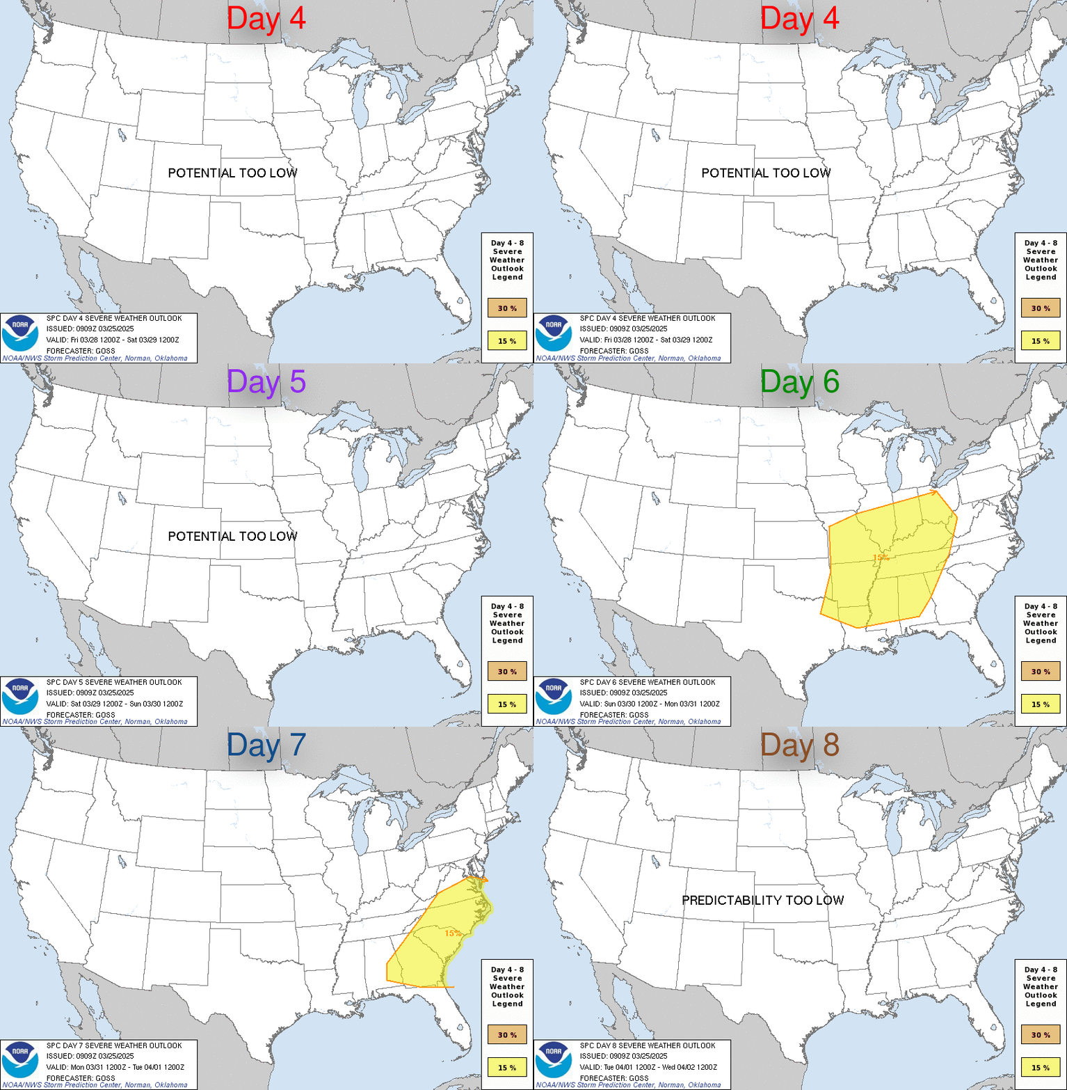
Day 4-8 Convective Outlook
NWS Storm Prediction Center Norman OK
0357 AM CST Wed Nov 18 2026

Valid 211200Z - 261200Z

...DISCUSSION...
Isolated severe potential is evident D4/Saturday and D5/Sunday
across the central and southern Plains as a trailing upper trough
moves from the Four Corners into the central US. An initial low over
the Midwest will continue northeastward as a second lee cyclone and
cold front intensify over the central and southern Plains before
moving into the MS Valley. 50s to perhaps near 60 F surface
dewpoints beneath steepening mid-level lapse rates should support
modest destabilization ahead of the front. Thunderstorms are likely
and model soundings show strengthening deep-layer shear profiles
supportive of stronger/organized storms. However, uncertainty
remains too large for 15% probabilities given the lack of more
robust boundary-layer moisture and subsequent destabilization.

...Atlantic coast...
A coastal low, possibly with some subtropical characteristics, is
forecast lift northeastward along the Atlantic coast toward the end
of the weekend and into early next week. A strong coastal front will
likely be in place with a cooler and much drier air mass inland.
Guidance varies substantially on the placement and intensity of the
low which will likely dictate if any substantial moisture and
buoyancy can move inland. Thunderstorms are possible across the
eastern Carolinas and Mid Atlantic before the low moves offshore
midweek, but severe potential appears low.

...Rest of next week..
Predictability through the remainder of the forecast period is also
low. Progressive mid-level flow will likely continue, but
latitudinal displaced across the southern third of the US by high
pressure to the north and the prior cold front. Model guidance
varies considerably on the positions and timing of any of these
systems, as well as the presence of robust moisture/buoyancy.
Read morehttps://www.spc.noaa.gov/products/exper/day4-8/
|
|



CMS The Best Conveyancing solicitors conveyancing quotes throughout the UK
For any webhosting enquiries please email webmaster@aus-city.com
|
|
Entire Thread
|

 SPC Nov 18, 2026 Day 4-8 Severe Weather Outlook |
Webmaster
|
3 hours ago
|
|
Forums60
Topics933,619
Posts968,416
Members2,960
| |
Most Online102,106
Jul 10th, 2026
|
|
|
|
|

|









































