|
|
|
0 members (),
1,352
guests, and
25
robots. |
|
Key:
Admin,
Global Mod,
Mod
|
|
S |
M |
T |
W |
T |
F |
S |
|
1
|
2
|
3
|
4
|
5
|
6
|
7
|
|
8
|
9
|
10
|
11
|
12
|
13
|
14
|
|
15
|
16
|
17
|
18
|
19
|
20
|
21
|
|
22
|
23
|
24
|
25
|
26
|
27
|
28
|
|
29
|
30
|
|
|
|
|
|
|
There are no members with birthdays on this day. |
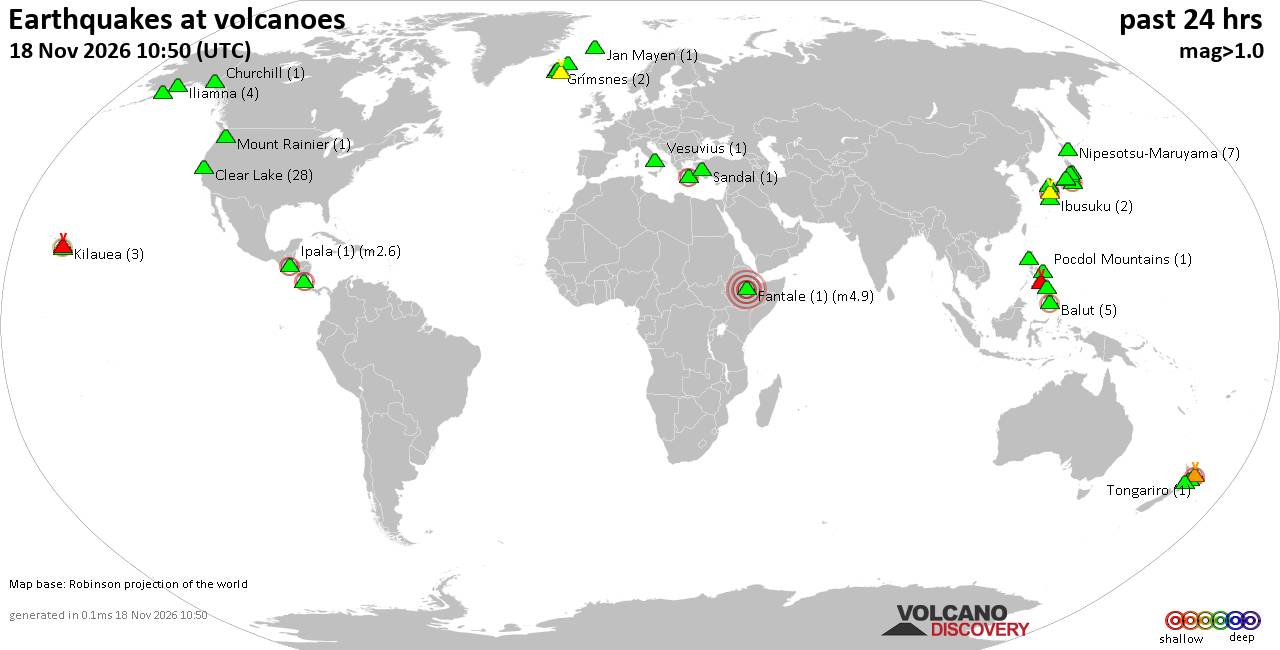
Volcano earthquake report for Wednesday, 18 November 2026
• M 0.7 - 10 km S of Idyllwild, CA
• M 1.3 - 15 km NE of Milford, Utah
• M 2.2 - 7 km W of Cleveland, North Carolina
• M 1.6 - 14 km NNE of Milford, Utah
• M 1.4 - 15 km NNE of Milford, Utah
|
|
|
Joined: Feb 2001
Posts: 800,656
Launch Director
|
|
Launch Director
Joined: Feb 2001
Posts: 800,656 |
SPC Nov 18, 2026 1630 UTC Day 1 Convective OutlookSPC 1630Z Day 1 Outlook 
Day 1 Convective Outlook
NWS Storm Prediction Center Norman OK
1022 AM CST Wed Nov 18 2026

Valid 181630Z - 191200Z

...NO SEVERE THUNDERSTORM AREAS FORECAST...

...SUMMARY...
Severe thunderstorms are not forecast across the contiguous U.S.
through tonight.

...Florida Peninsula...
A convective complex/MCV will continue to move slowly
south-southeastward over the FL Straits this afternoon as a weak
mid-level low persists over the Southeast/northern Gulf. This
activity should gradually trend away from the Keys and southern FL
Peninsula, but transient low-level circulations may persist over
nearshore waters for a bit longer. The latest KAMX/KBYX VWPs show
modestly enhanced easterly winds around 1-2 km AGL in the presence
of a very moist low-level airmass and convectively reinforced
baroclinic zone. While a waterspout/occasional strong thunderstorm
could occur near coastal areas, a continued offshore drift to the
parent MCV and weak mid-level flow should limit organized severe
potential over land.

Farther north across the eastern FL Peninsula, modest low-level
easterly flow will continue to transport a moist low-level airmass
inland along the Atlantic Coast. But, poor mid-level lapse rates and
generally modest winds in the 850-500 mb layer noted in the observed
12Z MFL/TBW soundings will likely hinder updraft intensity and
overall severe threat with any convection that develops this
afternoon and evening.

...California...
An upper trough/low centered off the coastal Pacific Northwest and
northern CA will approach the West Coast by tonight, with an
inland-moving front and a strong, cyclonically curved mid-level jet
developing from CA toward the Great Basin. A post-frontal/diurnal
steepening of low/mid-level lapse rates will support isolated
thunderstorm potential initially focused near coastal northern CA
this afternoon, and expanding to include central/interior CA tonight
through early Thursday morning. While occasional strong/gusty winds
could occur with this convection, instability should remain too
limited to support an appreciable severe risk.

..Gleason/Halbert-E.. 11/18/2026
Read morehttps://www.spc.noaa.gov/products/outlook/day1otlk_1630.html
|
|



CMS The Best Conveyancing solicitors conveyancing quotes throughout the UK
For any webhosting enquiries please email webmaster@aus-city.com
|
|
Entire Thread
|

 SPC Nov 18, 2026 1630 UTC Day 1 Convective Outlook |
Webmaster
|
2 hours ago
|
|
Forums60
Topics933,888
Posts968,685
Members2,960
| |
Most Online102,106
Jul 10th, 2026
|
|
|
|
|

|









































