|
|
|
0 members (),
1,509
guests, and
24
robots. |
|
Key:
Admin,
Global Mod,
Mod
|
|
S |
M |
T |
W |
T |
F |
S |
|
1
|
2
|
3
|
4
|
5
|
6
|
7
|
|
8
|
9
|
10
|
11
|
12
|
13
|
14
|
|
15
|
16
|
17
|
18
|
19
|
20
|
21
|
|
22
|
23
|
24
|
25
|
26
|
27
|
28
|
|
29
|
30
|
|
|
|
|
|
|
There are no members with birthdays on this day. |
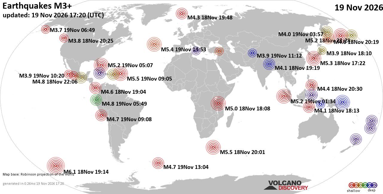
World Earthquake Report for Thursday, 19 November 2026
• M 1.8 - 23 km WSW of Ackerly, Texas
• M 0.7 - 2 km N of The Geysers, CA
• M 1.9 - 23 km E of Beluga, Alaska
• M 1.3 - 1 km E of The Geysers, CA
• M 1.2 - 14 km NNE of Milford, Utah
• M 4.4 - off the coast of Oregon
|
|
|
Joined: Feb 2001
Posts: 800,656
Launch Director
|
|
Launch Director
Joined: Feb 2001
Posts: 800,656 |
SPC Nov 19, 2026 1930 UTC Day 3 Severe Thunderstorm OutlookSPC 1930Z Day 3 Outlook 
Day 3 Convective Outlook
NWS Storm Prediction Center Norman OK
0134 PM CST Thu Nov 19 2026

Valid 211200Z - 221200Z

...THERE IS A MARGINAL RISK OF SEVERE THUNDERSTORMS FROM PARTS OF
THE SOUTHERN PLAINS INTO SOUTH-CENTRAL KANSAS...

...SUMMARY...
Isolated strong to severe storms are possible over the central and
southern Plains Saturday.

...Synopsis...
A strong shortwave trough will eject into parts of the
southern/central Plains late Saturday afternoon into early evening.
The strongest forcing appears likely to exist in the southern High
Plains vicinity. Recent model trends have showed a slight slowing of
the trough leading to later and more westward convective
development. Models indicate that a low will develop off the east
coast of Florida and move northward with time. If and when this
potential low impacts the coast is not certain.

...Southern into central Plains...
Given the later timing of the trough in recent guidance, the amount
of available buoyancy across these areas has become more
questionable. Low-level moisture will be somewhat marginal and
surface temperatures relatively cool (particularly into Kansas).
Even so, forcing for ascent at mid-levels will be strong and the
surface low/cold front will provide low-level convergence. Shear
will be strong enough to support organized storms. Isolated severe
potential remains evident with the strongest storms.

...NC Outer Banks...
A high degree of variability is present within guidance as to the
location and timing of the potential low pressure system. GFS/RRFS
suggest that convection could impact parts of the Outer Banks early
Sunday morning. Confidence remains much too low for severe
probabilities, but trends in guidance will be monitored.

..Wendt.. 11/19/2026
Read morehttps://www.spc.noaa.gov/products/outlook/day3otlk_1930.html
|
|



CMS The Best Conveyancing solicitors conveyancing quotes throughout the UK
For any webhosting enquiries please email webmaster@aus-city.com
|
|
Entire Thread
|

 SPC Nov 19, 2026 1930 UTC Day 3 Severe Thunderstorm Outlook |
Webmaster
|
1 hour ago
|
|
Forums60
Topics935,961
Posts970,758
Members2,960
| |
Most Online102,106
Jul 10th, 2026
|
|
|
|
|

|









































