|
0 members (),
1,509
guests, and
24
robots. |
|
Key:
Admin,
Global Mod,
Mod
|
|
S |
M |
T |
W |
T |
F |
S |
|
1
|
2
|
3
|
4
|
5
|
6
|
7
|
|
8
|
9
|
10
|
11
|
12
|
13
|
14
|
|
15
|
16
|
17
|
18
|
19
|
20
|
21
|
|
22
|
23
|
24
|
25
|
26
|
27
|
28
|
|
29
|
30
|
|
|
|
|
|
|
There are no members with birthdays on this day. |
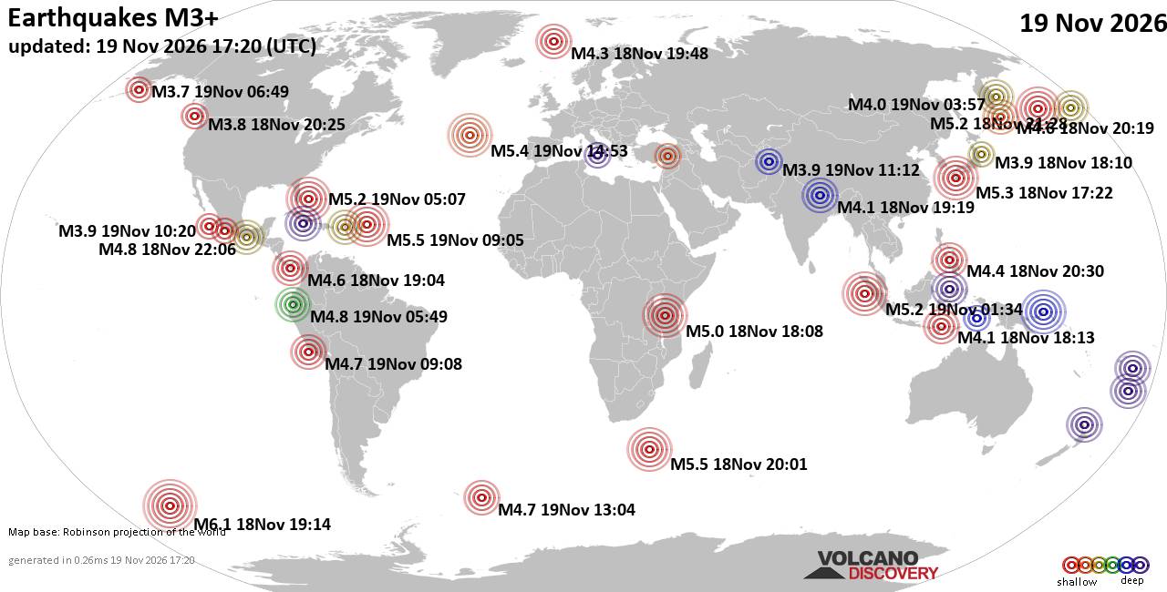
World Earthquake Report for Thursday, 19 November 2026
• M 1.8 - 23 km WSW of Ackerly, Texas
• M 0.7 - 2 km N of The Geysers, CA
• M 1.9 - 23 km E of Beluga, Alaska
• M 1.3 - 1 km E of The Geysers, CA
• M 1.2 - 14 km NNE of Milford, Utah
• M 4.4 - off the coast of Oregon
|
|
|
Joined: Feb 2001
Posts: 800,656
Launch Director
|
|
Launch Director
Joined: Feb 2001
Posts: 800,656 |
SPC Day 2 Fire Weather OutlookSPC Day 2 Fire Weather Outlook 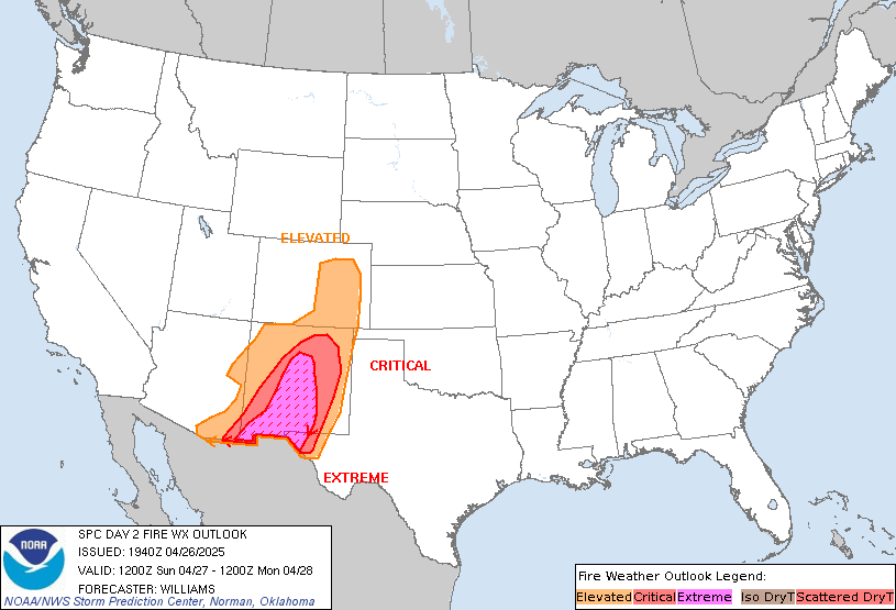
Day 2 Fire Weather Outlook
NWS Storm Prediction Center Norman OK
0137 PM CST Thu Nov 19 2026

Valid 201200Z - 211200Z

Only minor adjustments were made to the Elevated risk area across
portions of the central Plains on Day 2/Friday. Enhanced
southwesterly flow associated with upper troughing will extend from
the Four Corners region into the Upper Midwest. A 30-40 kt 700 mb
jet will overspread the Front Range and adjacent plains, allowing
wind gusts of 35-45 mph to mix down to the surface amid minimum RH
values of 20-25%. These meteorological conditions will align with a
mixed fuelscape consisting of pockets of dry fine fuels, maintaining
elevated fire weather concerns. Please see the previous discussion
for additional details.

..Elizalde-Garcia.. 11/19/2026

.PREV DISCUSSION... /ISSUED 1145 PM CST Wed Nov 18 2026/

...Synopsis...
A pronounced 65-75 knot mid-level jet accompanying a progressive
trough over the western U.S. will push into the Colorado Plateau and
central Rockies D2/Friday, coinciding with a strengthening surface
low over the northern Plains. This setup will contribute to strong,
westerly to southwesterly winds of 15-25 mph across the CO High
Plains and closer to 30 mph in southeastern WY. The breezy winds
coupled with minimum RH of 20-25% will promote elevated fire weather
conditions for D2/Friday, where elevated highlights were introduced
into portions of central CO, far southeastern WY and extreme western
NE. Marginal fuels overall will tend to attenuate the meteorological
impacts but pockets of cured/emergent dormant fine fuels could
support fire spread in the dry and breezy environment should fires
initiate.

A broad surface high across the Mid-Atlantic shifts into the
Northeast D2/Friday. Dry conditions including afternoon RH as low as
20% will prevail across the Appalachians and Mid Atlantic promoting
increasingly dry fuels in the Appalachians. However, winds will
remain light at less than 10 mph mitigating more significant fire
weather concerns.

...Please see www.spc.noaa.gov/fire for graphic product...
Read morehttps://www.spc.noaa.gov/products/fire_wx/fwdy2.html
|
|



CMS The Best Conveyancing solicitors conveyancing quotes throughout the UK
For any webhosting enquiries please email webmaster@aus-city.com
|
|
Entire Thread
|

 SPC Day 2 Fire Weather Outlook |
Webmaster
|
1 hour ago
|
|
Forums60
Topics935,961
Posts970,758
Members2,960
| |
Most Online102,106
Jul 10th, 2026
|
|
|









































