|
0 members (),
2,197
guests, and
25
robots. |
|
Key:
Admin,
Global Mod,
Mod
|
|
S |
M |
T |
W |
T |
F |
S |
|
1
|
2
|
3
|
4
|
5
|
6
|
7
|
|
8
|
9
|
10
|
11
|
12
|
13
|
14
|
|
15
|
16
|
17
|
18
|
19
|
20
|
21
|
|
22
|
23
|
24
|
25
|
26
|
27
|
28
|
|
29
|
30
|
|
|
|
|
|
|
There are no members with birthdays on this day. |

Volcano earthquake report for Sunday, 22 November 2026
• Moderate mag. 4.5 earthquake - 73 km north of Calama, Provincia de El Loa, ...
• Magnitude 5.2 earthquake strikes near Cerro de Pasco, Pasco Province, Depar...
• M 2.0 - 8 km NW of Pinnacles, CA
• M 2.7 - 26 km WNW of Yachats, Oregon
• M 5.0 - 15 km NNE of Carhuamayo, Peru
|
|
|
Joined: Feb 2001
Posts: 800,656
Launch Director
|
|
Launch Director
Joined: Feb 2001
Posts: 800,656 |
SPC Day 2 Fire Weather OutlookSPC Day 2 Fire Weather Outlook 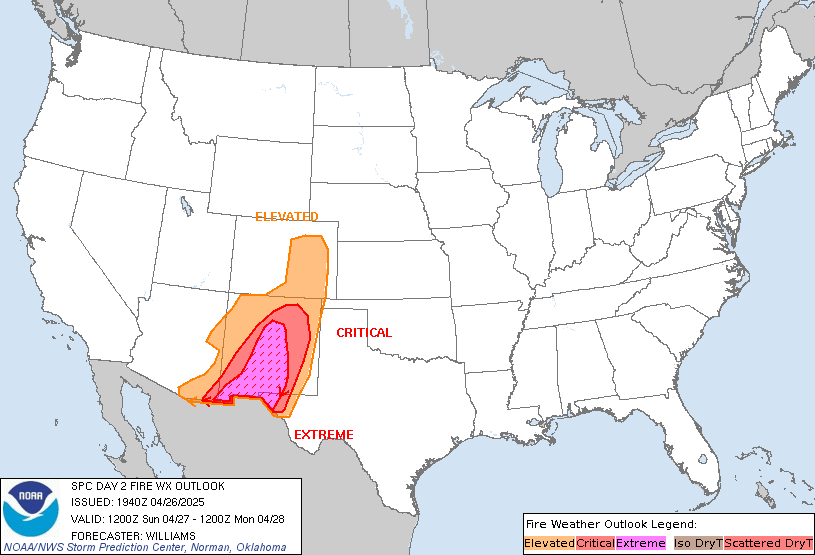
Day 2 Fire Weather Outlook
NWS Storm Prediction Center Norman OK
0121 PM CST Sat Nov 21 2026

Valid 221200Z - 231200Z

...NO CRITICAL AREAS...

No forecast changes were needed for this update as fire weather
concerns remain low across CONUS for D2/Sunday. Increasing
atmospheric moisture and cloud cover moving into the Appalachians
from a low just offshore from the Carolina coast will contribute to
rising relative humidity through D2/Sunday. Rainfall will be
confined across the Piedmont region. This will promote gradually
improving fuel conditions across the region and limit a more
significant fire weather threat.

..Williams.. 11/21/2026

.PREV DISCUSSION... /ISSUED 1146 PM CST Fri Nov 20 2026/

...Synopsis...
Upper troughs will progress eastward across the Great Lakes and
southwestern CONUS, respectively, reinforcing the expansion of
surface high pressure and accompanying cooler conditions across much
of the western and northern CONUS tomorrow (Sunday). A surface
trough will also traverse the Ohio and Tennessee Valley regions,
accompanied by wet conditions. With relatively moist conditions
expected over the eastern portions of the U.S., no widespread and
significant wildfire-spread potential appears evident across the
CONUS on Sunday.

...Please see www.spc.noaa.gov/fire for graphic product...
Read morehttps://www.spc.noaa.gov/products/fire_wx/fwdy2.html
|
|



CMS The Best Conveyancing solicitors conveyancing quotes throughout the UK
For any webhosting enquiries please email webmaster@aus-city.com
|
|
Entire Thread
|

 SPC Day 2 Fire Weather Outlook |
Webmaster
|
Yesterday at 07:22 PM
|
|
Forums60
Topics940,686
Posts975,483
Members2,960
| |
Most Online102,106
Jul 10th, 2026
|
|
|









































