|
|
|
0 members (),
3,202
guests, and
26
robots. |
|
Key:
Admin,
Global Mod,
Mod
|
|
S |
M |
T |
W |
T |
F |
S |
|
|
|
|
|
1
|
2
|
3
|
|
4
|
5
|
6
|
7
|
8
|
9
|
10
|
|
11
|
12
|
13
|
14
|
15
|
16
|
17
|
|
18
|
19
|
20
|
21
|
22
|
23
|
24
|
|
25
|
26
|
27
|
28
|
29
|
30
|
31
|
|
There are no members with birthdays on this day. |
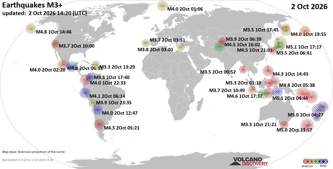
World Earthquake Report for Friday, 2 October 2026
• M 5.0 - 6 km E of Inglewood, New Zealand
• M 1.2 - 7 km N of Beaumont, CA
• M 1.2 - 12 km WNW of Calipatria, CA
• M 5.0 - 6 km E of Inglewood, New Zealand
• M 5.0 - 6 km E of Inglewood, New Zealand
|

#667127
Fri 29 Jul 2022 05:31:AM
|
Joined: Feb 2001
Posts: 678,977
Launch Director
|
|
Launch Director
Joined: Feb 2001
Posts: 678,977 |
SPC Jul 29, 2022 0600 UTC Day 1 Convective OutlookSPC 1200Z Day 1 Outlook 
Day 1 Convective Outlook
NWS Storm Prediction Center Norman OK
1227 AM CDT Fri Jul 29 2022

Valid 291200Z - 301200Z

...THERE IS A SLIGHT RISK OF SEVERE THUNDERSTORMS ACROSS EASTERN
VIRGINIA INTO PARTS OF MARYLAND AND DELAWARE...

...SUMMARY...
Damaging thunderstorm gusts may occur from the southern Arkansas to
parts of the Mid-Atlantic region, as well as over parts of the
southern High Plains.

...VA/MD/DE...

A lead shortwave impulse is forecast to migrate across the Delmarva
vicinity this afternoon ahead of the main upper shortwave trough
ejecting across the Great Lakes and Northeast through the period.
This will result in moderate vertical shear ahead of an
eastward-advancing surface cold front. Ahead of the front, a very
moist airmass with dewpoints in the mid 60s to low 70s F will be in
place. Midlevel lapse rates will remain poor, but areas of strong
heating will aid in moderate destabilization. Thunderstorms should
develop first over the higher terrain of WV/western VA by early
afternoon and spread eastward in clusters and/or bowing segments.
Damaging gusts will be possible with organized convection as it
moves across eastern VA/MD and DE.

...Southern AR into western VA/NC...

Thunderstorm clusters will be possible along the southward sagging
surface front. Vertical shear will remain weak across the region,
while stronger large-scale ascent remains further north across the
Midwest toward the Delmarva vicinity. Nevertheless, strong heating
of a very moist airmass will support MLCAPE values as high as 2500
J/kg. High PW values and weak shear will favor sporadic wet
microbursts in isolated, briefly intense cells. If any storms can
organize along outflow, some increased risk for damaging gusts may
accompany any forward-propagating cluster.

...TX Panhandle into western OK...

High-based thunderstorms are expected to develop in the vicinity of
the west to east oriented surface front during the afternoon.
Vertical shear will remain weak, but 60s surface dewpoints will
foster MLCAPE values around 1000-2000 J/kg. Forecast soundings show
a deeply mixed boundary-layer with inverted-v sub-cloud layer
thermodynamic profiles. This could support storms capable of
sporadic strong outflow winds/downbursts through early evening.

..Leitman/Weinman.. 07/29/2022
Read morehttps://www.spc.noaa.gov/products/outlook/day1otlk_1200.html
|
|



CMS The Best Conveyancing solicitors conveyancing quotes throughout the UK
For any webhosting enquiries please email webmaster@aus-city.com
|
|
Forums60
Topics853,347
Posts888,142
Members2,960
| |
Most Online102,106
Jul 10th, 2026
|
|
|
|
|

|









































