|
|
|
0 members (),
1,649
guests, and
21
robots. |
|
Key:
Admin,
Global Mod,
Mod
|
|
S |
M |
T |
W |
T |
F |
S |
|
1
|
2
|
3
|
4
|
5
|
6
|
7
|
|
8
|
9
|
10
|
11
|
12
|
13
|
14
|
|
15
|
16
|
17
|
18
|
19
|
20
|
21
|
|
22
|
23
|
24
|
25
|
26
|
27
|
28
|
|
29
|
30
|
|
|
|
|
|
|
There are no members with birthdays on this day. |
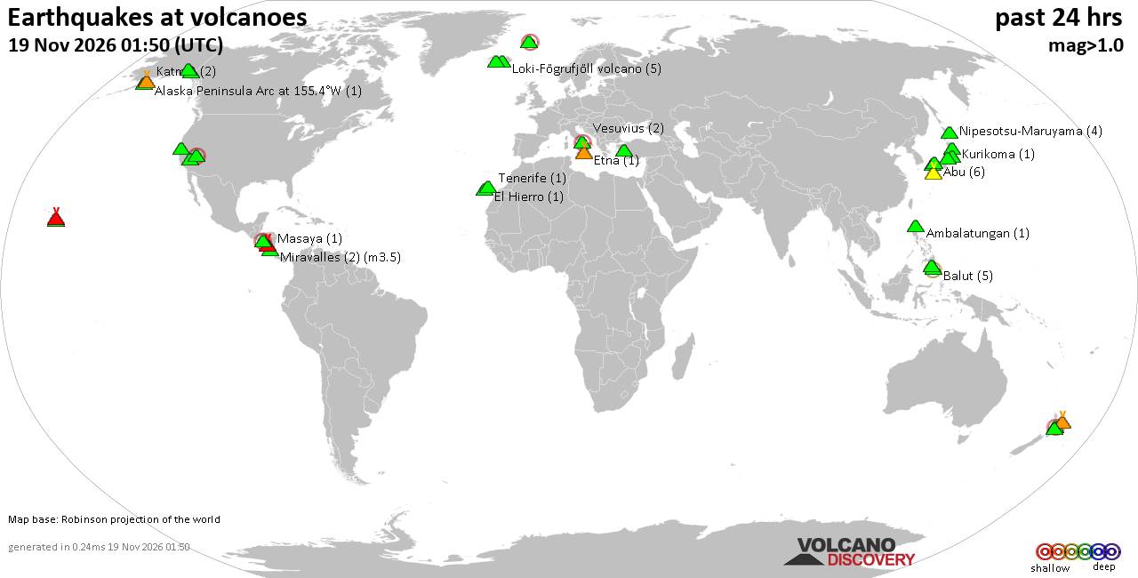
Volcano earthquake report for Thursday, 19 November 2026
• M 1.8 - 23 km WSW of Ackerly, Texas
• M 0.7 - 2 km N of The Geysers, CA
• M 1.9 - 23 km E of Beluga, Alaska
• M 1.3 - 1 km E of The Geysers, CA
• M 1.2 - 14 km NNE of Milford, Utah
|

#70233
Thu 06 Oct 2011 07:59:AM
|
Joined: Feb 2001
Posts: 800,656
Launch Director
|
|
Launch Director
Joined: Feb 2001
Posts: 800,656 |
5.8 Mw - STATE OF YAP, MICRONESIA
Preliminary Earthquake Report
Magnitude 5.8 Mw
Date-Time
6 Oct 2011 07:37:03 UTC
6 Oct 2011 17:37:03 near epicenter
6 Oct 2011 17:37:03 standard time in your timezone
Location 9.712N 138.292E
Depth 35 km
Distances
28 km (18 miles) NNE (33 degrees) of Yap, Micronesia
491 km (305 miles) ENE (57 degrees) of KOROR, Palau
1387 km (862 miles) N (349 degrees) of Jayapura, Irian Jaya, Indonesia
Location Uncertainty Horizontal: 15.3 km; Vertical 9.3 km
Parameters Nph = 83; Dmin = 836.0 km; Rmss = 0.97 seconds; Gp = 64°
M-type = Mw; Version = 7
Event ID US c00065bd
David Cottle
UBB Owner & Administrator
|
|



CMS The Best Conveyancing solicitors conveyancing quotes throughout the UK
For any webhosting enquiries please email webmaster@aus-city.com
|
|
Forums60
Topics936,067
Posts970,864
Members2,960
| |
Most Online102,106
Jul 10th, 2026
|
|
|
|
|

|









































