|
|
|
0 members (),
1,130
guests, and
86
robots. |
|
Key:
Admin,
Global Mod,
Mod
|
|
S |
M |
T |
W |
T |
F |
S |
|
|
|
|
|
|
|
1
|
|
2
|
3
|
4
|
5
|
6
|
7
|
8
|
|
9
|
10
|
11
|
12
|
13
|
14
|
15
|
|
16
|
17
|
18
|
19
|
20
|
21
|
22
|
|
23
|
24
|
25
|
26
|
27
|
28
|
29
|
|
30
|
31
|
|
|
|
|
|
|
There are no members with birthdays on this day. |

Volcano earthquake report for Sunday, 16 Aug 2026
• Moderate mag. 4.4 earthquake - Fukuoka, Japan, on Monday, Aug 17, 2026, at ...
• Moderate mag. 4.7 earthquake - Banda Sea, 78 km east of Pulau Banda Besar I...
• Moderate mag. 4.4 earthquake - Banda Sea, 46 km north of Pulau Dai Island, ...
• World Earthquake Report for Sunday, 16 August 2026
• Magnitude 5.2 earthquake strikes near San Antonio de los Cobres, Los Andes ...
|

#725424
Mon 10 Jun 2024 05:32:PM
|
Joined: Feb 2001
Posts: 678,976
Launch Director
|
OP

Launch Director
Joined: Feb 2001
Posts: 678,976 |
SPC Jun 10, 2024 1730 UTC Day 2 Convective OutlookSPC 1730Z Day 2 Outlook 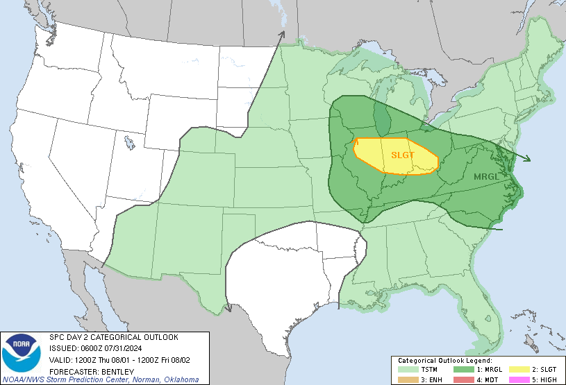
Day 2 Convective Outlook
NWS Storm Prediction Center Norman OK
1229 PM CDT Mon Jun 10 2024

Valid 111200Z - 121200Z

...THERE IS A SLIGHT RISK OF SEVERE THUNDERSTORMS IN THE EDWARDS
PLATEAU OF TX...

...SUMMARY...
A cluster of severe thunderstorms capable of large hail to around
golf ball size and wind gusts to around 70 mph will be possible
across a portion of Texas centered on the Edwards Plateau from 3 to
10 PM CDT Tuesday.

...Edwards Plateau Vicinity of TX...
A minor mid-level low will drift east-southeastward from the
southern High Plains across the Red River Valley. A belt of enhanced
northwesterlies from 25-35 kts at 500-mb is expected in the
southwest quadrant of this wave. This should overlap a zone of
pronounced differential heating between residual clouds/morning
convection centered on the Big Country and nearly full insolation in
south TX. While confidence is about average with where exactly this
corridor should setup, it appears most likely to be centered on the
Edwards Plateau vicinity by peak heating. This should foster at
least a few supercells during the mid to late afternoon, which may
congeal into a southeast-moving cluster during the evening. Large
hail should be the primary initial threat, with severe wind gusts
becoming more likely towards the Hill Country vicinity. These
threats should wane after dusk.

...Upper MS Valley...
A swath of showers and embedded non-severe thunderstorms should be
ongoing at 12Z within the low-level warm conveyor ahead of a
shortwave trough shifting east across the Prairie Provinces into the
Upper Midwest. The warm-moist sector in the wake of surface warm
front passage should be relatively narrow ahead of an occluding cold
front. Consensus of guidance suggests at least isolated
thunderstorms should develop by mid to late afternoon from the St.
Croix Valley through at least north-central IA, despite a
predominately westerly low-level wind profile ahead of the front.
Isolated severe hail should be most favored with northern extent
owing to cooler mid-level temperatures/steeper lapse rates. Isolated
severe wind should tend to be favored with southern extent owing to
a warmer/more deeper-mixed boundary layer. The relatively isolated
expected coverage along with the aforementioned limiting factors
preclude higher probabilities with this cycle.

...Northeast NC/far southeast VA...
A mid-level shortwave impulse embedded within the broader trough
over the Northeast is expected to progress across NC and southern VA
Tuesday morning into early afternoon. A minor surface trough should
be centered across eastern NC into extreme southeast VA. Prior to
mid-level warming/drying in the wake of the impulse, a few
thunderstorms may be sustained along the surface trough over
northeast NC into far southeast VA. While low-level winds will be
light, sufficient speed shear above 700 mb should foster a threat
for marginally severe hail from midday to mid-afternoon. Localized
strong downbursts will also be possible as convection matures.

...Southeast CO/northeast NM...
Isolated to scattered afternoon thunderstorms should develop along
the Sangre de Cristo Mountains. Deep-layer shear profiles will be
modest in the wake of the Red River mid-level impulse. But they may
be adequate enough when coupled with the steep low to mid-level
lapse rate environment to foster a threat for marginally severe hail
and locally strong gusts into the adjacent High Plains.

..Grams.. 06/10/2024
Read morehttps://www.spc.noaa.gov/products/outlook/day2otlk_1730.html
|
|



CMS The Best Conveyancing solicitors conveyancing quotes throughout the UK
For any webhosting enquiries please email webmaster@aus-city.com
|
|
Forums60
Topics797,295
Posts832,085
Members2,960
| |
Most Online102,106
Jul 10th, 2026
|
|
|
|
|

|





































