|
1 members (Alisa),
1,452
guests, and
26
robots. |
|
Key:
Admin,
Global Mod,
Mod
|
|
S |
M |
T |
W |
T |
F |
S |
|
|
|
1
|
2
|
3
|
4
|
5
|
|
6
|
7
|
8
|
9
|
10
|
11
|
12
|
|
13
|
14
|
15
|
16
|
17
|
18
|
19
|
|
20
|
21
|
22
|
23
|
24
|
25
|
26
|
|
27
|
28
|
29
|
30
|
|
|
|
|
There are no members with birthdays on this day. |
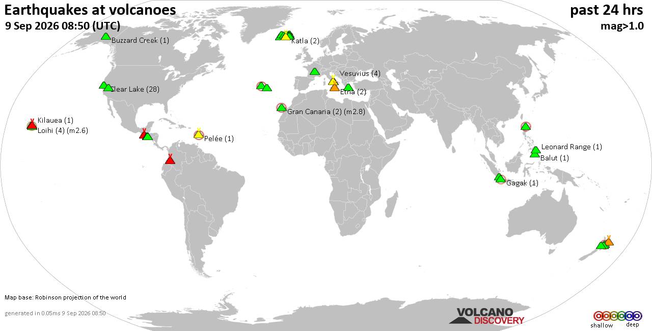
Volcano earthquake report for Wednesday, 9 September 2026
• World Earthquake Report for Wednesday, 9 September 2026
• Strong mag. 5.0 earthquake - Celebes Sea, 49 km north of Tahuna, Indonesia,...
• Moderate mag. 4.7 earthquake - Philippine Sea, 135 km southeast of Shima, M...
• The 10 most powerful earthquakes in the world since 1900
• Moderate mag. 4.0 earthquake - Indian Ocean, 80 km southwest of Labuan, Kab...
|

#726744
Sat 22 Jun 2024 05:31:PM
|
Joined: Feb 2001
Posts: 678,977
Launch Director
|
|
Launch Director
Joined: Feb 2001
Posts: 678,977 |
SPC Jun 22, 2024 1730 UTC Day 2 Convective OutlookSPC 1730Z Day 2 Outlook 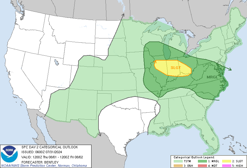
Day 2 Convective Outlook
NWS Storm Prediction Center Norman OK
1228 PM CDT Sat Jun 22 2024

Valid 231200Z - 241200Z

...THERE IS AN ENHANCED RISK OF SEVERE THUNDERSTORMS IN THE CENTRAL
NEW ENGLAND VICINITY...

...SUMMARY...
Scattered damaging winds and a few tornadoes are likely across parts
of the Northeast, mainly during Sunday afternoon.

...Northeast...
A relatively more active severe weather day is anticipated on Sunday
afternoon with increasing confidence in scattered damaging winds and
a few tornadoes across parts of the region.

A low-amplitude shortwave trough over the Upper Midwest will track
east to the Saint Lawrence Valley by Sunday afternoon, as a more
amplified upstream trough digs across the Great Lakes. Multiple
belts of enhanced low-level flow will likely accompany each impulse,
with the stronger strengthening occurring with the secondary wave. A
deepening surface cyclone should track across southeast ON/south QC.

While mid-level lapse rates will be weak, rich low-level moisture
will yield moderate buoyancy with a broadening plume of MLCAPE of
1500-2000 J/kg by afternoon. 12Z CAM guidance is fairly consistent
in suggesting that primary warm-sector development will occur with
the lead wave by late morning into the afternoon. A secondary round
of convection accompanying the cold front trailing southwestward
should occur downwind of the Lower Great Lakes during the late
afternoon to early evening.

The most favorable parameter space appears centered on parts of the
Hudson Valley through the central portion of New England. Here,
low-level hodographs are progged to be most enlarged in combination
with a favorable low-level thermodynamic environment. This may yield
a few discrete supercells with a risk for tornadoes and damaging
winds. Storm mergers and eventual clustering should maintain a
threat for isolated to scattered damaging winds as convection
approaches the coast. The degree of destabilization in the wake of
the lead activity is somewhat uncertain. But moderate to strong
southwesterly deep-layer shear should yield a threat for scattered
damaging winds with late-day convection as the cold front shifts
east of the Lower Great Lakes.

...OH Valley to Mid-South/TN Valley vicinity...
The cold front trailing from the New England system will move across
parts of the Ohio Valley during the afternoon and evening. Isolated
to scattered thunderstorm development will be possible along/ahead
of the front within a moderately unstable and modestly sheared
environment. A few stronger cells or small clusters will be possible
within this regime, with a threat of sporadic damaging winds and
small to marginally severe hail. Primary change with this outlook is
to expand the level 2-SLGT risk southwestward in the Upper OH Valley
where confidence is greater in storm coverage and resultant damaging
wind threat.

...East MT into northwest ND...
A shortwave trough should move east across parts of WA and the
southern Canadian Rockies. A deepening surface cyclone will
accompany this wave over the southern AB and move into SK, with a
cold front trailing southward into MT. Low-level southeasterly flow
will transport a confined plume of modest low-level moisture into
parts of east MT, resulting in a corridor of MLCAPE from 500-1500
J/kg. Deep-layer shear will be favorable for organized convection,
but large-scale ascent attendant to the shortwave trough may tend to
remain north of the international border. Development of a severe
storm or two across east MT is possible by early evening, which
would then potentially spread into northwest ND Sunday night.

...Northwest KS/southwest NE...
Hot temperatures along a lee trough should yield at least isolated
late afternoon thunderstorm development. A deeply mixed boundary
layer with modest mid-level northwesterlies could foster small
hail-loaded downdrafts capable of a few strong microbursts into
early evening.

...North WI/northeast MN...
On the backside of the Great Lakes mid/upper trough, favorable speed
shear within the northwesterly flow regime should yield an elongated
hodograph. Forecast soundings suggest mid-level lapse rates will be
weak as the thermal trough shifts east. But isolated, low-topped
convection might produce small hail and locally gusty winds,
centered on late afternoon.

..Grams.. 06/22/2024
Read morehttps://www.spc.noaa.gov/products/outlook/day2otlk_1730.html
|
|



CMS The Best Conveyancing solicitors conveyancing quotes throughout the UK
For any webhosting enquiries please email webmaster@aus-city.com
|
|
Forums60
Topics822,541
Posts857,334
Members2,960
| |
Most Online102,106
Jul 10th, 2026
|
|
|





































