|
|
|
0 members (),
1,002
guests, and
20
robots. |
|
Key:
Admin,
Global Mod,
Mod
|
|
S |
M |
T |
W |
T |
F |
S |
|
|
|
1
|
2
|
3
|
4
|
5
|
|
6
|
7
|
8
|
9
|
10
|
11
|
12
|
|
13
|
14
|
15
|
16
|
17
|
18
|
19
|
|
20
|
21
|
22
|
23
|
24
|
25
|
26
|
|
27
|
28
|
29
|
30
|
|
|
|
|
There are no members with birthdays on this day. |

M 6.3 - 84 km SSW of Nikolski, Alaska
• M 1.5 - 17 km WNW of Mentone, Texas
• M 0.9 - 2 km SW of Dibble, Oklahoma
• M 4.1 - 104 km ENE of Khorugh, Tajikistan
• M 3.6 - 14 km N of Warner Springs, CA
• M 1.5 - 43 km WNW of Valdez, Alaska
• M 1.2 - 16 km NNW of San Simeon, CA
|

#731055
Mon 12 Aug 2024 10:45:PM
|
Joined: Feb 2001
Posts: 678,977
Launch Director
|
|
Launch Director
Joined: Feb 2001
Posts: 678,977 |
SPC Aug 12, 2024 1930 UTC Day 3 Severe Thunderstorm OutlookSPC 1930Z Day 3 Outlook 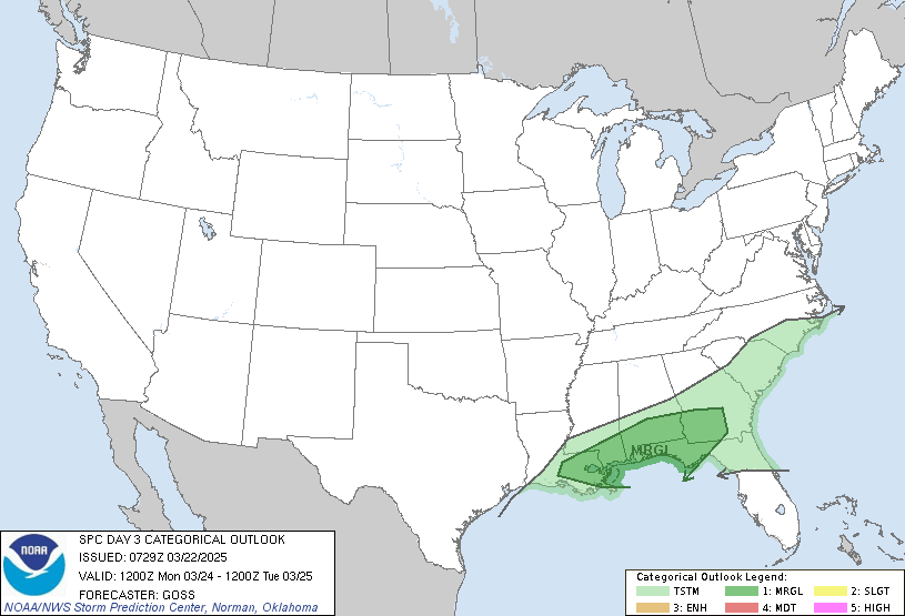
Day 3 Convective Outlook
NWS Storm Prediction Center Norman OK
0218 PM CDT Mon Aug 12 2024

Valid 141200Z - 151200Z

...THERE IS A MARGINAL RISK OF SEVERE THUNDERSTORMS ACROSS PORTIONS
OF THE CENTRAL/NORTHERN PLAINS INTO THE MID-MISSOURI VALLEY...

...SUMMARY...
At least isolated severe thunderstorms may occur Wednesday across
parts of the northern/central Plains into the mid Missouri Valley.

...Synopsis...
A band of elevated thunderstorms will likely be ongoing at the
beginning of the period across a broad region of isentropic ascent
from southeast South Dakota to southern Missouri. As the low-level
jet weakens through the morning, expect the intensity of these
storms to lessen as they move east into a more stable airmass. To
the west, an unstable airmass is forecast across much of the central
and northern Plains in the vicinity of a broad surface trough. At
least weak to moderate instability is forecast with the potential
for greater instability in eastern NE/KS where higher dewpoints
(upper 60s to low 70s) are forecast.

The breakdown of the upper-level ridge will lead to height falls
across much of the central and northern Plains. Given the unstable
environment across much of the area, this weak upper-level forcing
combined with the surface trough will likely result in scattered
thunderstorms across much of the central and northern Plains
Wednesday afternoon/evening. A more focused threat may exist farther
south across eastern Kansas in Nebraska. Some enhancement of the
mid-level flow ahead of the ridge breakdown may lead to a localized
region of more favorable wind shear, co-located with the forecast
greater instability. If this occurs, particularly with the
development of a surface low as forecast by the NAM/ECMWF, a locally
greater severe weather threat may occur across this region. At this
time, uncertainty in the mesoscale features which will impact this
potential are too great to warrant higher severe weather
probabilities.

..Bentley.. 08/12/2024
Read morehttps://www.spc.noaa.gov/products/outlook/day3otlk_1930.html
|
|



CMS The Best Conveyancing solicitors conveyancing quotes throughout the UK
For any webhosting enquiries please email webmaster@aus-city.com
|
|
Forums60
Topics822,144
Posts856,937
Members2,960
| |
Most Online102,106
Jul 10th, 2026
|
|
|
|
|

|





































