|
0 members (),
1,400
guests, and
22
robots. |
|
Key:
Admin,
Global Mod,
Mod
|
|
S |
M |
T |
W |
T |
F |
S |
|
|
|
|
|
1
|
2
|
3
|
|
4
|
5
|
6
|
7
|
8
|
9
|
10
|
|
11
|
12
|
13
|
14
|
15
|
16
|
17
|
|
18
|
19
|
20
|
21
|
22
|
23
|
24
|
|
25
|
26
|
27
|
28
|
29
|
30
|
31
|
|
There are no members with birthdays on this day. |
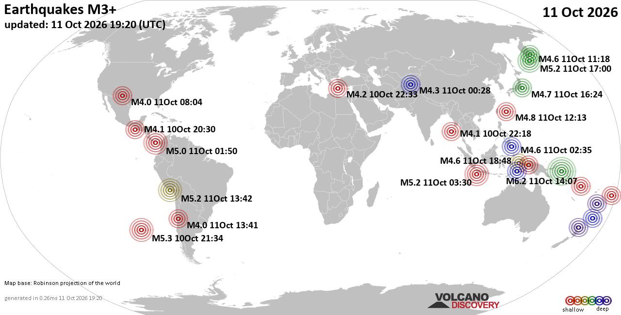
World Earthquake Report for Sunday, 11 October 2026
• M 4.7 - 156 km ESE of Neiafu, Tonga
• M 4.6 - Southwest Indian Ridge
• M 7.7 - 12 km WSW of Pitaloza Arriba, Panama
• M 2.5 - 73 km SSW of Adak, Alaska
• M 5.2 - 18 km SSE of Camaná, Peru
|

#731056
Mon 12 Aug 2024 07:30:PM
|
Joined: Feb 2001
Posts: 678,977
Launch Director
|
|
Launch Director
Joined: Feb 2001
Posts: 678,977 |
SPC Day 2 Fire Weather OutlookSPC Day 2 Fire Weather Outlook 
Day 2 Fire Weather Outlook
NWS Storm Prediction Center Norman OK
0228 PM CDT Mon Aug 12 2024

Valid 131200Z - 141200Z

An isolated dry thunderstorm risk area has been introduced to
portions of eastern OR into ID. Isolated thunderstorms will likely
be ongoing at the start of the period across far eastern OR, and
should migrate eastward over the central ID mountains through the
afternoon with little in the way of wetting rainfall given fast
storm motions.

A second round of convection remains possible during the late
afternoon across southeast OR/southwest ID, and will likely feature
dry convection given forecast PWAT values at/below 0.6 inch. While
ensemble guidance has trended towards higher probability for this to
occur, the overall signal remains fairly weak.

..Moore.. 08/12/2024

.PREV DISCUSSION... /ISSUED 1252 AM CDT Mon Aug 12 2024/

...Synopsis...
On Tuesday, the upper trough will lift out of the northern Great
Basin and into the northern High Plains, all while losing amplitude.
While some increase in mid-level winds may occur over the Great
Basin, this will not occur until late in the period. At the surface,
the pressure pattern will be more disorganized than Monday and
stronger winds will likely be diurnally/terrain-driven.

...Nevada...
Areas of locally elevated fire weather are possible as RH will still
fall to 15-20% during the afternoon. Slightly stronger winds appear
possible in southern Nevada, but fuels are also less receptive than
farther north. Sustained elevated conditions are not currently
expected.

...Central Idaho...
With the mid-level trough moving through early in the period,
mid/upper-level cloud cover will be possible. This may impact
destabilization enough to reduce potential storm coverage during the
afternoon. Should storms occur, some could be dry. Confidence in
coverage is too low for highlights.

...Please see www.spc.noaa.gov/fire for graphic product...
Read morehttps://www.spc.noaa.gov/products/fire_wx/fwdy2.html
|
|



CMS The Best Conveyancing solicitors conveyancing quotes throughout the UK
For any webhosting enquiries please email webmaster@aus-city.com
|
|
Forums60
Topics869,478
Posts904,274
Members2,960
| |
Most Online102,106
Jul 10th, 2026
|
|
|









































