|
0 members (),
1,574
guests, and
24
robots. |
|
Key:
Admin,
Global Mod,
Mod
|
|
S |
M |
T |
W |
T |
F |
S |
|
|
|
|
|
1
|
2
|
3
|
|
4
|
5
|
6
|
7
|
8
|
9
|
10
|
|
11
|
12
|
13
|
14
|
15
|
16
|
17
|
|
18
|
19
|
20
|
21
|
22
|
23
|
24
|
|
25
|
26
|
27
|
28
|
29
|
30
|
31
|
|
There are no members with birthdays on this day. |
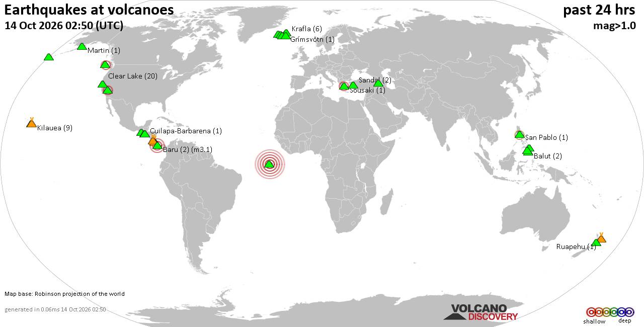
Volcano earthquake report for Wednesday, 14 October 2026
• M 2.0 - 4 km SW of Thomasville, Missouri
• M 3.0 - 23 km NE of Hydesville, CA
• M 2.8 - 6 km WSW of Wilderness Rim, Washington
• M 2.5 - 7 km N of Alex, Oklahoma
• M 3.0 - 23 km NE of Hydesville, CA
• M 7.7 - 12 km WSW of Pitaloza Arriba, Panama
|

#732604
Fri 30 Aug 2024 07:54:PM
|
Joined: Feb 2001
Posts: 678,977
Launch Director
|
|
Launch Director
Joined: Feb 2001
Posts: 678,977 |
SPC Day 2 Fire Weather OutlookSPC Day 2 Fire Weather Outlook 
Day 2 Fire Weather Outlook
NWS Storm Prediction Center Norman OK
0253 PM CDT Fri Aug 30 2024

Valid 311200Z - 011200Z

Minor adjustments were made to extend isolated dry thunderstorm
chances further westward in southern Nevada in agreement with latest
guidance. For more information, see the previous discussion below.

..Thornton.. 08/30/2024

.PREV DISCUSSION... /ISSUED 0115 AM CDT Fri Aug 30 2024/

...Synopsis...
Fire weather concerns will remain confined to portions of the Great
Basin for Saturday. Upper-level ridging currently over the western
CONUS will begin to slowly shift east towards the central Rockies
over the next 48-72 hours. As this occurs, a modest plume of
monsoonal moisture will spread north/northwest into southeastern NV
and southwest UT. Weak mid/upper-level ascent impinging on the
fringe of the moisture plume should support isolated thunderstorms
by late afternoon. A deep, well-mixed boundary layer will promote
limited rainfall with this activity over a region with generally
receptive fuels (ERC values at/above the 80th percentile).
Consequently, dry lightning will be a fire weather concern.

Elsewhere across the West, dry conditions will persist, and
increasing mid-level flow along the West Coast may support some
breezy conditions in the immediate lee of the central to southern
Sierra Nevada. However, confidence in widespread elevated conditions
remains too limited for highlights.

...Please see www.spc.noaa.gov/fire for graphic product...
Read morehttps://www.spc.noaa.gov/products/fire_wx/fwdy2.html
|
|



CMS The Best Conveyancing solicitors conveyancing quotes throughout the UK
For any webhosting enquiries please email webmaster@aus-city.com
|
|
Forums60
Topics874,660
Posts909,456
Members2,960
| |
Most Online102,106
Jul 10th, 2026
|
|
|









































