|
|
|
0 members (),
1,406
guests, and
21
robots. |
|
Key:
Admin,
Global Mod,
Mod
|
|
S |
M |
T |
W |
T |
F |
S |
|
|
|
|
|
1
|
2
|
3
|
|
4
|
5
|
6
|
7
|
8
|
9
|
10
|
|
11
|
12
|
13
|
14
|
15
|
16
|
17
|
|
18
|
19
|
20
|
21
|
22
|
23
|
24
|
|
25
|
26
|
27
|
28
|
29
|
30
|
31
|
|
There are no members with birthdays on this day. |
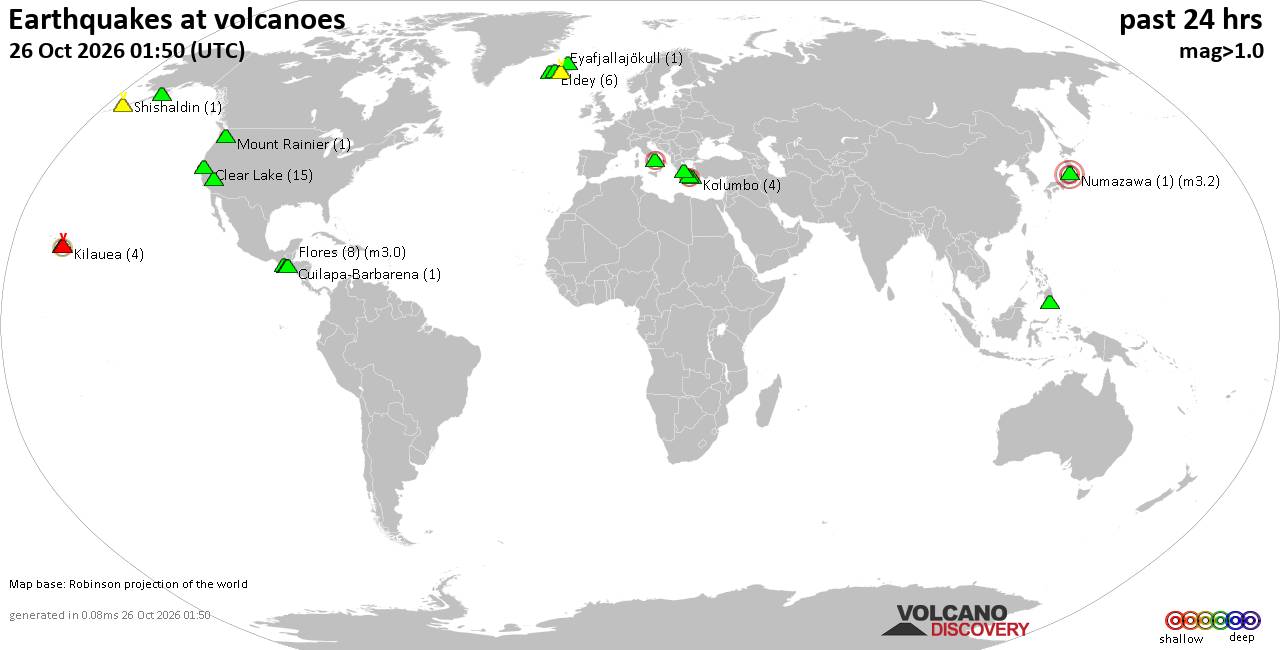
Volcano earthquake report for Monday, 26 October 2026
• M 2.3 - 27 km E of Honaunau-Napoopoo, Hawaii
• M 1.1 - 62 km WNW of Happy Valley, Alaska
• M 2.6 - 37 km ESE of Malaga, New Mexico
• M 2.1 - 57 km S of Whites City, New Mexico
• M 2.9 - 121 km SSW of Nikolski, Alaska
• M 4.9 - 100 km E of La Tirana, Chile
|

#733782
Wed 04 Sep 2024 12:45:AM
|
Joined: Feb 2001
Posts: 678,977
Launch Director
|
|
Launch Director
Joined: Feb 2001
Posts: 678,977 |
SPC Sep 4, 2024 0100 UTC Day 1 Convective OutlookSPC 0100Z Day 1 Outlook 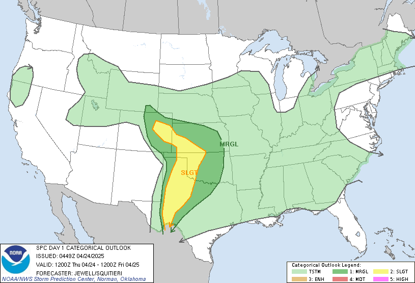
Day 1 Convective Outlook
NWS Storm Prediction Center Norman OK
0741 PM CDT Tue Sep 03 2024

Valid 040100Z - 041200Z

...THERE IS A MARGINAL RISK OF SEVERE THUNDERSTORMS ACROSS PARTS OF
THE CENTRAL AND NORTHERN ROCKIES INTO THE NORTHERN HIGH PLAINS...

...SUMMARY...
Isolated severe storms, associated with marginally severe wind
gusts, will be possible this evening across parts of the central and
northern Rockies into the northern High Plains.

...Central and Northern Rockies/Northern High Plains...
A positively-tilted upper-level trough is evident on water vapor
imagery over the northern Rockies, with southwest mid-level flow
from the Intermountain West into the northern High Plains. A weakly
unstable airmass is located ahead of the trough from Wyoming
northward into southern and central Montana, with scattered
thunderstorms ongoing near the instability axis. RAP forecast
soundings this evening from west of Billings, Montana southward to
near Jackson, Wyoming have MLCAPE near 500 J/kg, 0-6 km shear around
40 knots and 700-500 mb lapse near 8 C/km. This environment should
continue to support an isolated severe threat. Although instability
is the limiting factor, the threat could continue for a few more
hours this evening before surface temperatures cool significantly.
The primary threat will be for marginally severe wind gusts. Hail
will be possible from south-central Montana into northwest Wyoming,
where large-scale ascent appears to be maximized ahead of the
approaching upper-level trough. The severe threat could impact areas
further to the east in the northern High Plains later this evening.

..Broyles.. 09/04/2024
Read morehttps://www.spc.noaa.gov/products/outlook/day1otlk_0100.html
|
|



CMS The Best Conveyancing solicitors conveyancing quotes throughout the UK
For any webhosting enquiries please email webmaster@aus-city.com
|
|
Forums60
Topics895,347
Posts930,144
Members2,960
| |
Most Online102,106
Jul 10th, 2026
|
|
|
|
|

|









































