|
|
|
0 members (),
847
guests, and
25
robots. |
|
Key:
Admin,
Global Mod,
Mod
|
|
S |
M |
T |
W |
T |
F |
S |
|
|
|
1
|
2
|
3
|
4
|
5
|
|
6
|
7
|
8
|
9
|
10
|
11
|
12
|
|
13
|
14
|
15
|
16
|
17
|
18
|
19
|
|
20
|
21
|
22
|
23
|
24
|
25
|
26
|
|
27
|
28
|
29
|
30
|
|
|
|
|
There are no members with birthdays on this day. |
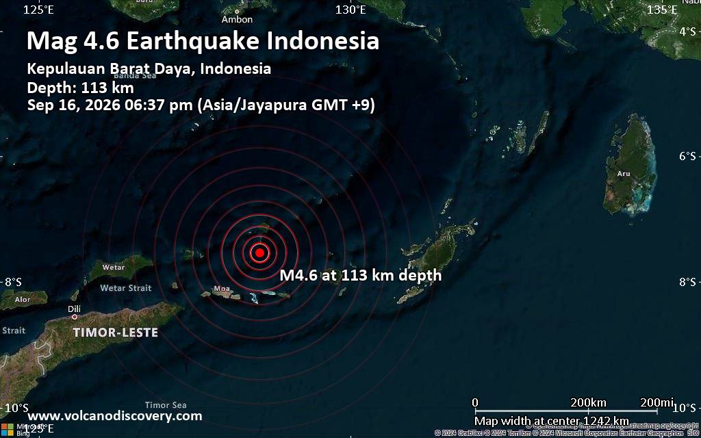
Moderate magnitude 4.6 quake hits 107 km northeast of Tiakur, Indonesia, in the early evening
• Volcano earthquake report for Wednesday, 16 September 2026
• Moderate mag. 4.6 earthquake - Kabupaten Maluku Barat Daya, Maluku, Indones...
• World Earthquake Report for Wednesday, 16 September 2026
• M 2.4 - 6 km WSW of Wilderness Rim, Washington
• M 4.4 - 184 km W of Ferndale, California
|

#741355
Wed 16 Oct 2024 04:48:PM
|
Joined: Feb 2001
Posts: 678,977
Launch Director
|
|
Launch Director
Joined: Feb 2001
Posts: 678,977 |
SPC Oct 16, 2024 1730 UTC Day 2 Convective OutlookSPC 1730Z Day 2 Outlook 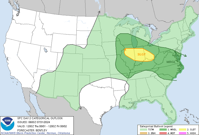
Day 2 Convective Outlook
NWS Storm Prediction Center Norman OK
1144 AM CDT Wed Oct 16 2024

Valid 171200Z - 181200Z

...NO SEVERE THUNDERSTORM AREAS FORECAST...

...SUMMARY...
The risk for severe thunderstorms appears negligible across the U.S.
Thursday through Thursday night.

...Synopsis...

An upper trough will deepen as it shifts east across the northern
Rockies and Great Basin on Thursday. Meanwhile, an amplified upper
ridge will envelop much of the CONUS east of the MS River as an
upper low moves offshore the Mid-Atlantic coast. At the surface,
strong high pressure beneath the upper ridge will be centered over
the Ohio Valley. A prior cold frontal passage and
north/northeasterly low-level flow will result in Gulf moisture
remaining well offshore. A strong baroclinic zone will be oriented
from the Upper Midwest toward the southern High Plains with surface
low development expected across the Great Basin with the approach of
the upper trough. Boundary-layer moisture will remain scant, but
cooling aloft as the upper trough progresses eastward will support
enough elevated instability such that isolated thunderstorms will be
possible from the Pacific Northwest coast into the Great Basin and
central/southern Rockies vicinity. Severe thunderstorms are not
expected.

..Leitman.. 10/16/2024
Read morehttps://www.spc.noaa.gov/products/outlook/day2otlk_1730.html
|
|



CMS The Best Conveyancing solicitors conveyancing quotes throughout the UK
For any webhosting enquiries please email webmaster@aus-city.com
|
|
Forums60
Topics828,624
Posts863,417
Members2,960
| |
Most Online102,106
Jul 10th, 2026
|
|
|
|
|

|





































