|
|
|
0 members (),
1,365
guests, and
21
robots. |
|
Key:
Admin,
Global Mod,
Mod
|
|
S |
M |
T |
W |
T |
F |
S |
|
|
|
|
|
|
1
|
2
|
|
3
|
4
|
5
|
6
|
7
|
8
|
9
|
|
10
|
11
|
12
|
13
|
14
|
15
|
16
|
|
17
|
18
|
19
|
20
|
21
|
22
|
23
|
|
24
|
25
|
26
|
27
|
28
|
29
|
30
|
|
31
|
|
|
|
|
|
|
|
There are no members with birthdays on this day. |
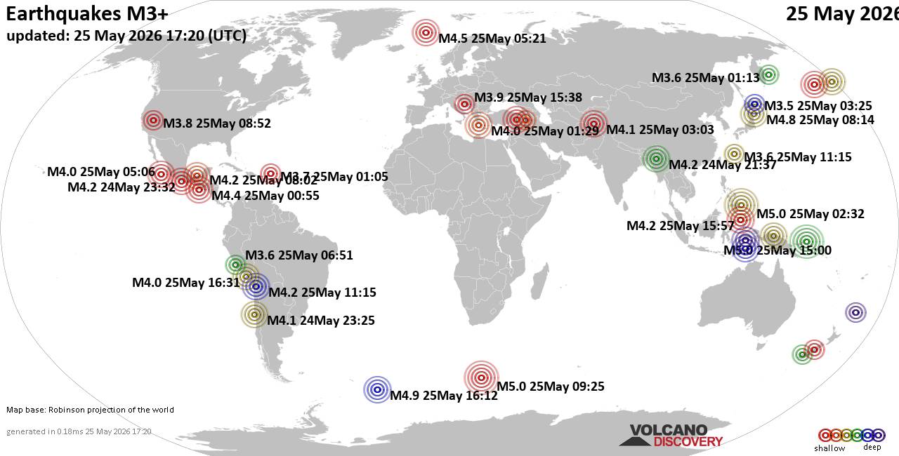
World Earthquake Report for Monday, 25 May 2026
• Moderate mag. 4.1 earthquake - 80 km northwest of Galela, Kabupaten Halmahe...
• Moderate magnitude 4.5 quake hits 102 km northeast of Manokwari, Indonesia ...
• Volcano earthquake report for Monday, 25 May 2026
• Moderate mag. 4.8 earthquake - South Pacific Ocean, 89 km northeast of Mano...
• Moderate mag. 4.0 earthquake - South Pacific Ocean, 81 km southwest of Moll...
|

#741356
Wed 16 Oct 2024 07:22:PM
|
Joined: Feb 2001
Posts: 381,904
Launch Director
|
OP

Launch Director
Joined: Feb 2001
Posts: 381,904 |
SPC Oct 16, 2024 1930 UTC Day 3 Severe Thunderstorm OutlookSPC 1930Z Day 3 Outlook 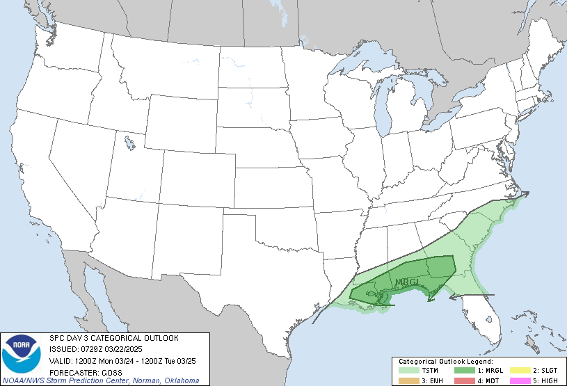
Day 3 Convective Outlook
NWS Storm Prediction Center Norman OK
0220 PM CDT Wed Oct 16 2024

Valid 181200Z - 191200Z

...THERE IS A MARGINAL RISK OF SEVERE THUNDERSTORMS ACROSS PARTS OF
THE SOUTHERN HIGH PLAINS...

...SUMMARY...
Strong thunderstorms are possible Friday night across parts of
eastern New Mexico and adjacent portions of the Texas/Oklahoma
Panhandle vicinity. Isolated small to marginally severe hail and
damaging wind gusts are possible.

...Arizona...

An upper low will develop over AZ as an upper trough develops east
toward the Four Corners region on Friday. This will bring a belt of
moderate southerly deep-layer flow over the Southwest. At the
surface, a moist axis will spread across southern AZ on
southwesterly low-level flow ahead of an eastward-advancing front.
This may support a narrow corridor of organized thunderstorm
potential from near the Phoenix vicinity southward during the
morning and early afternoon hours as sufficient instability overlaps
strong deep-layer flow. If current trends persist, a marginal risk
for strong gusts and hail may be needed in subsequent outlooks,
though the overall corridor both spatially and temporarily appears
fairly small.

...Southern High Plains...

Southeasterly low-level flow will gradually transport modest Gulf
moisture southwestward across west TX into eastern NM through the
period. Mid/upper level south/southwesterly flow will also gradually
increase through the day as the western upper trough approaches the
Four Corners vicinity. However, as the upper low develops over AZ,
the core of stronger flow aloft will remain west of the region.
Nevertheless, low-level convergence along a weak surface
trough/dryline is expected during the late afternoon into evening.
Vertically veering wind profiles will result in effective shear
magnitudes around 25-30 kt, supporting marginal supercells. Midlevel
lapse rates will remain modest, and MLCAPE will generally be less
than 750 J/kg, but any better organized cell could produce locally
strong gusts or marginally severe hail during the evening.

..Leitman.. 10/16/2024
Read morehttps://www.spc.noaa.gov/products/outlook/day3otlk_1930.html
|
|



CMS The Best Conveyancing solicitors conveyancing quotes throughout the UK
For any webhosting enquiries please email webmaster@aus-city.com
|
|
Forums60
Topics777,018
Posts811,818
Members2,960
| |
Most Online22,463
May 9th, 2026
|
|
|
|
|
Copyright 1996 - 2026 by David Cottle. Designed by David Bate Jr. All Rights Reserved.
By using this forum, the user agrees not to transfer any data or technical information received under this agreement to any other entity without the express approval of the AUS-CITY Forum Admins and/or authors of individual posts (Forum Admins and DoD/USSPACECOM for the analysis of satellite tracking data).
Two-line elements (TLE) and all other satellite data presented and distributed via this forum and AUS-CITY mailing lists are distributed with permission from DoD/USSTRATCOM.

|

|