|
0 members (),
2,892
guests, and
27
robots. |
|
Key:
Admin,
Global Mod,
Mod
|
|
S |
M |
T |
W |
T |
F |
S |
|
|
|
|
|
1
|
2
|
3
|
|
4
|
5
|
6
|
7
|
8
|
9
|
10
|
|
11
|
12
|
13
|
14
|
15
|
16
|
17
|
|
18
|
19
|
20
|
21
|
22
|
23
|
24
|
|
25
|
26
|
27
|
28
|
29
|
30
|
31
|
|
There are no members with birthdays on this day. |
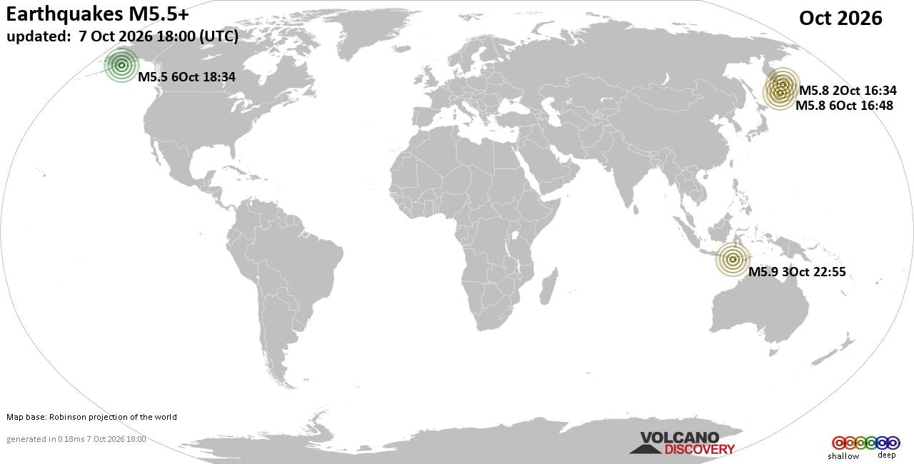
World Earthquake Report for October 2026
• M 1.3 - 57 km NW of Ninilchik, Alaska
• M 1.3 - 3 km ESE of Rose Lodge, Oregon
• M 2.1 - 6 km SSW of Pāhala, Hawaii
• M 1.5 - 27 km E of Honaunau-Napoopoo, Hawaii
• M 1.0 - 6 km WSW of Wilderness Rim, Washington
• M 3.0 - 23 km NE of Hydesville, CA
|

#741357
Wed 16 Oct 2024 05:00:PM
|
Joined: Feb 2001
Posts: 678,977
Launch Director
|
|
Launch Director
Joined: Feb 2001
Posts: 678,977 |
SPC Day 1 Fire Weather OutlookSPC Day 1 Fire Weather Outlook 
Day 1 Fire Weather Outlook
NWS Storm Prediction Center Norman OK
1159 AM CDT Wed Oct 16 2024

Valid 161700Z - 171200Z

...CRITICAL FIRE WEATHER AREA FOR PORTIONS OF THE NORTHERN AND
CENTRAL PLAINS...

The previous forecast (see below) remains on track, and only minor
adjustments were made with this update. In particular, the
Elevated/Critical highlights in the northern Plains were expanded
northward, and the Elevated area in the central Gulf Coast was
expanded eastward into the western FL Panhandle -- both based on the
latest surface observations and latest high-resolution guidance.

..Weinman.. 10/16/2024

.PREV DISCUSSION... /ISSUED 0143 AM CDT Wed Oct 16 2024/

...Synopsis...
...Central and Northern Plains...
A strong (sub 1000mb) surface cyclone will develop across eastern
Montana on Wednesday, with strong winds expected across much of the
central and northern Plains. This is due to the tight pressure
gradient between this surface low and the strong area of high
pressure centered over the Tennessee Valley. The strongest winds are
expected from west-central Kansas to southern South Dakota where
sustained winds of 25 to 30 mph are possible. The lowest relative
humidity is also expected in a similar area with sub 20 percent
values from the Texas Panhandle to central Minnesota. A Critical
area from west-central Kansas to southern South Dakota, where these
strongest winds and low relative humidities overlap the driest
fuels, seems appropriately placed based on the latest guidance.

...Central Nevada into western Utah...
Some troughing may develop in the lee of the Sierra on Wednesday as
a mid-level trough crosses California. The combination of some
modest mid-level flow strengthening above a well-mixed airmass, and
some tightening of the pressure gradient, may result in 15 to 20 mph
winds across central Nevada and into western Utah. An extended
period of above-normal temperatures have dried fuels substantially
in this region recently. Therefore, an Elevated delineation has been
added to address the threat.

...Gulf Coast...
Some dry and breezy offshore flow is possible across portions of the
Gulf Coast Wednesday with relative humidity of 20 to 30 percent and
surface winds of 10 to 15 mph. The strongest winds are currently
only forecast near the coast where fuels are not as receptive. The
only exception is across central Louisiana where some stronger winds
are possible. Some Elevated fire weather conditions are possible
across this region, within the post-frontal airmass.

...Please see www.spc.noaa.gov/fire for graphic product...
Read morehttps://www.spc.noaa.gov/products/fire_wx/fwdy1.html
|
|



CMS The Best Conveyancing solicitors conveyancing quotes throughout the UK
For any webhosting enquiries please email webmaster@aus-city.com
|
|
Forums60
Topics875,107
Posts909,903
Members2,960
| |
Most Online102,106
Jul 10th, 2026
|
|
|









































