|
|
|
0 members (),
1,609
guests, and
28
robots. |
|
Key:
Admin,
Global Mod,
Mod
|
|
S |
M |
T |
W |
T |
F |
S |
|
|
|
|
|
|
|
1
|
|
2
|
3
|
4
|
5
|
6
|
7
|
8
|
|
9
|
10
|
11
|
12
|
13
|
14
|
15
|
|
16
|
17
|
18
|
19
|
20
|
21
|
22
|
|
23
|
24
|
25
|
26
|
27
|
28
|
29
|
|
30
|
31
|
|
|
|
|
|
|
There are no members with birthdays on this day. |
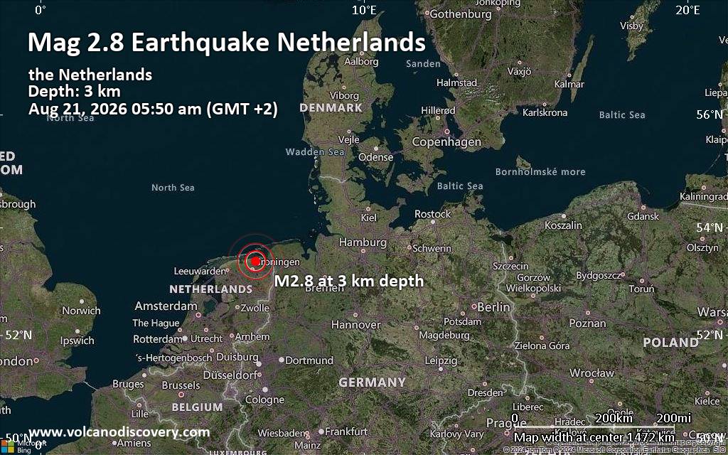
Small tremor of magnitude 2.8 just reported 20 km northeast of Groningen, Netherlands
|

#766724
Thu 03 Jul 2025 06:22:PM
|
Joined: Feb 2001
Posts: 678,976
Launch Director
|
OP

Launch Director
Joined: Feb 2001
Posts: 678,976 |
SPC MD 1549MD 1549 CONCERNING SEVERE POTENTIAL...WATCH POSSIBLE FOR NORTHERN NY AND NORTHWEST VT 
Mesoscale Discussion 1549
NWS Storm Prediction Center Norman OK
0120 PM CDT Thu Jul 03 2025

Areas affected...northern NY and northwest VT

Concerning...Severe potential...Watch possible

Valid 031820Z - 032015Z

Probability of Watch Issuance...40 percent

SUMMARY...The final round of strong to isolated severe thunderstorms
should spread from the Saint Lawrence Valley across northern New
York through the rest of the afternoon. Marginal storm
intensity/coverage may mitigate Severe Thunderstorm Watch issuance.

DISCUSSION...Convection has increased along the synoptic cold front
arcing southwestward across far eastern ON. Despite earlier
convection across northern NY, robust insolation in its wake is
supporting airmass recovery ahead of this last round of convection.
Surface temperatures in the mid to upper 70s are becoming common
downstream of Lake ON and recovery back through the 70s may occur
across the northern Adirondacks and Champlain Valley. Despite weak
low-level westerlies ahead of the front, strong deep-layer speed
shear per the TYX VWP data should support a few cells with mid-level
rotation as they cross into northern NY. Guidance suggests that the
attendant mid-level jetlet will shift south into early evening.
This, combined with uncertainty over the degree of boundary-layer
recovery, suggests the overall damaging wind and hail threats may
remain marginal/isolated.

..Grams/Mosier.. 07/03/2025

...Please see www.spc.noaa.gov for graphic product...

ATTN...WFO...BTV...ALY...BUF...

LAT...LON   45107263 43907311 43667358 43777534 44057617 44537600
            45077492 45107263

MOST PROBABLE PEAK WIND GUST...UP TO 60 MPH
MOST PROBABLE PEAK HAIL SIZE...UP TO 1.25 IN
Read morehttps://www.spc.noaa.gov/products/md/md1549.html
|
|



CMS The Best Conveyancing solicitors conveyancing quotes throughout the UK
For any webhosting enquiries please email webmaster@aus-city.com
|
|
Forums60
Topics800,642
Posts835,432
Members2,960
| |
Most Online102,106
Jul 10th, 2026
|
|
|
|
|

|





































