|
|
|
0 members (),
2,324
guests, and
25
robots. |
|
Key:
Admin,
Global Mod,
Mod
|
|
S |
M |
T |
W |
T |
F |
S |
|
1
|
2
|
3
|
4
|
5
|
6
|
7
|
|
8
|
9
|
10
|
11
|
12
|
13
|
14
|
|
15
|
16
|
17
|
18
|
19
|
20
|
21
|
|
22
|
23
|
24
|
25
|
26
|
27
|
28
|
|
29
|
30
|
|
|
|
|
|
|
There are no members with birthdays on this day. |
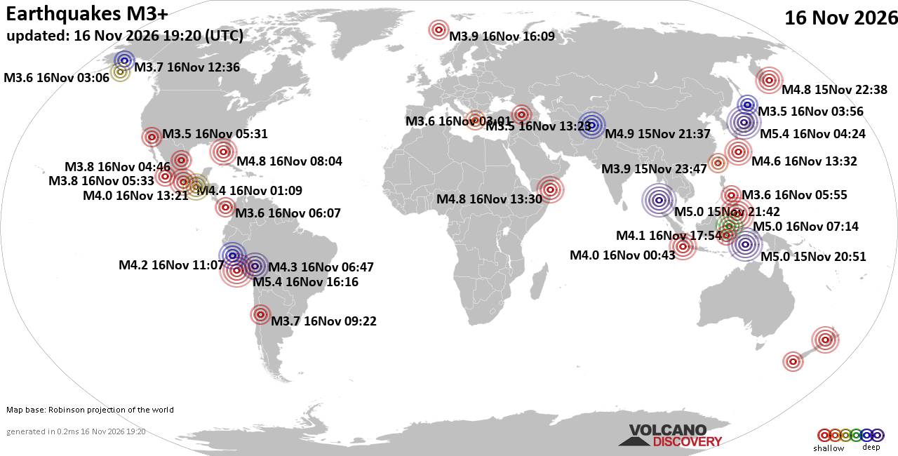
World Earthquake Report for Monday, 16 November 2026
• Moderate mag. 4.5 earthquake - 160 km northwest of Kavieng, New Ireland Pro...
• M 4.4 - off the coast of Oregon
• M 2.3 - 14 km ESE of Clam Gulch, Alaska
• M 3.9 - Rat Islands, Aleutian Islands, Alaska
• M 1.8 - 8 km NW of Round Valley, CA
• M 0.7 - 9 km S of Idyllwild, CA
|

#770635
Wed 06 Aug 2025 04:33:PM
|
Joined: Feb 2001
Posts: 800,656
Launch Director
|
|
Launch Director
Joined: Feb 2001
Posts: 800,656 |
SPC Aug 6, 2025 1630 UTC Day 1 Convective OutlookSPC 1630Z Day 1 Outlook 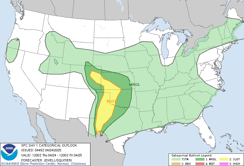
Day 1 Convective Outlook
NWS Storm Prediction Center Norman OK
1129 AM CDT Wed Aug 06 2025

Valid 061630Z - 071200Z

...THERE IS A MARGINAL RISK OF SEVERE THUNDERSTORMS ACROSS PARTS OF
THE NORTHERN/CENTRAL PLAINS TO THE MID-MISSISSIPPI VALLEY. AND PART
OF NORTHERN MINNESOTA...

...SUMMARY...
Isolated strong to severe thunderstorms are possible across parts of
the northern/central Plains to the Mid-Mississippi Valley, and over
part of northern Minnesota this afternoon and tonight.

...Northern/Central Plains into the Mid MS Valley...
Water-vapor imagery late this morning shows a quasi-zonal flow
regime from the northern Intermountain region east into the central
Great Plains.  A disturbance along the ND/Canadian border will
continue east into the western ON vicinity late tonight.  Weak
mid-level height rises are forecast over the northern Great Plains
downstream  of a trough moving east into the northwestern CONUS from
the eastern Pacific.  A belt of stronger mid-level flow (i.e. around
40 kt at 500 mb) will extend across the region, and  diurnal heating
of the moist airmass in place will foster moderate to strong
buoyancy.

Forecast soundings show a vigorous combination of shear/buoyancy but
nebulous forcing mechanisms suggest storm coverage later
today/tonight will likely remain isolated/sparse.  Little in the way
of large-scale forcing for ascent will contribute to suppressing
convective development through at least mid afternoon.  Considerable
uncertainty in storm development is apparent in convection-allowing
models and some of these models show isolated storms perhaps
favoring the greater Black Hills area.  Will maintain a Marginal
risk (level 1 of 5) despite favorable environmental conditions for
supercells.  Later tonight in association with low-level warm-air
advection, a cluster or two of storms may evolve from the eastern
half of SD/NE into the lower MO Valley/mid MS Valley.  An isolated
hail/wind threat could accompany this activity.

...Northern MN...
A few storms may develop along the southern periphery of the
Canadian Prairies shortwave upper trough and surface low. Lapse
rates will be weaker across this area and the favorable
thermodynamic environment will be narrow. Any stronger storms will
likely remain close to the international border, but could produce
locally strong gusts or marginal hail.

..Smith/Wendt.. 08/06/2025
Read morehttps://www.spc.noaa.gov/products/outlook/day1otlk_1630.html
|
|



CMS The Best Conveyancing solicitors conveyancing quotes throughout the UK
For any webhosting enquiries please email webmaster@aus-city.com
|
|
Forums60
Topics930,716
Posts965,513
Members2,960
| |
Most Online102,106
Jul 10th, 2026
|
|
|
|
|

|









































