|
|
|
0 members (),
1,942
guests, and
24
robots. |
|
Key:
Admin,
Global Mod,
Mod
|
|
S |
M |
T |
W |
T |
F |
S |
|
|
|
|
|
|
|
1
|
|
2
|
3
|
4
|
5
|
6
|
7
|
8
|
|
9
|
10
|
11
|
12
|
13
|
14
|
15
|
|
16
|
17
|
18
|
19
|
20
|
21
|
22
|
|
23
|
24
|
25
|
26
|
27
|
28
|
29
|
|
30
|
31
|
|
|
|
|
|
|
There are no members with birthdays on this day. |
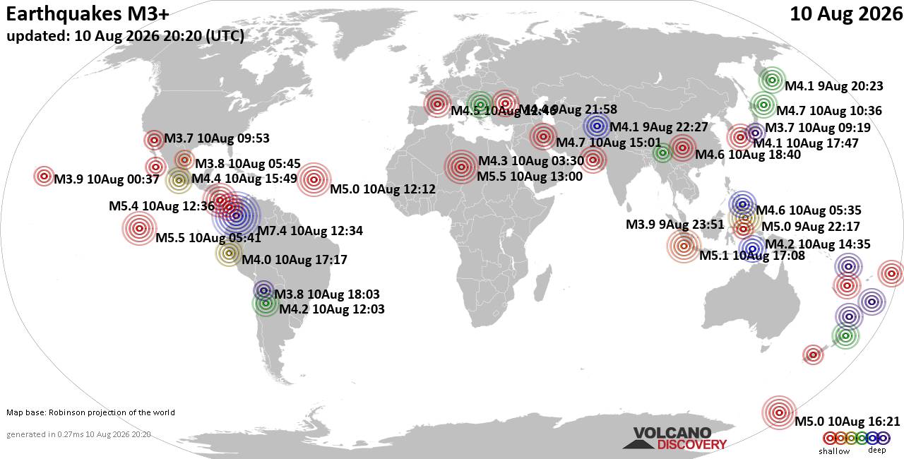
World Earthquake Report for Monday, 10 August 2026
• Volcano earthquake report for Monday, 10 Aug 2026
• Moderate mag. 4.0 earthquake - Zangilan Rayon, 58 km southwest of Ganja, Ga...
• Moderate mag. 4.6 earthquake - 31 km northeast of Xunchang, Sichuan, China,...
• Moderate mag. 4.2 earthquake - New Zealand on Tuesday, Aug 11, 2026, at 06:...
• World Earthquake Report for August 2026
|

#780003
Tue 28 Oct 2025 12:49:PM
|
Joined: Feb 2001
Posts: 678,976
Launch Director
|
OP

Launch Director
Joined: Feb 2001
Posts: 678,976 |
SPC Oct 28, 2025 1300 UTC Day 1 Convective OutlookSPC 1300Z Day 1 Outlook 
Day 1 Convective Outlook
NWS Storm Prediction Center Norman OK
0745 AM CDT Tue Oct 28 2025

Valid 281300Z - 291200Z

...THERE IS A MARGINAL RISK OF SEVERE THUNDERSTORMS ACROSS
EAST/SOUTHEAST TEXAS AND LOUISIANA/ARKLATEX...

...SUMMARY...
Isolated severe storms capable of large hail, damaging winds, and a
tornado risk will be possible mainly during the mid/late afternoon
and evening across east/southeast Texas and Louisiana.

...East/Southeast Texas to ArkLaTex/Louisiana...
Large-scale trough amplification will steadily occur from the Great
Plains toward the Ozarks/Mid-South through tonight. A related
southeastward-moving cold front will reach the Lower Mississippi
Valley by this evening, intercepting a relatively moist air mass
(mid/upper 60s F surface dewpoints) that will continue to advect
northward across southeast/east Texas and southern/western
Louisiana. Ample warm-sector pre-frontal heating will occur into the
afternoon particularly across east/southeast Texas, where
mixed-layer buoyancy may exceed 2000 J/kg MLCAPE.

Increasing storm development/intensification is expected into
mid/late afternoon near the advancing front, with strengthening
winds aloft (45+ kt effective shear) supportive of organized storms
including a few supercells. Any such supercells could pose a risk
for large hail, and possibly some tornado risk. Damaging winds may
also occur as storms increase/merge and spread east-southward from
far east/southeast Texas into Louisiana by early/mid-evening.
Current thinking is the overall risk will remain relatively
isolated, but subsequent outlooks will reevaluate any need for
somewhat higher probabilities on a sub-regional basis.

..Guyer/Weinman.. 10/28/2025
Read morehttps://www.spc.noaa.gov/products/outlook/day1otlk_1300.html
|
|



CMS The Best Conveyancing solicitors conveyancing quotes throughout the UK
For any webhosting enquiries please email webmaster@aus-city.com
|
|
Forums60
Topics795,887
Posts830,677
Members2,960
| |
Most Online102,106
Jul 10th, 2026
|
|
|
|
|

|





































