|
0 members (),
887
guests, and
22
robots. |
|
Key:
Admin,
Global Mod,
Mod
|
|
S |
M |
T |
W |
T |
F |
S |
|
|
|
|
|
|
|
1
|
|
2
|
3
|
4
|
5
|
6
|
7
|
8
|
|
9
|
10
|
11
|
12
|
13
|
14
|
15
|
|
16
|
17
|
18
|
19
|
20
|
21
|
22
|
|
23
|
24
|
25
|
26
|
27
|
28
|
29
|
|
30
|
31
|
|
|
|
|
|
|
There are no members with birthdays on this day. |
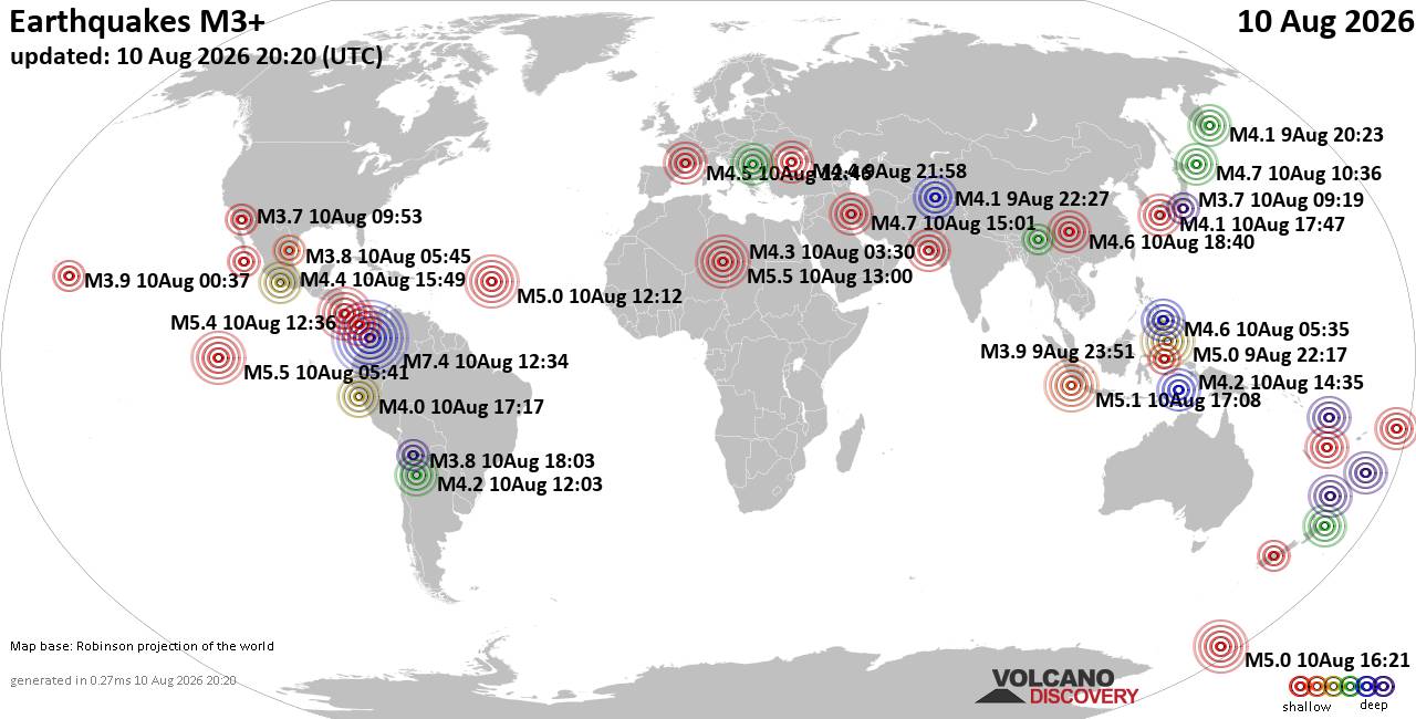
World Earthquake Report for Monday, 10 August 2026
• Volcano earthquake report for Monday, 10 Aug 2026
• Moderate mag. 4.0 earthquake - Zangilan Rayon, 58 km southwest of Ganja, Ga...
• Moderate mag. 4.6 earthquake - 31 km northeast of Xunchang, Sichuan, China,...
• Moderate mag. 4.2 earthquake - New Zealand on Tuesday, Aug 11, 2026, at 06:...
• World Earthquake Report for August 2026
|

#780909
Thu 30 Oct 2025 09:40:PM
|
Joined: Feb 2001
Posts: 678,976
Launch Director
|
OP

Launch Director
Joined: Feb 2001
Posts: 678,976 |
SPC Day 3-8 Fire Weather OutlookSPC Day 3-8 Fire Weather Outlook 
Day 3-8 Fire Weather Outlook
NWS Storm Prediction Center Norman OK
0435 PM CDT Thu Oct 30 2025

Valid 011200Z - 071200Z

...Days 3-4/Saturday-Sunday...
A mid-level trough pivoting into the southeastern U.S. is expected
to bring light precipitation across portions of the Ohio River
Valley, Appalachians and Mid-Atlantic region. A diffuse pressure
gradient at the surface will support lighter winds overall,
minimizing fire weather concerns for the weekend for much of the
eastern U.S. Upper-level ridging across the West will continue to
promote warm and dry conditions across much of the region but light
winds and largely unreceptive fuels should mitigate the fire weather
threat.

...Days 5-8/Monday-Thursday...
A strong polar jet within a more progressive wave pattern along with
emergent lee surface trough/cyclones will present opportunities for
enhanced winds across the Plains through the middle of next week.
Stronger south/southwest winds in response to a deepening lee trough
in addition to minimal Gulf moisture return amid a low-level thermal
ridge could bring a fire weather threat to portions of the southern
High Plains on Day 6/Tuesday. Additional fine fuel availability due
to recent frost/freeze events could also support wildfire spread.
However, overall predictability remains low in timing and magnitude
for introduction of critical probabilities at this time. Farther
east, high pressure moving into the Tennessee Valley on Days
5-6/Monday-Tuesday should maintain a dry, offshore flow across the
northern Gulf Coast. Rainfall deficits across portions of southern
AL/GA and northern FL along with pockets of dry fuels could combine
with the dry offshore flow to promote an elevated fire weather
concern but light winds should mitigate a broader critical fire
weather threat early next week.

..Williams.. 10/30/2025

...Please see www.spc.noaa.gov/fire for graphic product...
Read morehttps://www.spc.noaa.gov/products/exper/fire_wx/
|
|



CMS The Best Conveyancing solicitors conveyancing quotes throughout the UK
For any webhosting enquiries please email webmaster@aus-city.com
|
|
Forums60
Topics796,363
Posts831,153
Members2,960
| |
Most Online102,106
Jul 10th, 2026
|
|
|





































