|
|
|
0 members (),
1,649
guests, and
21
robots. |
|
Key:
Admin,
Global Mod,
Mod
|
|
S |
M |
T |
W |
T |
F |
S |
|
1
|
2
|
3
|
4
|
5
|
6
|
7
|
|
8
|
9
|
10
|
11
|
12
|
13
|
14
|
|
15
|
16
|
17
|
18
|
19
|
20
|
21
|
|
22
|
23
|
24
|
25
|
26
|
27
|
28
|
|
29
|
30
|
|
|
|
|
|
|
There are no members with birthdays on this day. |
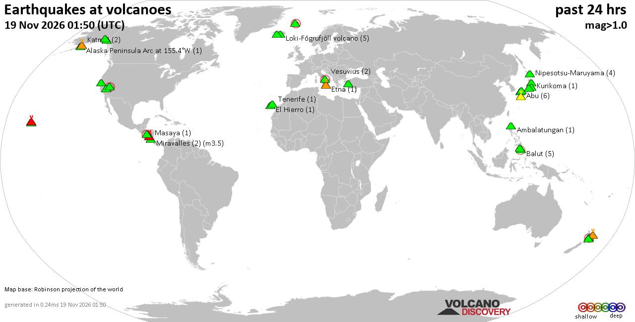
Volcano earthquake report for Thursday, 19 November 2026
• M 1.8 - 23 km WSW of Ackerly, Texas
• M 0.7 - 2 km N of The Geysers, CA
• M 1.9 - 23 km E of Beluga, Alaska
• M 1.3 - 1 km E of The Geysers, CA
• M 1.2 - 14 km NNE of Milford, Utah
|

#800933
Tue 03 Mar 2026 06:08:PM
|
Joined: Feb 2001
Posts: 800,656
Launch Director
|
|
Launch Director
Joined: Feb 2001
Posts: 800,656 |
SPC Mar 3, 2026 1630 UTC Day 1 Convective OutlookSPC 1630Z Day 1 Outlook 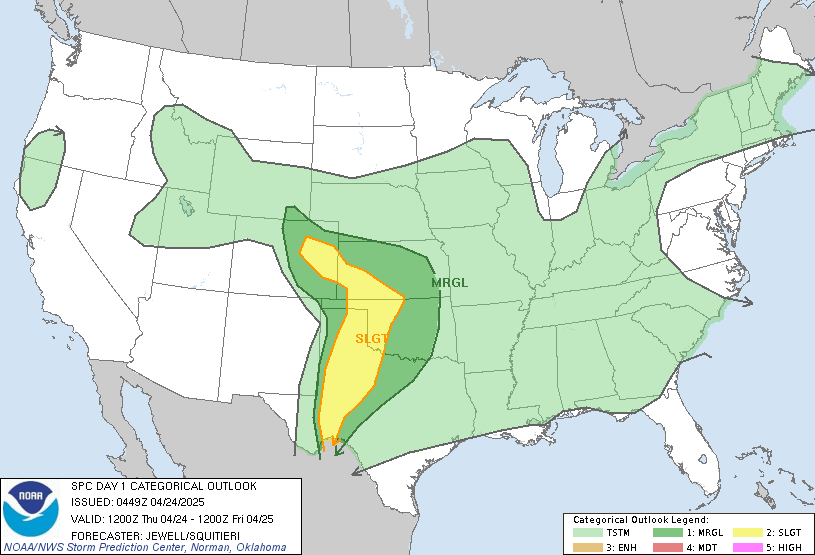
Day 1 Convective Outlook
NWS Storm Prediction Center Norman OK
1030 AM CST Tue Mar 03 2026

Valid 031630Z - 041200Z

...THERE IS A MARGINAL RISK OF SEVERE THUNDERSTORMS ACROSS PARTS OF
THE SOUTHERN/CENTRAL PLAINS INTO MISSOURI AND WESTERN ILLINOIS...

...SUMMARY...
Isolated severe hail may occur this evening into the overnight hours
across parts of the southern/central Plains into Missouri and
western Illinois.

...Southern/Central Plains into Missouri and Western Illinois...
Water-vapor imagery this morning shows a mid-level shortwave trough
over the central Rockies and this feature will move into the central
High Plains late tonight.  A frontal zone this morning is draped
from near the Raton Mesa into the TX Panhandle extends
east-northeastward across northern OK into the Ozarks.  A weak
surface low over northeast NM and the OK/TX Panhandles this morning
will gradually develop towards northwest TX by this evening.
Southerly low-level flow will maintain a moist fetch into OK today
and into the Ozarks and parts of the mid MS Valley.  A dryline is
forecast to mix eastward across the southern High Plains by late
this afternoon, intersecting the surface front in the northwest
TX/southwest OK vicinity.

Convection will likely be inhibited during the day across much of
the MRGL Risk owing to both capping and weak mid-level shortwave
ridging.  The strongest heating and low-level convergence is
forecast across parts of northwest TX/southwest OK where convective
inhibition will become weakened by late afternoon.  Have adjusted
severe hail probabilities farther south into parts of northwest TX
to account for the potential for a supercell or two this evening
into the overnight hours.  As large-scale forcing for ascent
continues to strengthen through the evening into the overnight,
expected widely scattered thunderstorms to eventually develop near
the frontal zone (perhaps favoring a northwest OK/southern KS
corridor).  Large hail will be the hazard with the stronger storms.
Around 1000-1500 J/kg of MUCAPE, steepened mid-level lapse rates,
and strong effective bulk shear suggest that some of these cells may
pose a threat for isolated severe hail as they spread from OK/KS
into MO and western IL through early Wednesday morning.

..Smith/Wendt.. 03/03/2026
Read morehttps://www.spc.noaa.gov/products/outlook/day1otlk_1630.html
|
|



CMS The Best Conveyancing solicitors conveyancing quotes throughout the UK
For any webhosting enquiries please email webmaster@aus-city.com
|
|
Forums60
Topics936,067
Posts970,864
Members2,960
| |
Most Online102,106
Jul 10th, 2026
|
|
|
|
|

|









































