|
|
|
0 members (),
863
guests, and
25
robots. |
|
Key:
Admin,
Global Mod,
Mod
|
|
S |
M |
T |
W |
T |
F |
S |
|
|
|
1
|
2
|
3
|
4
|
5
|
|
6
|
7
|
8
|
9
|
10
|
11
|
12
|
|
13
|
14
|
15
|
16
|
17
|
18
|
19
|
|
20
|
21
|
22
|
23
|
24
|
25
|
26
|
|
27
|
28
|
29
|
30
|
|
|
|
|
There are no members with birthdays on this day. |
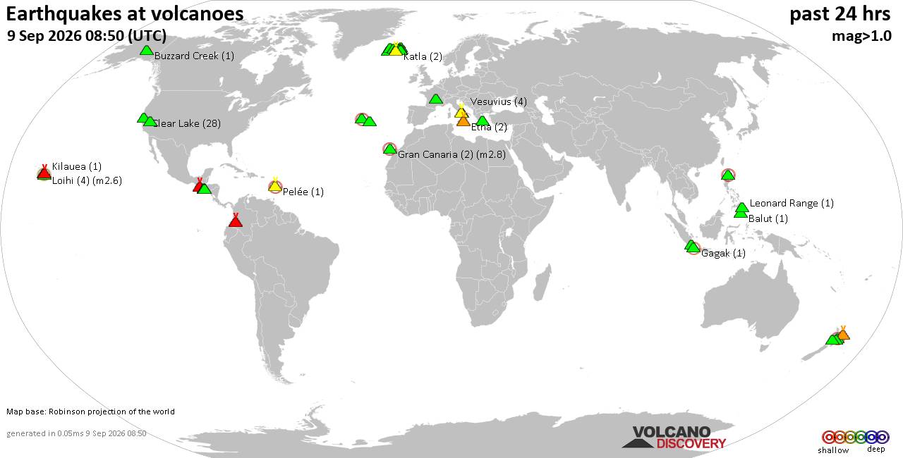
Volcano earthquake report for Wednesday, 9 September 2026
• World Earthquake Report for Wednesday, 9 September 2026
• Strong mag. 5.0 earthquake - Celebes Sea, 49 km north of Tahuna, Indonesia,...
• Moderate mag. 4.7 earthquake - Philippine Sea, 135 km southeast of Shima, M...
• The 10 most powerful earthquakes in the world since 1900
• Moderate mag. 4.0 earthquake - Indian Ocean, 80 km southwest of Labuan, Kab...
|

#802335
Sat 14 Mar 2026 06:33:AM
|
Joined: Feb 2001
Posts: 678,977
Launch Director
|
|
Launch Director
Joined: Feb 2001
Posts: 678,977 |
SPC Day 2 Fire Weather OutlookSPC Day 2 Fire Weather Outlook 
Day 2 Fire Weather Outlook
NWS Storm Prediction Center Norman OK
0131 AM CDT Sat Mar 14 2026

Valid 151200Z - 161200Z

...CRITICAL FIRE WEATHER AREA FOR CENTRAL/EASTERN NEW MEXICO AND
PORTIONS OF WEST TEXAS...

...Synopsis...
Behind a departing low pressure system on D2/Sunday, strong
northwesterly flow will continue across the southern High Plains.
Elevated to Critical fire weather is likely to be ongoing at the
start of the period, continuing overnight from D1/Saturday.

Through the afternoon on Sunday, a cold front will shift southwards
across southern Kansas into the OK/TX Panhandles and eastern New
Mexico, bringing a shift from westerly to northerly winds which may
pose a risk with any ongoing fires. Ahead of the front, relative
humidity reductions around 10-15% will overlap sustained westerly
winds 20-25 mph. Though relative humidity may initially improve post
cold frontal passage, a secondary period of Elevated to Critical
conditions appears likely across the OK/TX Panhandles into the
afternoon/evening where relative humidity will drop near 15% again
overlapping north to northwesterly winds 20-25 mph. A large Critical
area was maintained with this outlook from central/eastern New
Mexico into Western Texas where highest confidence in Critical
conditions remains.

Broader Elevated fire weather concerns will extend into portions of
central Texas and Oklahoma, where afternoon relative humidity around
20-25% will overlap with sustained winds around 20 mph. Elevated
conditions will also extend into much of northern and western New
Mexico where fuels are expected to experience drying over the D1/D2
period.

..Thornton.. 03/14/2026

...Please see www.spc.noaa.gov/fire for graphic product...
Read morehttps://www.spc.noaa.gov/products/fire_wx/fwdy2.html
|
|



CMS The Best Conveyancing solicitors conveyancing quotes throughout the UK
For any webhosting enquiries please email webmaster@aus-city.com
|
|
Forums60
Topics822,449
Posts857,242
Members2,960
| |
Most Online102,106
Jul 10th, 2026
|
|
|
|
|

|





































