|
|
|
0 members (),
1,255
guests, and
22
robots. |
|
Key:
Admin,
Global Mod,
Mod
|
|
S |
M |
T |
W |
T |
F |
S |
|
|
|
|
|
|
|
1
|
|
2
|
3
|
4
|
5
|
6
|
7
|
8
|
|
9
|
10
|
11
|
12
|
13
|
14
|
15
|
|
16
|
17
|
18
|
19
|
20
|
21
|
22
|
|
23
|
24
|
25
|
26
|
27
|
28
|
29
|
|
30
|
31
|
|
|
|
|
|
|
There are no members with birthdays on this day. |
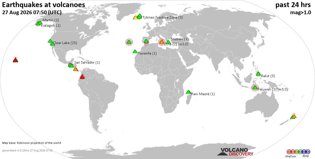
Volcano earthquake report for Thursday, 27 Aug 2026
• Strong mag. 5.2 earthquake - 334 km south of Ogasawara, Tokyo, Japan, on Th...
• Seismic-like event, possible earthquake, reported minutes ago near Granada,...
• World Earthquake Report for Thursday, 27 August 2026
• Possible earthquake reported near Acapulco de Juárez, Guerrero, Mexico, a ...
• Moderate mag. 4.3 earthquake - 16 km southeast of Acapulco de Juárez, Esta...
|

#805808
Thu 16 Apr 2026 07:07:AM
|
Joined: Feb 2001
Posts: 678,977
Launch Director
|
|
Launch Director
Joined: Feb 2001
Posts: 678,977 |
SPC Apr 16, 2026 0730 UTC Day 3 Severe Thunderstorm OutlookSPC 0730Z Day 3 Outlook 
Day 3 Convective Outlook
NWS Storm Prediction Center Norman OK
0205 AM CDT Thu Apr 16 2026

Valid 181200Z - 191200Z

...THERE IS A SLIGHT RISK OF SEVERE THUNDERSTORMS ACROSS PORTIONS OF
THE OHIO VALLEY...

...SUMMARY...
Isolated strong to severe thunderstorms capable of damaging winds
and hail will be possible on Saturday across part of the Ohio
Valley.

...Ohio Valley...

A large-scale upper trough oriented over the Upper Midwest and
Plains will shift east over the Great Lakes, Midwest and TN Valley
on Saturday/Saturday night. Strong deep-layer southwesterly flow
will overspread the Ohio Valley ahead of an eastward-advancing cold
front. This front should be located from Lower MI into southeast MO
Saturday morning, moving across the Ohio Valley through early
evening. Modest boundary-layer moisture will be in place ahead of
the front. Daytime heating into the 70s and modestly steep midlevel
lapse rates will support weak destabilization (generally less than
1000 J/kg MLCAPE). While instability will be modest, strong low and
midlevel flow will support organized cells and/or line segments
capable of strong gusts. Any discrete cellular activity also may
produce marginally severe hail. These severe risk should gradually
wane during the evening with eastward extent.

...TX to the Lower MS Valley...

Thunderstorms are expected along a southeast-advancing cold front
Saturday afternoon and evening. Deep-layer flow will be oriented
parallel to the front, and convection may largely be anafrontal or
quickly undercut by the front. While weak MUCAPE is noted in
forecast soundings, severe potential is not expected at this time.

..Leitman.. 04/16/2026
Read morehttps://www.spc.noaa.gov/products/outlook/day3otlk_0730.html
|
|



CMS The Best Conveyancing solicitors conveyancing quotes throughout the UK
For any webhosting enquiries please email webmaster@aus-city.com
|
|
Forums60
Topics813,588
Posts848,381
Members2,960
| |
Most Online102,106
Jul 10th, 2026
|
|
|
|
|

|





































