|
|
|
0 members (),
2,892
guests, and
27
robots. |
|
Key:
Admin,
Global Mod,
Mod
|
|
S |
M |
T |
W |
T |
F |
S |
|
|
|
|
|
1
|
2
|
3
|
|
4
|
5
|
6
|
7
|
8
|
9
|
10
|
|
11
|
12
|
13
|
14
|
15
|
16
|
17
|
|
18
|
19
|
20
|
21
|
22
|
23
|
24
|
|
25
|
26
|
27
|
28
|
29
|
30
|
31
|
|
There are no members with birthdays on this day. |
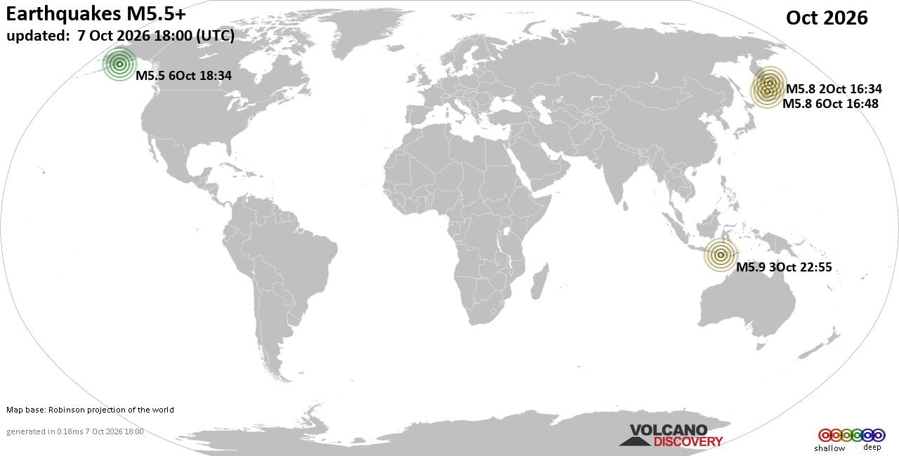
World Earthquake Report for October 2026
• M 1.3 - 57 km NW of Ninilchik, Alaska
• M 1.3 - 3 km ESE of Rose Lodge, Oregon
• M 2.1 - 6 km SSW of Pāhala, Hawaii
• M 1.5 - 27 km E of Honaunau-Napoopoo, Hawaii
• M 1.0 - 6 km WSW of Wilderness Rim, Washington
• M 3.0 - 23 km NE of Hydesville, CA
|

#809873
Tue 12 May 2026 05:55:AM
|
Joined: Feb 2001
Posts: 678,977
Launch Director
|
|
Launch Director
Joined: Feb 2001
Posts: 678,977 |
SPC May 12, 2026 0600 UTC Day 2 Convective OutlookSPC 0600Z Day 2 Outlook 
Day 2 Convective Outlook
NWS Storm Prediction Center Norman OK
1239 AM CDT Tue May 12 2026

Valid 131200Z - 141200Z

...THERE IS A MARGINAL RISK OF SEVERE THUNDERSTORMS ACROSS PARTS OF
THE OHIO VALLEY...CENTRAL APPALACHIANS...NORTHERN ROCKIES AND GREAT
BASIN...

...SUMMARY...
Thunderstorms with isolated severe wind gusts are expected on
Wednesday across parts of the Ohio Valley, central Appalachians,
northern Rockies and Great Basin. Hail will also be possible in
parts of western Montana.

...Ohio Valley/Central Appalachians...
An upper-level trough will move east-southeastward across the Great
Lakes on Wednesday, as an associated mid-level jet streak translates
southeastward into the Ohio Valley. At the surface, a low will move
eastward across southwestern Ontario as a cold front advances
east-southeastward into the central Appalachians. Ahead of the
front, surface dewpoints in the lower to mid 50s F will contribute
to weak instability as surface temperatures warm during the day.
Increasing low-level convergence near the front will lead to
scattered thunderstorm development, with additional storms forming
due to topographic forcing in the central Appalachians. Ahead of the
front, low to mid-level lapse rates are forecast to become steep in
the afternoon peaking in the 7 to 7.5 C/km range, which should
support a threat for isolated severe wind gusts.

...Northern Rockies/Great Basin...
At mid-levels, a shortwave trough will move through the northwestern
U.S. on Wednesday as a 60 to 80 knot jet streak passes eastward into
the northern Rockies. At the surface, a trough will develop from
western Montana southward into Idaho and Utah, ahead of a cold front
passing through the Pacific Northwest. Near the surface trough, an
axis of instability will be in place by afternoon as surface
temperatures warm into the 80s F. In response, thunderstorms will
form in the higher terrain from western Montana southward into the
deserts of eastern Idaho and northern Utah. Near the instability
axis, low to mid-level lapse rates will be very steep likely
exceeding 9 C/km. This will support a threat for isolated severe
wind gusts. Hail could also occur in the northern Rockies.

..Broyles.. 05/12/2026
Read morehttps://www.spc.noaa.gov/products/outlook/day2otlk_0600.html
|
|



CMS The Best Conveyancing solicitors conveyancing quotes throughout the UK
For any webhosting enquiries please email webmaster@aus-city.com
|
|
Forums60
Topics875,107
Posts909,903
Members2,960
| |
Most Online102,106
Jul 10th, 2026
|
|
|
|
|

|









































