|
|
|
1 members (Alisa),
2,530
guests, and
26
robots. |
|
Key:
Admin,
Global Mod,
Mod
|
|
S |
M |
T |
W |
T |
F |
S |
|
|
|
1
|
2
|
3
|
4
|
5
|
|
6
|
7
|
8
|
9
|
10
|
11
|
12
|
|
13
|
14
|
15
|
16
|
17
|
18
|
19
|
|
20
|
21
|
22
|
23
|
24
|
25
|
26
|
|
27
|
28
|
29
|
30
|
|
|
|
|
There are no members with birthdays on this day. |
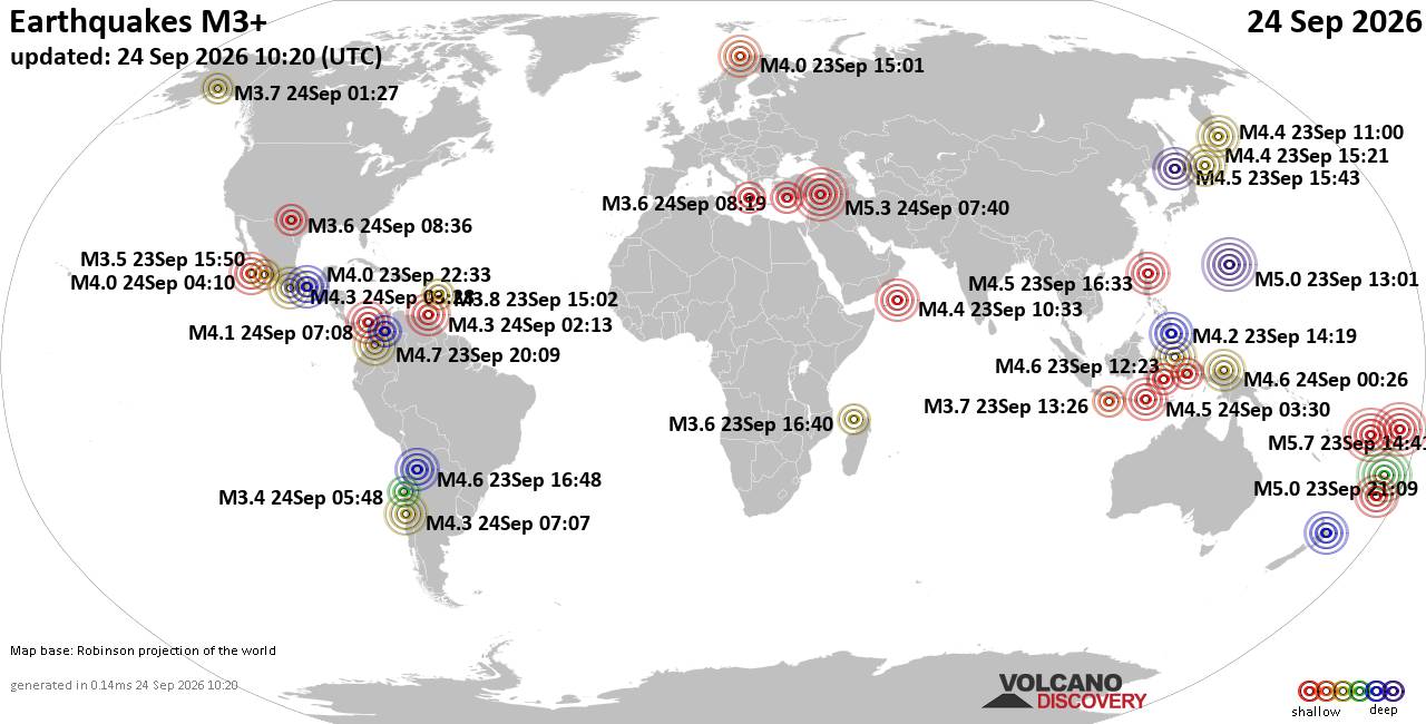
World Earthquake Report for Thursday, 24 September 2026
• Moderate mag. 4.3 earthquake - Madagascar: Mozambique Channel on Thursday, ...
• Small magnitude 3.9 earthquake hits near Hastings, Hastings District, Hawke...
• Volcano earthquake report for Thursday, 24 September 2026
• Light mag. 3.9 earthquake - South Pacific Ocean, 10.2 km south of Hastings,...
• Moderate magnitude 4.1 quake hits 31 miles southeast of Midland, Texas, Uni...
|

#830987
Wed 05 Aug 2026 12:48:PM
|
Joined: Feb 2001
Posts: 678,977
Launch Director
|
|
Launch Director
Joined: Feb 2001
Posts: 678,977 |
SPC Aug 5, 2026 1300 UTC Day 1 Convective OutlookSPC 1300Z Day 1 Outlook 
Day 1 Convective Outlook
NWS Storm Prediction Center Norman OK
0745 AM CDT Wed Aug 05 2026

Valid 051300Z - 061200Z

...THERE IS A MARGINAL RISK OF SEVERE THUNDERSTORMS ACROSS PARTS OF
THE MID MISSISSIPPI VALLEY...SOUTHERN HIGH PLAINS...AND SOUTHEASTERN
ARIZONA...

...SUMMARY...
Isolated severe thunderstorms are possible today across the mid
Mississippi Valley.  Isolated severe gusts may also occur in parts
of the southern High Plains, and in southeastern Arizona.

...Mid Mississippi Valley...
Water-vapor imagery this morning shows a broad upper trough over the
north-central U.S. with a couple of embedded disturbances.  A
leading weak impulse appears associated with a small cluster of
strong to locally severe activity early this morning across the
IA-MO border vicinity, near and immediately north of a stationary
front.  These showers/thunderstorms will likely continue east of the
MS River but it remains unclear whether these storms maintain a
localized risk for severe before gradually weakening.  Later today,
ascent associated with an upstream disturbance moving through the
base of the larger-scale trough over NE into IA, will favor
additional storm development as the boundary layer heats south of
the frontal zone.  Moderate buoyancy is forecast by guidance and
sufficient deep-layer shear will support some potential storm
organization.  The stronger storms may yield an episodic severe risk
before gradually diminishing during the evening.

...Southeastern Arizona...
A seasonably moist airmass sampled this morning by surface
observations (lower 60s F dewpoints) will undergo strong heating
through late afternoon.  Orographic lifting will favor convection
developing over the higher terrain and gradually
spreading/developing into the lower deserts during the early
evening.  Very steep low to mid-level lapse rates will contribute
towards a risk for strong downdrafts capable of a microburst threat
(60-80 mph).  Considered a Slight-Risk based on potentially
scattered storm coverage moving into the lower deserts, but
sufficient model run-to-run (time-lagged HRRR) variability and model
ensemble spread (i.e., 00z HREF vs. REFS) preclude a wind-driven
upgrade at this time.

...Southern High Plains...
Weak but adequately moist, post-frontal upslope flow into the Raton
Mesa vicinity will favor widely scattered diurnal storm development
by mid-late afternoon.  Modest west-northwesterly mid-level flow
will favor storms and their incipient outflow to the east-southeast
into the adjacent High Plains.  Given the steep lapse rates and
relatively dry sub-cloud layer, evaporative cooling will probably
result in a few storms being capable of localized severe gusts
(60-80 mph).

..Smith/Bentley.. 08/05/2026
Read morehttps://www.spc.noaa.gov/products/outlook/day1otlk_1300.html
|
|



CMS The Best Conveyancing solicitors conveyancing quotes throughout the UK
For any webhosting enquiries please email webmaster@aus-city.com
|
|
Forums60
Topics840,505
Posts875,300
Members2,960
| |
Most Online102,106
Jul 10th, 2026
|
|
|
|
|

|





































