|
0 members (),
2,211
guests, and
22
robots. |
|
Key:
Admin,
Global Mod,
Mod
|
|
S |
M |
T |
W |
T |
F |
S |
|
|
|
|
|
|
|
1
|
|
2
|
3
|
4
|
5
|
6
|
7
|
8
|
|
9
|
10
|
11
|
12
|
13
|
14
|
15
|
|
16
|
17
|
18
|
19
|
20
|
21
|
22
|
|
23
|
24
|
25
|
26
|
27
|
28
|
29
|
|
30
|
31
|
|
|
|
|
|
|
There are no members with birthdays on this day. |
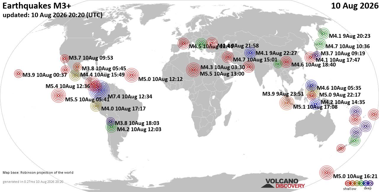
World Earthquake Report for Monday, 10 August 2026
• Volcano earthquake report for Monday, 10 Aug 2026
• Moderate mag. 4.0 earthquake - Zangilan Rayon, 58 km southwest of Ganja, Ga...
• Moderate mag. 4.6 earthquake - 31 km northeast of Xunchang, Sichuan, China,...
• Moderate mag. 4.2 earthquake - New Zealand on Tuesday, Aug 11, 2026, at 06:...
• World Earthquake Report for August 2026
|
|
|
Joined: Feb 2001
Posts: 678,976
Launch Director
|
OP

Launch Director
Joined: Feb 2001
Posts: 678,976 |
SPC MD 1903MD 1903 CONCERNING SEVERE POTENTIAL...WATCH POSSIBLE FOR NORTHEAST CO...FAR NORTHWEST KS...AND PORTIONS OF WESTERN NE 
Mesoscale Discussion 1903
NWS Storm Prediction Center Norman OK
0351 PM CDT Mon Aug 10 2026

Areas affected...Northeast CO...far northwest KS...and portions of
western NE

Concerning...Severe potential...Watch possible

Valid 102051Z - 102315Z

Probability of Watch Issuance...60 percent

SUMMARY...The risk of severe wind gusts and hail will increase from
west to east during the next few hours. A watch may be needed
relatively soon for parts of the area.

DISCUSSION...Isolated high-based thunderstorms are evolving along a
lee trough extending from the NE Panhandle southward into
northeastern CO, and storm coverage should continue to increase as a
subtle midlevel wave approaches the area from the west (per recent
WV loops). Over the next few hours, this activity will spread
eastward into a a plume of middle/upper 50s dewpoints and steep
deep-layer lapse rates, which are contributing to a moderately
unstable air mass. This, combined with an elongating and mostly
straight hodograph, should support some convective organization/cell
splitting. While severe hail will be possible (especially in the
earlier stages of convective intensification), the primary concern
will be an increasing risk of severe wind gusts with any clustering
that occurs. A watch may be needed relatively soon for parts of the
area.

..Weinman/Hart.. 08/10/2026

...Please see www.spc.noaa.gov for graphic product...

ATTN...WFO...LBF...GLD...BOU...CYS...

LAT...LON   39600332 40770330 41620325 42140304 42400259 42430206
            42310162 41750126 40630117 39750134 39230174 39130245
            39330309 39600332

MOST PROBABLE PEAK WIND GUST...65-80 MPH
MOST PROBABLE PEAK HAIL SIZE...1.00-1.75 IN
Read morehttps://www.spc.noaa.gov/products/md/md1903.html
|
|



CMS The Best Conveyancing solicitors conveyancing quotes throughout the UK
For any webhosting enquiries please email webmaster@aus-city.com
|
|
Forums60
Topics795,908
Posts830,698
Members2,960
| |
Most Online102,106
Jul 10th, 2026
|
|
|





































