|
1 members (Webmaster),
877
guests, and
19
robots. |
|
Key:
Admin,
Global Mod,
Mod
|
|
S |
M |
T |
W |
T |
F |
S |
|
|
|
|
|
|
|
1
|
|
2
|
3
|
4
|
5
|
6
|
7
|
8
|
|
9
|
10
|
11
|
12
|
13
|
14
|
15
|
|
16
|
17
|
18
|
19
|
20
|
21
|
22
|
|
23
|
24
|
25
|
26
|
27
|
28
|
29
|
|
30
|
31
|
|
|
|
|
|
|
There are no members with birthdays on this day. |
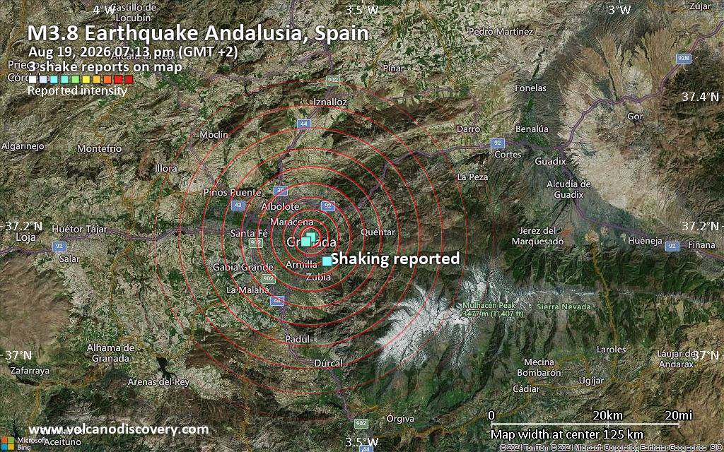
Seismic-like event, possible earthquake, reported few minutes ago near Granada, Andalusia, Spain
• Volcano earthquake report for Wednesday, 19 Aug 2026
• Moderate magnitude 4.8 earthquake 81 km north of Sanchez-Mira, Philippines
• Moderate mag. 4.0 earthquake - North Pacific Ocean, 30 km southeast of Peta...
• Moderate mag. 4.8 earthquake - South China Sea, 36 km west of Calayan Islan...
• World Earthquake Report for Wednesday, 19 August 2026
|
|
|
Joined: Feb 2001
Posts: 678,976
Launch Director
|
OP

Launch Director
Joined: Feb 2001
Posts: 678,976 |
SPC Day 2 Fire Weather OutlookSPC Day 2 Fire Weather Outlook 
Day 2 Fire Weather Outlook
NWS Storm Prediction Center Norman OK
0221 PM CDT Wed Aug 19 2026

Valid 201200Z - 211200Z

...NO CRITICAL AREAS...

The previously drawn elevated area in place over northeastern CA,
northwestern NV, and southern OR was removed. While RHs will still
fall to near 10-15%, the latest forecast guidance has trended weaker
with winds during the afternoon across the region on Day 2/Thursday.
Outside of localized terrain-enhanced wind, widespread afternoon
winds of 10-15 mph are expected to remain below elevated thresholds.
Thus, only brief and localized elevated fire environment conditions
are expected over much of the Intermountain West on Day 2/Thursday
afternoon.

..Stearns.. 08/19/2026

.PREV DISCUSSION... /ISSUED 1240 AM CDT Wed Aug 19 2026/

...Synopsis...
Upper-level troughing will persist over the northeastern CONUS on
Day 2/Thursday, with an embedded mid-level shortwave yielding
increased precipitation chances over a drought-stressed environment
in northern Minnesota and Wisconsin. The established upper ridge
over the Great Basin will continue to amplify, delivering above
normal temperatures and dry conditions to the Interior West.
Meanwhile, an upper trough will deepen along the West Coast,
ushering stronger southwesterly flow into the northwestern CONUS.

Across northeastern California, northwestern Nevada, and southern
Oregon, daytime high temperatures will range from 90-100 F or
greater amid 10-20 mph sustained west-southwesterly winds and RH
values of 10-15%. These meteorological conditions will overlap a
receptive fuelscape, promoting an Elevated fire weather threat. RH
values of 15-20% and 10-20 mph southwesterly winds will also overlap
portions of southeastern Nevada; however, recent monsoonal moisture
has contributed to less receptive fuels, precluding the expansion of
Elevated highlights.

...Please see www.spc.noaa.gov/fire for graphic product...
Read morehttps://www.spc.noaa.gov/products/fire_wx/fwdy2.html
|
|



CMS The Best Conveyancing solicitors conveyancing quotes throughout the UK
For any webhosting enquiries please email webmaster@aus-city.com
|
|
Forums60
Topics799,665
Posts834,455
Members2,960
| |
Most Online102,106
Jul 10th, 2026
|
|
|





































