|
0 members (),
766
guests, and
31
robots. |
|
Key:
Admin,
Global Mod,
Mod
|
|
S |
M |
T |
W |
T |
F |
S |
|
|
|
|
|
|
|
1
|
|
2
|
3
|
4
|
5
|
6
|
7
|
8
|
|
9
|
10
|
11
|
12
|
13
|
14
|
15
|
|
16
|
17
|
18
|
19
|
20
|
21
|
22
|
|
23
|
24
|
25
|
26
|
27
|
28
|
29
|
|
30
|
31
|
|
|
|
|
|
|
There are no members with birthdays on this day. |
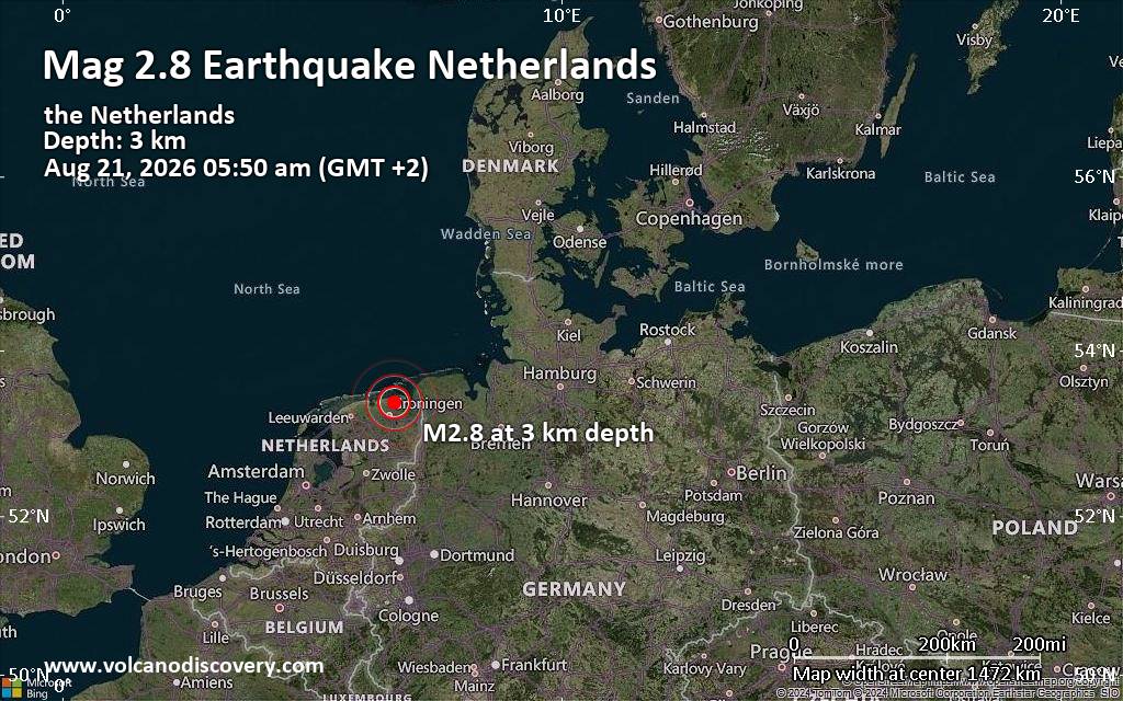
Small tremor of magnitude 2.8 just reported 20 km northeast of Groningen, Netherlands
|
|
|
Joined: Feb 2001
Posts: 678,976
Launch Director
|
OP

Launch Director
Joined: Feb 2001
Posts: 678,976 |
SPC Day 1 Fire Weather OutlookSPC Day 1 Fire Weather Outlook 
Day 1 Fire Weather Outlook
NWS Storm Prediction Center Norman OK
1131 AM CDT Mon Aug 24 2026

Valid 241700Z - 251200Z

A passing mid-level wave will induce periods of locally elevated
fire weather conditions across portions of the Klamath River Basin
today. RH values may decline to less than 15% with wind gusts over
20 mph in terrain favored areas; however, spatial extent and
duration of these conditions will be limited, precluding the
introduction of highlights.

Based on the latest guidance and observations, only minor
adjustments were made to the Isolated Dry Thunderstorm risk area in
the northern Great Basin and Elevated highlights in the southern
Plains. Please see the previous discussion for more details.

..Elizalde-Garcia.. 08/24/2026

.PREV DISCUSSION... /ISSUED 0157 AM CDT Mon Aug 24 2026/

...Synopsis...
A subtle/low-amplitude midlevel wave will move northeastward across
parts of the northern Great Basin today. Farther south, a separate
shortwave trough will track southeastward across the
central/southern Plains -- along the northeastern periphery of an
expansive upper ridge centered on the southern Rockies. In response
to this feature, a surface low will evolve slowly eastward across
parts of OK.

...Dry Thunderstorms - Northern Great Basin...
Diurnal heating/boundary-layer mixing beneath a well-established
midlevel moisture plume will contribute to weak surface-based
destabilization across parts of the northern Great Basin today. As
large-scale forcing for ascent accompanying the midlevel wave
overspreads this instability, isolated high-based thunderstorms will
track northeastward across the area. The deeply mixed boundary layer
(inverted-V profiles) and 25-30 mph storm motions will favor dry
thunderstorms capable of lightning-induced ignitions -- given
receptive fuels.

...Southern Plains...
Along/behind the evolving surface low, a dry air mass (15-20 percent
RH) will develop amid 15-20 mph sustained west-southwesterly surface
winds. These dry/breezy conditions atop increasingly dry fuels
(95th+ percentile ERCs) will yield elevated fire-weather conditions
during the late morning and afternoon.

...Please see www.spc.noaa.gov/fire for graphic product...
Read morehttps://www.spc.noaa.gov/products/fire_wx/fwdy1.html
|
|



CMS The Best Conveyancing solicitors conveyancing quotes throughout the UK
For any webhosting enquiries please email webmaster@aus-city.com
|
|
Forums60
Topics801,062
Posts835,853
Members2,960
| |
Most Online102,106
Jul 10th, 2026
|
|
|





































