|
|
|
0 members (),
2,076
guests, and
24
robots. |
|
Key:
Admin,
Global Mod,
Mod
|
|
S |
M |
T |
W |
T |
F |
S |
|
|
|
1
|
2
|
3
|
4
|
5
|
|
6
|
7
|
8
|
9
|
10
|
11
|
12
|
|
13
|
14
|
15
|
16
|
17
|
18
|
19
|
|
20
|
21
|
22
|
23
|
24
|
25
|
26
|
|
27
|
28
|
29
|
30
|
|
|
|
|
There are no members with birthdays on this day. |
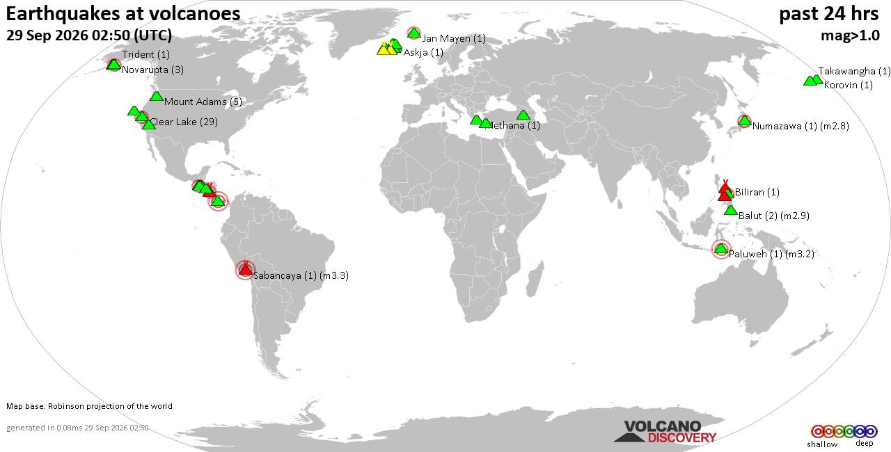
Volcano earthquake report for Tuesday, 29 September 2026
• M 1.0 - 7 km NW of The Geysers, CA
• M 1.8 - 57 km S of Whites City, New Mexico
• M 1.8 - 57 km S of Whites City, New Mexico
• M 2.2 - 8 km W of Cotati, CA
• M 3.5 - 184 km SE of Perryville, Alaska
|
|
|
Joined: Feb 2001
Posts: 678,977
Launch Director
|
|
Launch Director
Joined: Feb 2001
Posts: 678,977 |
SPC Day 2 Fire Weather OutlookSPC Day 2 Fire Weather Outlook 
Day 2 Fire Weather Outlook
NWS Storm Prediction Center Norman OK
0234 PM CDT Tue Sep 29 2026

Valid 301200Z - 011200Z

...NO CRITICAL AREAS...

Drier northerly flow in the wake of a eastward progressing closed
mid/upper low over the Southwest is expected over portions of the
Great Basin into Utah for D2/Wednesday. However, marginal fuels and
recent precipitation will offset impacts of winds of up to 15 mph
and RH of 15-20%, particularly across Utah. Farther east, above
normal temperatures in the lower 90s, RH reductions down to 20% by
peak boundary layer heating/mixing and exceedingly dry fuels will
align over portions of the Mid-South and Lower Mississippi River
Valley Wednesday afternoon. However, light southerly winds under a
ridge aloft of 15 mph or less should limit a broader fire weather
concern across this region.

..Williams.. 09/29/2026

.PREV DISCUSSION... /ISSUED 0101 AM CDT Tue Sep 29 2026/

...Synopsis...
A ridge of high pressure will transition into the western CONUS,
bringing warmer temperatures and a lighter wind regime to California
and the western Great Basin on Day 2/Wednesday. The center of an
eastward progressing mid-level low will enter New Mexico, gradually
weakening as it becomes reincorporated within broader troughing.
Southerly flow will deepen ahead of the low, providing ample
moisture transport bringing PWAT values above the 95th percentile
across much of the central CONUS into the Upper Midwest. This system
will induce widespread precipitation over an environment stressed by
long-term drought, particularly across portions of the southern
Plains and the New Mexico/Colorado Rocky Mountains. Ahead of the
advancing moisture, a residual hot and dry airmass will remain in
place across the lower Mississippi River Valley where receptive
fuels exist; however, light surface winds should limit fire weather
concerns.

...Please see www.spc.noaa.gov/fire for graphic product...
Read morehttps://www.spc.noaa.gov/products/fire_wx/fwdy2.html
|
|



CMS The Best Conveyancing solicitors conveyancing quotes throughout the UK
For any webhosting enquiries please email webmaster@aus-city.com
|
|
Forums60
Topics847,853
Posts882,648
Members2,960
| |
Most Online102,106
Jul 10th, 2026
|
|
|
|
|

|









































