|
0 members (),
1,975
guests, and
29
robots. |
|
Key:
Admin,
Global Mod,
Mod
|
|
S |
M |
T |
W |
T |
F |
S |
|
|
|
1
|
2
|
3
|
4
|
5
|
|
6
|
7
|
8
|
9
|
10
|
11
|
12
|
|
13
|
14
|
15
|
16
|
17
|
18
|
19
|
|
20
|
21
|
22
|
23
|
24
|
25
|
26
|
|
27
|
28
|
29
|
30
|
|
|
|
|
There are no members with birthdays on this day. |
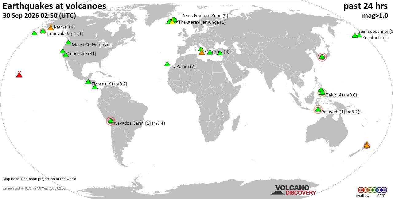
Volcano earthquake report for Wednesday, 30 September 2026
• Strong mag. 5.7 earthquake - 69 km Al Suroeste De Rosario, Costa Rica, on 2...
• M 0.9 - 4 km W of Devore, CA
• M 4.6 - 131 km SE of Itoman, Japan
• M -1.1 - 66 km ENE of Pedro Bay, Alaska
• M 1.6 - 8 km ESE of Cloverdale, CA
• M 3.0 - 8 km ESE of Cloverdale, CA
|
|
|
Joined: Feb 2001
Posts: 678,977
Launch Director
|
|
Launch Director
Joined: Feb 2001
Posts: 678,977 |
Issued at 1100 AM HST Wed Sep 30 2026 000
WTPA42 PHFO 302040
TCDCP2
Tropical Storm Nolo Discussion Number 41
NWS Central Pacific Hurricane Center Honolulu HI EP152026
Issued by NWS National Hurricane Center Miami FL
1100 AM HST Wed Sep 30 2026
Significant wind shear has caused Nolo to rapidly weaken over the
past day, with the remaining deep convection displaced well away
from the fully exposed center of circulation. The tropical storm has
also become increasingly vertically shallow and is currently
wobbling, likely in response to the low-level steering flow. The
latest subjective Dvorak intensity estimates were 35-45 kt, while
objective intensity estimates ranged from 31-41 kt. The initial
intensity is set at a potentially generous 45 kt for this advisory.
Nolo is currently situated between a strong upper-level low to the
northeast and a building ridge centered to the northwest. Despite
this pattern, the tropical storm is drifting toward the
south-southeast, and additional small wobbles in the motion are
possible over the next day or so. A turn back toward the west is
forecast by Thursday, followed by a slow forward motion over the
subsequent day as the upper-level low pulls away from Nolo and the
ridge expands north of the cyclone. By this weekend, Nolo is
expected to accelerate as a new area of high pressure develops to
its north. On the forecast track, Nolo is expected to cross the
International Date Line around days 4-5. The latest NHC forecast has
been shifted to the left from the previous one to account for
the southward initial motion, and is also closer to the latest HCCA
and Google DeepMind solutions.
Very hostile environmental conditions are expected to inhibit any
strengthening over the next day or so. Beyond 24-36 h, Nolo is
forecast to move over warmer ocean temperatures and into an
environment with substantially lower wind shear, supporting gradual
re-strengthening. However, persistent dry mid-level air could limit
the rate of intensification despite the otherwise favorable
conditions. The latest NHC intensity forecast lies near the middle
of the guidance envelope, with Nolo expected to regain hurricane
strength in a couple of days.
FORECAST POSITIONS AND MAX WINDS
INIT 30/2100Z 21.6N 164.7W 45 KT 50 MPH
12H 01/0600Z 21.8N 165.0W 45 KT 50 MPH
24H 01/1800Z 21.9N 165.6W 45 KT 50 MPH
36H 02/0600Z 22.3N 166.3W 50 KT 60 MPH
48H 02/1800Z 22.6N 167.1W 60 KT 70 MPH
60H 03/0600Z 22.8N 168.7W 70 KT 80 MPH
72H 03/1800Z 23.0N 171.3W 80 KT 90 MPH
96H 04/1800Z 24.1N 178.2W 95 KT 110 MPH
120H 05/1800Z 25.5N 174.9E 90 KT 105 MPH
$$
Forecaster Adams Source: Tropical Storm Nolo Forecast Discussion Number 41
|
|



CMS The Best Conveyancing solicitors conveyancing quotes throughout the UK
For any webhosting enquiries please email webmaster@aus-city.com
|
|
Forums60
Topics850,006
Posts884,801
Members2,960
| |
Most Online102,106
Jul 10th, 2026
|
|
|









































