|
|
|
0 members (),
1,071
guests, and
25
robots. |
|
Key:
Admin,
Global Mod,
Mod
|
|
S |
M |
T |
W |
T |
F |
S |
|
|
|
|
|
1
|
2
|
3
|
|
4
|
5
|
6
|
7
|
8
|
9
|
10
|
|
11
|
12
|
13
|
14
|
15
|
16
|
17
|
|
18
|
19
|
20
|
21
|
22
|
23
|
24
|
|
25
|
26
|
27
|
28
|
29
|
30
|
31
|
|
There are no members with birthdays on this day. |
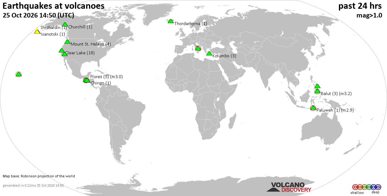
Volcano earthquake report for Sunday, 25 October 2026
• M 3.0 - 263 km SE of Chiniak, Alaska
• M 5.0 - 42 km NNW of Ruteng, Indonesia
• M 0.4 - 63 km WNW of Beluga, Alaska
• M 0.4 - 84 km NNW of Karluk, Alaska
• M 0.5 - 68 km WNW of Beluga, Alaska
|

#892711
Sun 04 Oct 2026 05:50:AM
|
Joined: Feb 2001
Posts: 678,977
Launch Director
|
|
Launch Director
Joined: Feb 2001
Posts: 678,977 |
SPC Oct 4, 2026 0600 UTC Day 1 Convective OutlookSPC 1200Z Day 1 Outlook 
Day 1 Convective Outlook
NWS Storm Prediction Center Norman OK
1247 AM CDT Sun Oct 04 2026

Valid 041200Z - 051200Z

...THERE IS A MARGINAL RISK OF SEVERE THUNDERSTORMS ACROSS PORTIONS
OF THE FLORIDA PANHANDLE...

...SUMMARY...
A few rotating thunderstorms will be possible across portions of the
northern Gulf Coast today, otherwise severe thunderstorms are not
expected.

... Synopsis ...

A midlevel shortwave trough moving across the Great Lakes this
morning will help carve out/reinforce a larger-scale trough across
the eastern US. At the same time, a midlevel anticyclone will remain
in place across the western US. This pattern will favor
northwesterly flow across much of the eastern half of the country,
in turn supporting reinforcing shots of cooler air.

At the surface, weak cyclogenesis should support the development of
a cyclone across the far northern Gulf Coast or just inland across
southern Alabama and the Florida Panhandle. This weak low will
slowly move east during the day.


... Portions of the Florida Panhandle and the Adjacent Coastal
Waters ...

A stalled surface front will be draped across the Southeast today,
with a very moist airmass in place along and south of it. Forecast
soundings across the area indicate nearly moist thermodynamic
profiles from surface to the tropopause, with the 20261004 00 UTC
HREF having mean precipitable water values around 2.5" across most
of the Florida Panhandle. Given these moist vertical profiles,
conditional instability will be low today, with mean MUCAPE values
generally 500 J/kg or less.

Despite the meager instability, one consequence of the moist
vertical profiles will be that LCL heights will be very low --
generally at or below 500 meters. At the same time, forecast
soundings in areas to the east of the surface low show modest wind
curvature in the lowest 3 km. Thus, despite the meager instability,
forced convective showers/thunderstorms will have the potential to
exhibit brief, transient low-level circulations, especially over
coastal areas where surface friction is reduced. The threat should
slowly move east during the day as the surface low slowly moves
east.

..Marsh/Wendt.. 10/04/2026
Read morehttps://www.spc.noaa.gov/products/outlook/day1otlk_1200.html
|
|



CMS The Best Conveyancing solicitors conveyancing quotes throughout the UK
For any webhosting enquiries please email webmaster@aus-city.com
|
|
Forums60
Topics893,863
Posts928,660
Members2,960
| |
Most Online102,106
Jul 10th, 2026
|
|
|
|
|

|









































