|
|
|
0 members (),
1,407
guests, and
27
robots. |
|
Key:
Admin,
Global Mod,
Mod
|
|
S |
M |
T |
W |
T |
F |
S |
|
|
|
|
|
1
|
2
|
3
|
|
4
|
5
|
6
|
7
|
8
|
9
|
10
|
|
11
|
12
|
13
|
14
|
15
|
16
|
17
|
|
18
|
19
|
20
|
21
|
22
|
23
|
24
|
|
25
|
26
|
27
|
28
|
29
|
30
|
31
|
|
There are no members with birthdays on this day. |
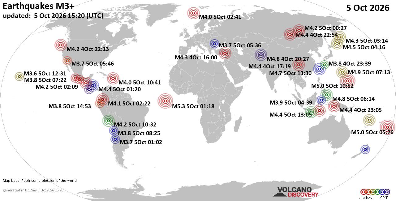
World Earthquake Report for Monday, 5 October 2026
• M 1.5 - 13 km E of Yountville, CA
• M 4.2 - 20 km W of Luzon, Philippines
• M 1.9 - 59 km S of Whites City, New Mexico
• M 3.6 - 12 km SW of Volcano, Hawaii
• M 1.9 - 19 km NW of Westbrook, Texas
|
|
|
Joined: Feb 2001
Posts: 678,977
Launch Director
|
|
Launch Director
Joined: Feb 2001
Posts: 678,977 |
SPC Oct 5, 2026 0730 UTC Day 3 Severe Thunderstorm OutlookSPC 0730Z Day 3 Outlook 
Day 3 Convective Outlook
NWS Storm Prediction Center Norman OK
0139 AM CDT Mon Oct 05 2026

Valid 071200Z - 081200Z

...NO SEVERE THUNDERSTORM AREAS FORECAST...

...SUMMARY...
Severe storms are unlikely on Wednesday.

...Synopsis...
An upper low will be situated near James Bay on Wednesday, with a
broad upper trough enveloping much of eastern Canada. A strong upper
speed max and tight midlevel temperature gradient will extend
roughly from MN to the Great Lakes, with gradual height falls across
the region. Meanwhile, a southern-stream upper jet will extend from
the Desert Southwest into TX, and across the Gulf Coast states. Cool
midlevel temperatures aloft will be prevalent over the Four Corners
states with -12 C at 500 mb.

Minimal instability will be present to support any thunderstorms
from the Great Lakes into the Northeast, despite the cooling aloft,
as surface temperatures will be relatively cool. A few low-topped
showers may affect the Lower Great Lakes Wednesday night.

Isolated thunderstorms will again be possible over the FL Peninsula,
as a front and surface trough gradually move south. Instability and
shear will be weak enough to preclude any severe weather chances.

Elsewhere, daytime heating and the presence of cool temperatures
aloft will support scattered afternoon showers and thunderstorms
over parts of UT, CO, AZ and NM. Isolated evening/overnight
thunderstorms may extend into NE, as southwest 850 mb winds develop
over the central Plains, aiding meager moisture advection. Severe
storms appear unlikely.

..Jewell.. 10/05/2026
Read morehttps://www.spc.noaa.gov/products/outlook/day3otlk_0730.html
|
|



CMS The Best Conveyancing solicitors conveyancing quotes throughout the UK
For any webhosting enquiries please email webmaster@aus-city.com
|
|
Forums60
Topics857,921
Posts892,716
Members2,960
| |
Most Online102,106
Jul 10th, 2026
|
|
|
|
|

|









































