|
|
|
0 members (),
1,381
guests, and
23
robots. |
|
Key:
Admin,
Global Mod,
Mod
|
|
S |
M |
T |
W |
T |
F |
S |
|
|
|
|
|
1
|
2
|
3
|
|
4
|
5
|
6
|
7
|
8
|
9
|
10
|
|
11
|
12
|
13
|
14
|
15
|
16
|
17
|
|
18
|
19
|
20
|
21
|
22
|
23
|
24
|
|
25
|
26
|
27
|
28
|
29
|
30
|
31
|
|
There are no members with birthdays on this day. |
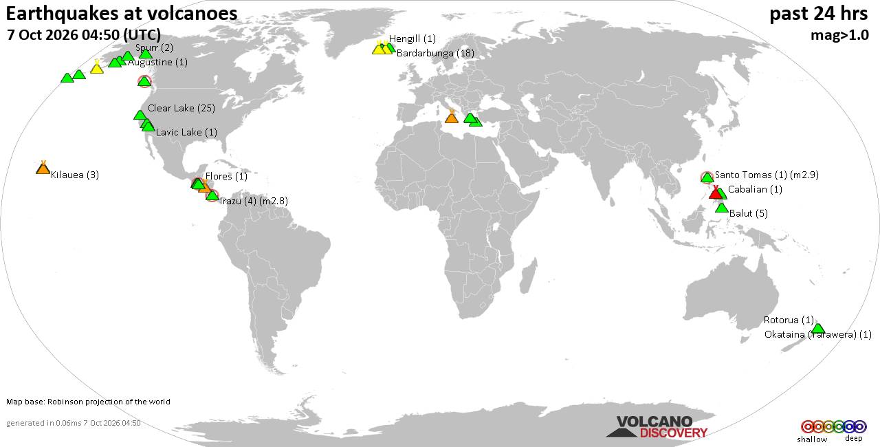
Volcano earthquake report for Wednesday, 7 October 2026
• M 1.2 - 10 km SSW of Idyllwild, CA
• M 1.7 - 10 km W of Boonville, CA
• M 2.4 - 6 km SE of Chickasha, Oklahoma
• M 1.5 - 1 km WNW of Loma Linda, CA
• M 1.5 - 49 km SSE of Tanana, Alaska
• M 1.7 - 8 km ESE of Prunedale, CA
|
|
|
Joined: Feb 2001
Posts: 678,977
Launch Director
|
|
Launch Director
Joined: Feb 2001
Posts: 678,977 |
SPC Oct 7, 2026 Day 4-8 Severe Weather OutlookDay 4-8 Outlook 
Day 4-8 Convective Outlook
NWS Storm Prediction Center Norman OK
0326 AM CDT Wed Oct 07 2026

Valid 101200Z - 151200Z

...DISCUSSION...
For Sat/D4, the latest NHC guidance (as of this writing) has brought
the center track of the developing hurricane farther east toward
southern AL and the western FL Panhandle, and thus the Slight Risk
for tornado potential has been shunted east. Further, given the
likelihood of a stronger cyclone and faster forward motion, the
Slight Risk has also been expanded farther north/inland, as it
appears the mid 70s F dewpoints may expand across much of southern
AL. The strong low-level shear east of the center, and increasing
midlevel winds (as a shortwave trough deepens over the Lower MS
Valley) should support a few supercells with tornado potential. It
should be noted that the Slight Risk area may shift in subsequent
outlooks if the center track shifts.

For Sun/D5, the shortwave trough and remnants of the tropical
cyclone will generally move northeastward toward the Appalachians
and toward the Carolinas and southern Mid Atlantic. It is possible
that the upper system outruns the unstable warm sector, but at least
a low end chance of severe is not out of the question.

For the remainder of the period, there may be a chance of severe
storms over parts of the Southern Plains into Wed/D8 as a developing
western trough eventually moves across the Rockies, and low-level
moisture returns in earnest. However, the evolution of this trough
and date of wave ejection is low predictability.
Read morehttps://www.spc.noaa.gov/products/exper/day4-8/
|
|



CMS The Best Conveyancing solicitors conveyancing quotes throughout the UK
For any webhosting enquiries please email webmaster@aus-city.com
|
|
Forums60
Topics862,309
Posts897,104
Members2,960
| |
Most Online102,106
Jul 10th, 2026
|
|
|
|
|

|









































