|
0 members (),
2,422
guests, and
26
robots. |
|
Key:
Admin,
Global Mod,
Mod
|
|
S |
M |
T |
W |
T |
F |
S |
|
|
|
|
|
1
|
2
|
3
|
|
4
|
5
|
6
|
7
|
8
|
9
|
10
|
|
11
|
12
|
13
|
14
|
15
|
16
|
17
|
|
18
|
19
|
20
|
21
|
22
|
23
|
24
|
|
25
|
26
|
27
|
28
|
29
|
30
|
31
|
|
There are no members with birthdays on this day. |
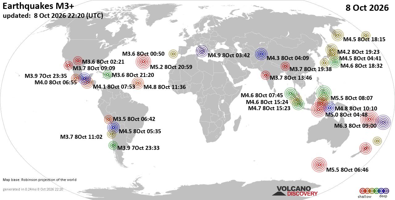
World Earthquake Report for Thursday, 8 October 2026
• M 4.2 - off the coast of Oregon
• M 0.7 - 2 km NE of Imperial Beach, CA
• M 0.1 - 5 km WNW of Cobb, CA
• M 1.4 - 11 km SSE of Malibu Beach, CA
• M 1.6 - 15 km NNW of Fishhook, Alaska
|
|
|
Joined: Feb 2001
Posts: 678,977
Launch Director
|
|
Launch Director
Joined: Feb 2001
Posts: 678,977 |
SPC Oct 8, 2026 1930 UTC Day 3 Severe Thunderstorm OutlookSPC 1930Z Day 3 Outlook 
Day 3 Convective Outlook
NWS Storm Prediction Center Norman OK
0230 PM CDT Thu Oct 08 2026

Valid 101200Z - 111200Z

...THERE IS A SLIGHT RISK OF SEVERE THUNDERSTORMS SATURDAY ACROSS
PARTS OF THE FLORIDA BIG BEND/PANHANDLE AND EASTERN ALABAMA INTO
GEORGIA...

...SUMMARY...
A corridor of tornado risk may develop out of the Florida Panhandle
and into parts of eastern Alabama and Georgia Saturday through
Saturday night.

...Discussion...
Models indicate considerable further amplification of large-scale
mid/upper troughing along much of the U.S. Pacific coast Saturday
through Saturday night.  It appears that this may include the
east-northeastward acceleration of a short wave trough into/across
southern California and northern Baja coastal areas, preceded by the
inland acceleration of remnants of Rachel into the lower Colorado
Valley by 12Z Sunday.

Downstream, broad mid/upper ridging is forecast to build within the
stronger mid-latitude westerlies, east of the Rockies through the
Atlantic Seaboard.  However, within a lingering weaker branch of
westerlies, a developing mid-level low, including remnants of
Isaias, is forecast to begin gradually turning northward and
northeastward, around the northwestern periphery of westward
building mid/upper ridging across the subtropical western Atlantic
through the northern Caribbean and southeastern Gulf Basin.

...Southeast...
The weakening low-level circulation center of Isaias is forecast to
continue accelerating northward, across western Alabama during the
day Saturday, before slowing across the lower Tennessee Valley
Saturday night.  As it progresses away from the Gulf coast, and
increasingly displaced from the better low-level moisture return off
the Gulf, the associated risk for severe weather seems likely to
diminish.

Guidance suggests that the return of higher low-level moisture
content will remain focused along/east of weak surface troughing,
developing along the southwestern flank of a surface ridge slowly
shifting across and offshore of middle/northern Atlantic coastal
areas.  It appears that this will generally set up across Georgia
into parts of the Carolinas, where boundary-layer dew points
increasing into the 70s F probably will contribute to at least
modest CAPE on the order of 1000+ J/kg, despite weak lapse rates.
Coupled with the maintenance of at least moderate southerly 850
flow, and enlarged low-level hodographs, forcing for ascent
downstream of the approaching mid-level low/trough may support
continuing convective development, including supercell structures,
Saturday into Saturday night.  Some of this activity may pose a risk
for tornadoes and/or locally damaging wind gusts.

Due to lingering forecast uncertainties, including those associated
with the extended time frame involved, the Slight Risk area has not
been changed at the  present time.  However, this may need to be
adjusted in later outlooks for this period.

..Kerr.. 10/08/2026
Read morehttps://www.spc.noaa.gov/products/outlook/day3otlk_1930.html
|
|



CMS The Best Conveyancing solicitors conveyancing quotes throughout the UK
For any webhosting enquiries please email webmaster@aus-city.com
|
|
Forums60
Topics864,565
Posts899,360
Members2,960
| |
Most Online102,106
Jul 10th, 2026
|
|
|









































