|
1 members (Webmaster),
1,617
guests, and
24
robots. |
|
Key:
Admin,
Global Mod,
Mod
|
|
S |
M |
T |
W |
T |
F |
S |
|
|
|
|
|
1
|
2
|
3
|
|
4
|
5
|
6
|
7
|
8
|
9
|
10
|
|
11
|
12
|
13
|
14
|
15
|
16
|
17
|
|
18
|
19
|
20
|
21
|
22
|
23
|
24
|
|
25
|
26
|
27
|
28
|
29
|
30
|
31
|
|
There are no members with birthdays on this day. |
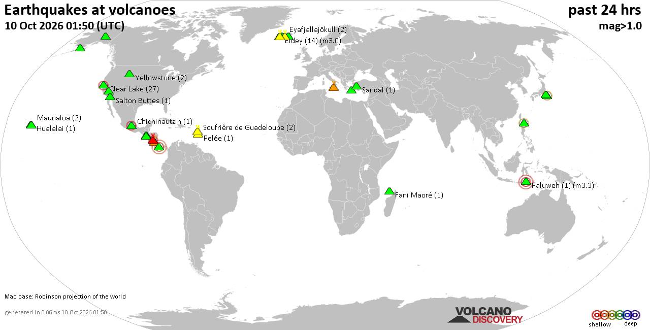
Volcano earthquake report for Saturday, 10 October 2026
• M 1.7 - 8 km W of Palomar Observatory, CA
• Moderate mag. 4.5 earthquake - Tonga on Saturday, Oct 10, 2026, at 08:38 am...
• M 2.2 - 6 km SE of Houston, Alaska
• M 2.0 - 9 km NNE of Pāhala, Hawaii
• M 3.2 - 2 km SW of Signal Hill, CA
|
|
|
Joined: Feb 2001
Posts: 678,977
Launch Director
|
|
Launch Director
Joined: Feb 2001
Posts: 678,977 |
Issued at 200 AM PDT Sat Oct 10 2026 000
WTPZ43 KNHC 100853
TCDEP3
Tropical Storm Rachel Discussion Number 53
NWS National Hurricane Center Miami FL EP182026
200 AM PDT Sat Oct 10 2026
Satellite imagery indicates that Rachel's convective organization
has changed little over the past several hours, with the deepest
convection remaining confined to the northern and northeastern
portions of the circulation due to increasing southwesterly vertical
wind shear. A 0505 UTC ASCAT-B scatterometer pass revealed peak
winds of around 46 kt and an expanding wind field, which helped
refine the initial wind radii. Based on these data, the initial
intensity is set at 50 kt.
The initial motion is northeastward, or 050/19 kt. A turn toward the
north-northeast, accompanied by additional acceleration to around 25
kt, is expected during the next 24 h as Rachel interacts with a
deepening mid- to upper-level trough over the western United States.
This motion should bring Rachel ashore just south of the
U.S./Mexico border tonight, followed by a rapid north-northeastward
motion into the southwestern United States. Track guidance has
shifted slightly to the right compared to 24 hours ago, but has
changed little since the previous cycle. The latest NHC track
forecast is essentially unchanged from the previous prediction and
lies close to the HCCA and GDMI aids.
Some additional strengthening is possible during the next 12 to 24 h
as Rachel accelerates northeastward and interacts with the deepening
upper-level trough. The NHC intensity forecast shows Rachel
strengthening to 55 kt before moving inland tonight. Rachel's wind
field has also begun to expand, and additional expansion is
possible as the cyclone accelerates northeastward and
interacts with the upper-level trough. This could result in
tropical-storm-force winds extending farther from the center as
Rachel begins to lose its tropical characteristics. Rachel is
expected to weaken rapidly after landfall as it encounters the
mountainous terrain of northern Baja California and the southwestern
United States. The cyclone is forecast to become post-tropical by 36
h and dissipate by 48 h. The latest NHC intensity forecast is
similar to the previous prediction and lies near the middle to upper
end of the guidance envelope.
Key Messages:
1. Rachel is expected to approach and move ashore along the coast of
northern Baja California or extreme Southern California at tropical
storm strength tonight. Tropical storm conditions are expected in
portions of northern Baja California, Mexico, where Tropical Storm
Warnings are in effect. Tropical storm conditions are also possible
in extreme Southern California, eastern Baja California, and
portions of northwestern Mexico where Tropical Storm Watches are in
effect.
2. Damaging wind gusts associated with Rachel and its remnants are
expected to spread over portions of northwestern Mexico and interior
portions of the Southwest United States, especially in areas of
higher terrain, tonight and Sunday.
3. Rachel and its moisture will spread over portions of the
Southwest United States and northern Baja California peninsula
through this weekend. This will lead to increasing coverage of
rainfall and for the potential for significant flash and urban
flooding.
4. Waves generated by Rachel, combined with an incoming long-period
southerly swell, will produce life-threatening surf and rip current
conditions along the coasts of Southern California and northern Baja
California. Major coastal flooding has already been occurring in
some areas, with observed water levels running as much as 1.5 feet
above predictions. Coastal flooding and erosion are expected to
worsen tonight into Sunday morning as the highest waves associated
with Rachel coincide with high tides and already elevated water
levels. Hazardous coastal conditions are expected to continue into
early next week. Please consult products from your local weather
office.
FORECAST POSITIONS AND MAX WINDS
INIT 10/0900Z 24.2N 121.4W 50 KT 60 MPH
12H 10/1800Z 26.6N 119.0W 55 KT 65 MPH
24H 11/0600Z 31.0N 116.6W 55 KT 65 MPH
36H 11/1800Z 36.0N 114.1W 40 KT 45 MPH...POST-TROP/INLAND
48H 12/0600Z...DISSIPATED
$$
Forecaster Gibbs Source: Tropical Storm Rachel Forecast Discussion Number 53
|
|



CMS The Best Conveyancing solicitors conveyancing quotes throughout the UK
For any webhosting enquiries please email webmaster@aus-city.com
|
|
Forums60
Topics867,413
Posts902,209
Members2,960
| |
Most Online102,106
Jul 10th, 2026
|
|
|









































