|
0 members (),
1,508
guests, and
24
robots. |
|
Key:
Admin,
Global Mod,
Mod
|
|
S |
M |
T |
W |
T |
F |
S |
|
|
|
|
|
1
|
2
|
3
|
|
4
|
5
|
6
|
7
|
8
|
9
|
10
|
|
11
|
12
|
13
|
14
|
15
|
16
|
17
|
|
18
|
19
|
20
|
21
|
22
|
23
|
24
|
|
25
|
26
|
27
|
28
|
29
|
30
|
31
|
|
There are no members with birthdays on this day. |
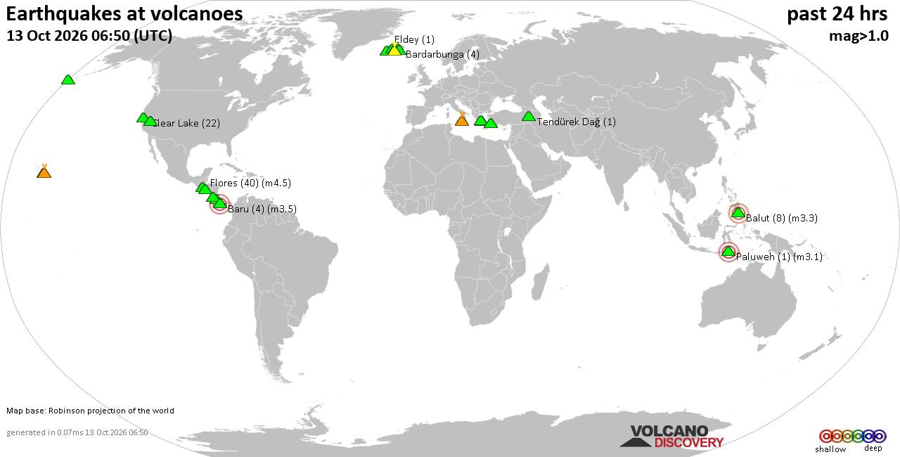
Volcano earthquake report for Tuesday, 13 October 2026
• M 0.7 - 77 km ENE of Akutan, Alaska
• M 1.3 - 34 km NE of Girdwood, Alaska
• M 2.0 - 24 km NE of Kelly, Wyoming
• M 1.9 - 18 km WSW of Gerlach, Nevada
• M 2.0 - 15 km NE of Milford, Utah
|
|
|
Joined: Feb 2001
Posts: 678,977
Launch Director
|
|
Launch Director
Joined: Feb 2001
Posts: 678,977 |
SPC Day 2 Fire Weather OutlookSPC Day 2 Fire Weather Outlook 
Day 2 Fire Weather Outlook
NWS Storm Prediction Center Norman OK
0242 PM CDT Tue Oct 13 2026

Valid 141200Z - 151200Z

...NO CRITICAL AREAS...

...Southern California...
An offshore wind event will begin to impact portions of southern CA
D2/Wednesday as a mid-level low pushes into the Four Corners region
and upper-level ridging evolves across the northwestern U.S. East to
northeast winds of 10-15 mph and commensurate downslope drying will
develop late D1/Tuesday into D2/Wednesday early afternoon. Localized
elevated fire weather conditions including wind speeds of 15-20 mph
coupled with RH of 15-20% in favored terrain gaps are expected in
western L.A. county and Ventura county, although recent light
rainfall and cooler temperatures have temporarily mitigated fuels.

..Williams.. 10/13/2026

.PREV DISCUSSION... /ISSUED 1241 AM CDT Tue Oct 13 2026/

...Synopsis...
A mid-level low over the Four Corners region will send an eastward
progressing cold front into eastern AZ/western NM on Day
2/Wednesday. High elevation snow is likely in southwestern to
central CO with precipitation chances spreading into the central
Plains as the trough lifts over northern CO. Farther west, an
offshore gradient will begin to develop on Day 2/Wednesday
afternoon, increasing east/northeast sustained winds to 15-25 mph in
terrain-favored areas of western L.A. county into Santa Barbara
county; thus, locally elevated fire weather conditions are possible
where dry fuels exist. The pressure gradient will strengthen late in
the Day 2/Wednesday period (early Thursday morning) leading into an
offshore wind event late this week (see the Day 3-8 Fire Weather
Outlook for details).

Meanwhile, high pressure will transition over the Southeast,
transporting rich Gulf moisture into the southern Plains and Ozarks.
As a result, anomalously high PWATs ranging from 1.8-2.2" and
afternoon large scale ascent are expected to promote areas of heavy
rainfall along a sagging cold front. This system is expected to
provide relief to drying fuels across the region, especially to
areas categorized by extreme to exceptional drought.

...Please see www.spc.noaa.gov/fire for graphic product...
Read morehttps://www.spc.noaa.gov/products/fire_wx/fwdy2.html
|
|



CMS The Best Conveyancing solicitors conveyancing quotes throughout the UK
For any webhosting enquiries please email webmaster@aus-city.com
|
|
Forums60
Topics873,543
Posts908,339
Members2,960
| |
Most Online102,106
Jul 10th, 2026
|
|
|









































