|
0 members (),
1,731
guests, and
26
robots. |
|
Key:
Admin,
Global Mod,
Mod
|
|
S |
M |
T |
W |
T |
F |
S |
|
|
|
|
|
1
|
2
|
3
|
|
4
|
5
|
6
|
7
|
8
|
9
|
10
|
|
11
|
12
|
13
|
14
|
15
|
16
|
17
|
|
18
|
19
|
20
|
21
|
22
|
23
|
24
|
|
25
|
26
|
27
|
28
|
29
|
30
|
31
|
|
There are no members with birthdays on this day. |
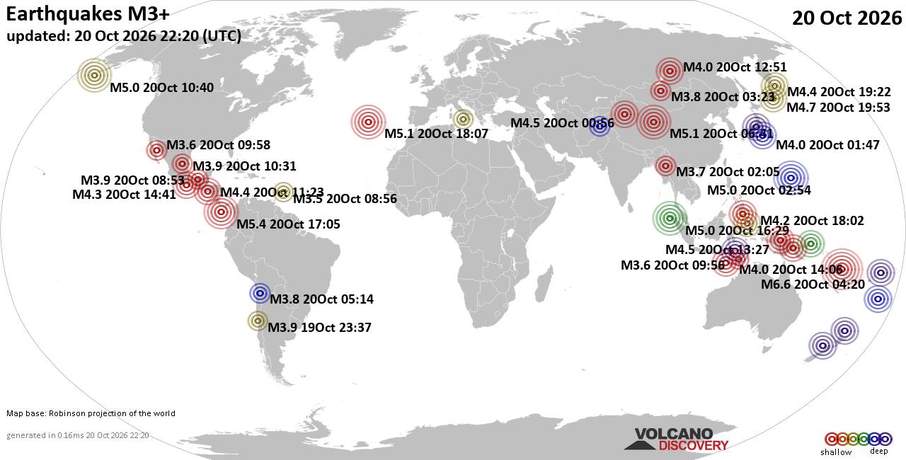
World Earthquake Report for Tuesday, 20 October 2026
• M 2.1 - 5 km SSW of Pāhala, Hawaii
• M 1.5 - 15 km NNE of Milford, Utah
• M 0.9 - 6 km WNW of Cobb, CA
• M 4.4 - 52 km S of Champerico, Guatemala
• M 1.9 - 8 km N of Redwood Valley, CA
|

#917869
Sun 18 Oct 2026 08:33:AM
|
Joined: Feb 2001
Posts: 678,977
Launch Director
|
|
Launch Director
Joined: Feb 2001
Posts: 678,977 |
Issued at 200 AM MST Sun Oct 18 2026 000
WTPZ41 KNHC 180833
TCDEP1
Hurricane Trudy Discussion Number 20
NWS National Hurricane Center Miami FL EP212026
200 AM MST Sun Oct 18 2026
Trudy has strengthened a little more tonight. Satellite images show
that the eye has become more distinct and deep convection is better
organized, especially on the west side of the circulation. The
latest satellite intensity estimates have increased slightly, and
the initial intensity is nudged up to 90 kt, in agreement with the
TAFB Dvorak classification. The outer rainbands are affecting
portions of southwestern and west-central Mexico, likely producing
heavy rains and strong winds. These conditions will likely persist
for several more hours. A partial ASCAT-B pass that caught the east
side of the circulation suggests that the hurricane has a slightly
smaller wind field than previously estimated, and the initial wind
radii have been adjusted based on that information.
Trudy has been moving northwestward at about 9 kt over the past 12
hours. This motion is expected to continue today, but a significant
slowdown is forecast after that as the system weakens and is
steered by the lighter low- to mid-level flow. The NHC track
forecast has been nudged to the left toward the latest EMXI, GDMI,
and HCCA models. On the expected track, the hurricane will begin
pulling away from southwest and west-central Mexico tonight and then
move slowly south of Baja California Sur on Monday and Tuesday.
The hurricane could strengthen a little more this morning, but a
notable increase in southwesterly vertical wind shear and intrusions
of dry and stable air should cause Trudy to begin weakening later
today. Given the expected hostile atmospheric conditions, the
weakening is expected to be rapid, and Trudy is now forecast to
become a post-tropical cyclone by 60 hours and dissipate in 3 or 4
days. In fact, it would not be surprising if both of these occurred
sooner than predicted.
KEY MESSAGES:
1. Damaging hurricane-force winds, especially in gusts, are likely
within the hurricane warning area today.
2. A dangerous storm surge accompanied by damaging waves is likely
in areas of onshore winds within the warning areas.
3. Heavy rainfall associated with Trudy will continue across the
southwest Mexican coast between Guerrero and Nayarit today. This
rainfall may produce life-threatening flooding and mudslides along
and near the southwest Mexican coast in Michoacán, Colima, and
Jalisco, especially in areas along steep terrain.
4. Large swells will continue to affect the coast of southwestern
Mexico and west-central Mexico during the next few days, causing
life-threatening surf and rip current conditions.
FORECAST POSITIONS AND MAX WINDS
INIT 18/0900Z 18.6N 106.3W 90 KT 105 MPH
12H 18/1800Z 19.5N 106.9W 90 KT 105 MPH
24H 19/0600Z 20.2N 107.5W 70 KT 80 MPH
36H 19/1800Z 20.4N 107.9W 55 KT 65 MPH
48H 20/0600Z 20.7N 108.5W 40 KT 45 MPH
60H 20/1800Z 21.1N 109.2W 30 KT 35 MPH...POST-TROP/REMNT LOW
72H 21/0600Z 21.6N 109.7W 25 KT 30 MPH...POST-TROP/REMNT LOW
96H 22/0600Z...DISSIPATED
$$
Forecaster Cangialosi Source: Hurricane Trudy Forecast Discussion Number 20
|
|



CMS The Best Conveyancing solicitors conveyancing quotes throughout the UK
For any webhosting enquiries please email webmaster@aus-city.com
|
|
Forums60
Topics885,562
Posts920,359
Members2,960
| |
Most Online102,106
Jul 10th, 2026
|
|
|









































