|
0 members (),
1,547
guests, and
23
robots. |
|
Key:
Admin,
Global Mod,
Mod
|
|
S |
M |
T |
W |
T |
F |
S |
|
|
|
|
|
1
|
2
|
3
|
|
4
|
5
|
6
|
7
|
8
|
9
|
10
|
|
11
|
12
|
13
|
14
|
15
|
16
|
17
|
|
18
|
19
|
20
|
21
|
22
|
23
|
24
|
|
25
|
26
|
27
|
28
|
29
|
30
|
31
|
|
There are no members with birthdays on this day. |
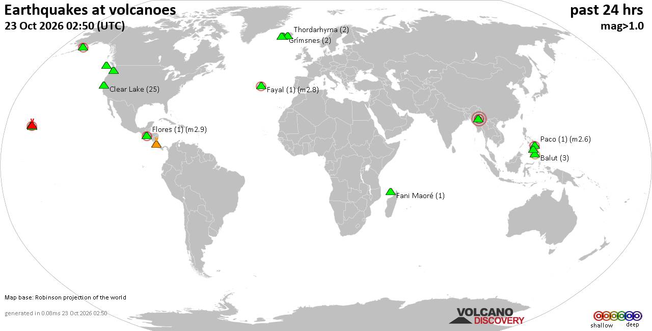
Volcano earthquake report for Friday, 23 October 2026
• M 4.0 - 42 km SSE of Acajutla, El Salvador
• M 3.2 - 23 km WSW of Gustine, CA
• M 0.6 - 22 km WSW of Dutch Harbor, Alaska
• M 0.6 - 43 km ENE of Pedro Bay, Alaska
• M 4.8 - 131 km ENE of Tadine, New Caledonia
|
|
|
Joined: Feb 2001
Posts: 678,977
Launch Director
|
|
Launch Director
Joined: Feb 2001
Posts: 678,977 |
SPC Day 1 Fire Weather OutlookSPC Day 1 Fire Weather Outlook 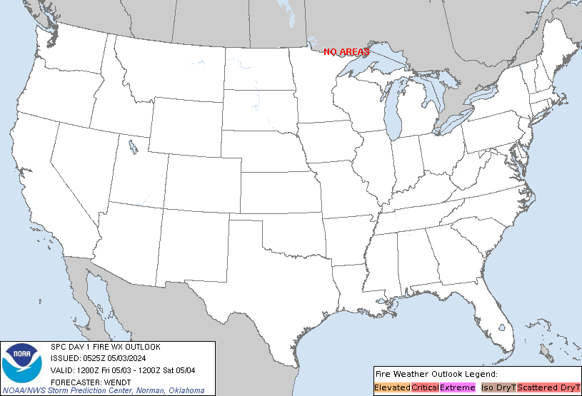
Day 1 Fire Weather Outlook
NWS Storm Prediction Center Norman OK
0145 AM CDT Fri Oct 23 2026

Valid 231200Z - 241200Z

...CRITICAL FIRE WEATHER AREA FOR PORTIONS OF NORTHEAST
WYOMING...FAR SOUTHEASTERN MONTANA...AND FAR WESTERN SOUTH DAKOTA...

...Synopsis...
Upper-level troughing across the Southwest will lift north into the
Intermountain West today, with a belt of enhanced west to
southwesterly flow overspreading the northern/central Rockies. A
surface low will deepen across Montana, with increasing
southwesterly surface gradients resulting in strengthening surface
southwesterly flow ahead of an approaching cold front. Elevated to
Critical fire weather conditions will be likely ahead of the front
for portions of the Northern High Plains.

...Northern High Plains...
The strengthening of the surface winds in combination with downslope
warming/drying will result in a period of Elevated to Critical fire
weather conditions across portions of northeastern WY, southeastern
MT, and western SD. Within these regions, afternoon relative
humidity reductions to around 15-25% will overlap with sustained
southwesterly winds at 20-30 mph. Additionally, above normal
temperatures in the 60s and lower 70s F are forecast. A Critical
delineation was maintained across portions of northeastern WY,
southeastern MT, and western SD where ensemble guidance continues to
show highest probabilities of sustained critical fire weather
conditions amid drying fuels (70-75th percentile ERCs). Broader
Elevated fire weather is expected from north-central Wyoming into
the Dakotas.

...Georgia...
Dry northeasterly flow is expected across portions of southern
Georgia this afternoon. Though wind speeds are likely to remain
below elevated thresholds, increased initial attack activity
associated with existing dry fuels will remain a concern.

..Thornton.. 10/23/2026

...Please see www.spc.noaa.gov/fire for graphic product...
Read morehttps://www.spc.noaa.gov/products/fire_wx/fwdy1.html
|
|



CMS The Best Conveyancing solicitors conveyancing quotes throughout the UK
For any webhosting enquiries please email webmaster@aus-city.com
|
|
Forums60
Topics889,849
Posts924,646
Members2,960
| |
Most Online102,106
Jul 10th, 2026
|
|
|









































