|
0 members (),
1,551
guests, and
22
robots. |
|
Key:
Admin,
Global Mod,
Mod
|
|
S |
M |
T |
W |
T |
F |
S |
|
|
|
|
|
1
|
2
|
3
|
|
4
|
5
|
6
|
7
|
8
|
9
|
10
|
|
11
|
12
|
13
|
14
|
15
|
16
|
17
|
|
18
|
19
|
20
|
21
|
22
|
23
|
24
|
|
25
|
26
|
27
|
28
|
29
|
30
|
31
|
|
There are no members with birthdays on this day. |
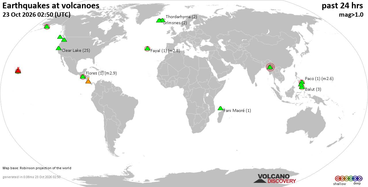
Volcano earthquake report for Friday, 23 October 2026
• M 1.9 - 4 km NE of Santa Rosa, CA
• Moderate mag. 4.2 earthquake - Provincia de Cachapoal, Region del Libertado...
• M 1.3 - 9 km SSW of Beaumont, CA
• Moderate mag. 4.8 earthquake - Taiwan on Friday, Oct 23, 2026, at 08:58 pm ...
• M 4.6 - south of the Kermadec Islands
• M 1.9 - 49 km NW of Toyah, Texas
|
|
|
Joined: Feb 2001
Posts: 678,977
Launch Director
|
|
Launch Director
Joined: Feb 2001
Posts: 678,977 |
SPC Day 2 Fire Weather OutlookSPC Day 2 Fire Weather Outlook 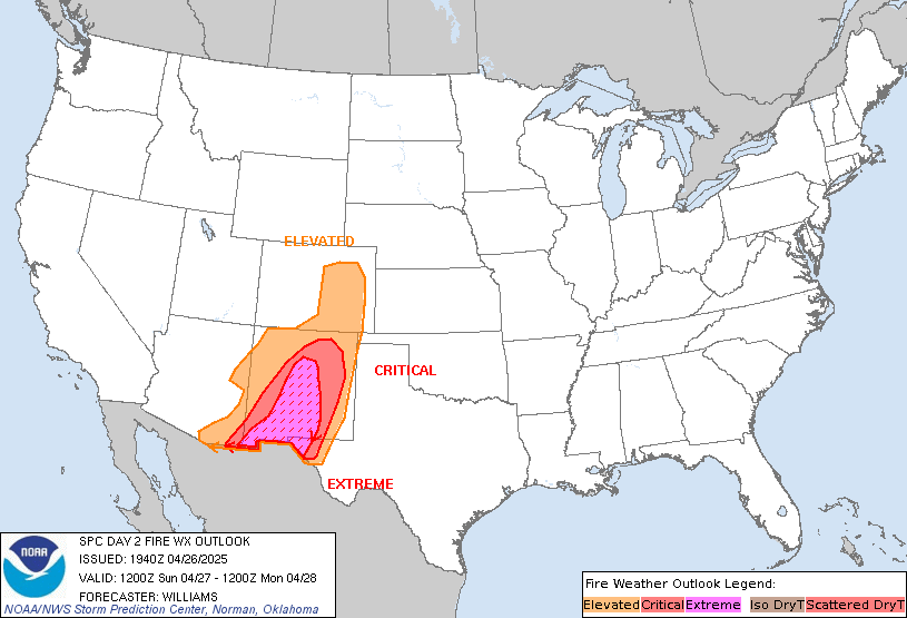
Day 2 Fire Weather Outlook
NWS Storm Prediction Center Norman OK
0213 PM CDT Fri Oct 23 2026

Valid 241200Z - 251200Z

...NO CRITICAL AREAS...

Reduced fire weather concerns are expected across CONUS on Saturday
with a limited overlap of dry and breezy conditions over receptive
fuels. Dry northeast low-level flow on the southern periphery of
surface high pressure across the eastern U.S., will keep Gulf
moisture shunted to the south through Saturday across much of the
Southeast into the lower MS River Valley. As above normal
temperatures rise into the lower 80s, resultant RH reductions to
20-30% will develop within the Lower MS River Valley into the
ArkLaTex region where receptive fuels exist (ERCs in the 90-95th
percentile). However, east/northeast winds will remain light at or
below 10 mph over much of the region limiting a broader fire weather
threat.

..Williams.. 10/23/2026

.PREV DISCUSSION... /ISSUED 0148 AM CDT Fri Oct 23 2026/

...Synopsis...
Fire weather concerns are expected to remain low on D2/Saturday. A
cold front will bring cooler conditions and increasing relative
humidity across the Northern High Plains. Breezy northeast winds
will overlap dry fuels across portions of southern Georgia Saturday
afternoon. Current forecast guidance indicates that afternoon RHs
will struggle to fall below 40-45% where winds are anticipated to be
the strongest (10-15 mph), precluding the need for any drawn areas.

...Please see www.spc.noaa.gov/fire for graphic product...
Read morehttps://www.spc.noaa.gov/products/fire_wx/fwdy2.html
|
|



CMS The Best Conveyancing solicitors conveyancing quotes throughout the UK
For any webhosting enquiries please email webmaster@aus-city.com
|
|
Forums60
Topics891,075
Posts925,872
Members2,960
| |
Most Online102,106
Jul 10th, 2026
|
|
|









































