|
|
|
0 members (),
1,359
guests, and
32
robots. |
|
Key:
Admin,
Global Mod,
Mod
|
|
S |
M |
T |
W |
T |
F |
S |
|
|
|
|
|
1
|
2
|
3
|
|
4
|
5
|
6
|
7
|
8
|
9
|
10
|
|
11
|
12
|
13
|
14
|
15
|
16
|
17
|
|
18
|
19
|
20
|
21
|
22
|
23
|
24
|
|
25
|
26
|
27
|
28
|
29
|
30
|
31
|
|
There are no members with birthdays on this day. |
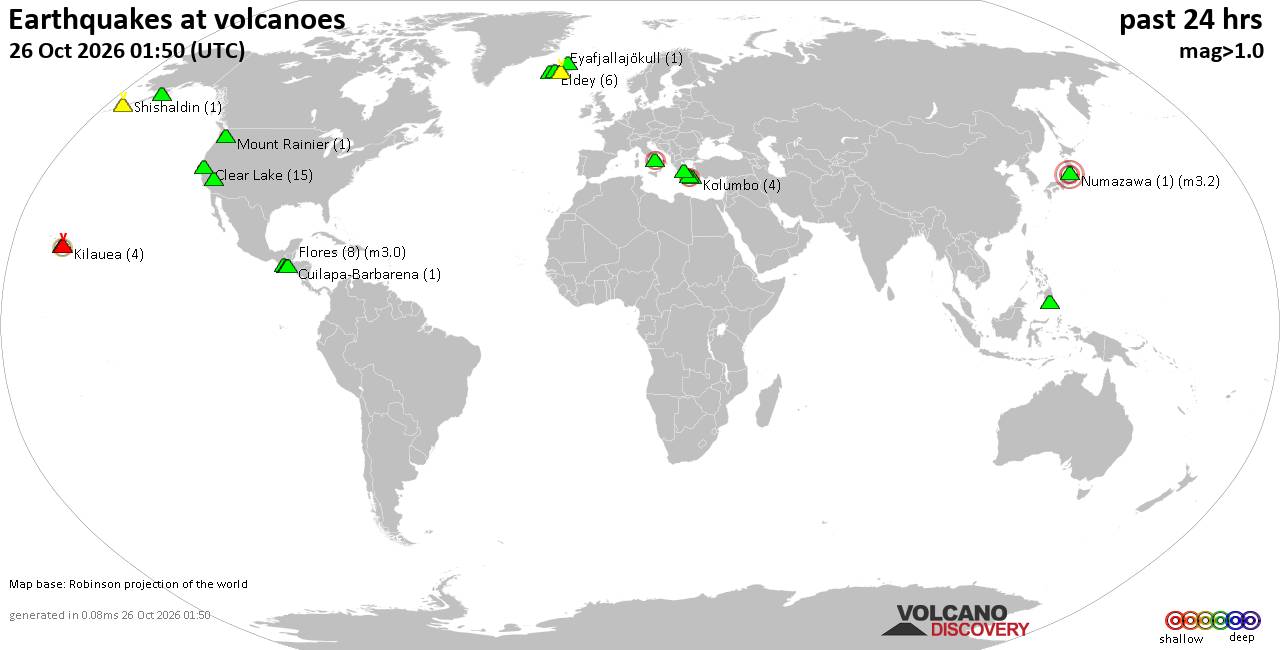
Volcano earthquake report for Monday, 26 October 2026
• M 0.5 - 7 km NW of Prague, Oklahoma
• M 2.3 - 14 km NE of Milford, Utah
• M 1.5 Quarry Blast - 6 km WNW of Catoosa, Oklahoma
• M 3.0 - 105 km ESE of Akutan, Alaska
• M 1.9 - 52 km SSW of Skwentna, Alaska
|
|
|
Joined: Feb 2001
Posts: 678,977
Launch Director
|
|
Launch Director
Joined: Feb 2001
Posts: 678,977 |
SPC Oct 26, 2026 1300 UTC Day 1 Convective OutlookSPC 1300Z Day 1 Outlook 
Day 1 Convective Outlook
NWS Storm Prediction Center Norman OK
0700 AM CDT Mon Oct 26 2026

Valid 261300Z - 271200Z

...NO SEVERE THUNDERSTORM AREAS FORECAST...

...SUMMARY...
Organized severe thunderstorms are not expected today.

...Far West TX...
The persistent upper trough over the southwest states is slowly
lifting northeastward today, with neutral to rising mid-level
heights expected over NM/west TX.  Water vapor imagery shows another
weak shortwave trough over northern Mexico that will approach far
west TX by late afternoon - likely aiding in the development of
scattered thunderstorms.  Forecast soundings show similar but
slightly weaker parameters compared to yesterday, so will maintain
less-than-5% severe probabilities over the region.  Nevertheless, a
strong storm or two is possible between El Paso and Midland TX, with
some risk of hail.

..Hart/Dean.. 10/26/2026
Read morehttps://www.spc.noaa.gov/products/outlook/day1otlk_1300.html
|
|



CMS The Best Conveyancing solicitors conveyancing quotes throughout the UK
For any webhosting enquiries please email webmaster@aus-city.com
|
|
Forums60
Topics894,782
Posts929,579
Members2,960
| |
Most Online102,106
Jul 10th, 2026
|
|
|
|
|

|









































