|
|
|
0 members (),
1,538
guests, and
23
robots. |
|
Key:
Admin,
Global Mod,
Mod
|
|
S |
M |
T |
W |
T |
F |
S |
|
|
|
|
|
1
|
2
|
3
|
|
4
|
5
|
6
|
7
|
8
|
9
|
10
|
|
11
|
12
|
13
|
14
|
15
|
16
|
17
|
|
18
|
19
|
20
|
21
|
22
|
23
|
24
|
|
25
|
26
|
27
|
28
|
29
|
30
|
31
|
|
There are no members with birthdays on this day. |
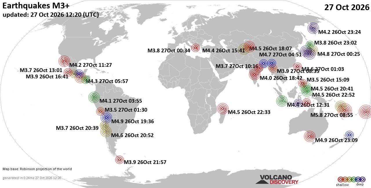
World Earthquake Report for Tuesday, 27 October 2026
• M 2.1 - 2 km E of Mountain Home, Arkansas
• M 1.8 - 17 km SE of Waynoka, Oklahoma
• M 4.6 - 100 km W of El Aguilar, Argentina
• M 4.6 - 100 km W of El Aguilar, Argentina
• M 4.6 - 100 km W of El Aguilar, Argentina
|
|
|
Joined: Feb 2001
Posts: 678,977
Launch Director
|
|
Launch Director
Joined: Feb 2001
Posts: 678,977 |
SPC Oct 27, 2026 Day 4-8 Severe Weather OutlookDay 4-8 Outlook 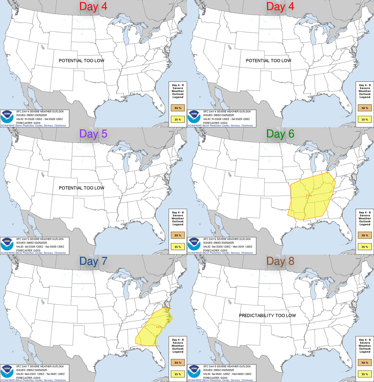
Day 4-8 Convective Outlook
NWS Storm Prediction Center Norman OK
0243 AM CDT Tue Oct 27 2026

Valid 301200Z - 041200Z

...DISCUSSION...
Severe potential appears low through Day 6/Sunday. Periods of
thunderstorms are possible from the southern/central Plains to the
Lower OH and TN Valleys during this time as a weak midlevel
shortwave trough slowly migrates east within a modest deep-layer
flow regime.

Medium-range forecast guidance suggests a deepening upper cyclone
and attendant trough will emerge from the western U.S. into the
Plains and Mid/Lower MS Valley vicinity Days 7-8/Monday-Tuesday.
Increasing southerly low-level flow via deepening surface
cyclogenesis will foster northward transport of rich Gulf moisture
ahead of an eastward-advancing cold front. Despite increasing
moisture, current forecast guidance maintains only modest
instability due to weak lapse rates and possible inhibition around
850-700 mb. This general pattern could support severe thunderstorms
depending on the evolution of the warm sector. However, uncertainty
is high due to large spread among forecast guidance in the placement
and timing of the upper trough. Trends will be monitored for
increasing severe potential across the south-central U.S. early next
week.
Read morehttps://www.spc.noaa.gov/products/exper/day4-8/
|
|



CMS The Best Conveyancing solicitors conveyancing quotes throughout the UK
For any webhosting enquiries please email webmaster@aus-city.com
|
|
Forums60
Topics896,508
Posts931,305
Members2,960
| |
Most Online102,106
Jul 10th, 2026
|
|
|
|
|

|









































