|
|
|
0 members (),
2,147
guests, and
27
robots. |
|
Key:
Admin,
Global Mod,
Mod
|
|
S |
M |
T |
W |
T |
F |
S |
|
|
|
|
|
1
|
2
|
3
|
|
4
|
5
|
6
|
7
|
8
|
9
|
10
|
|
11
|
12
|
13
|
14
|
15
|
16
|
17
|
|
18
|
19
|
20
|
21
|
22
|
23
|
24
|
|
25
|
26
|
27
|
28
|
29
|
30
|
31
|
|
There are no members with birthdays on this day. |
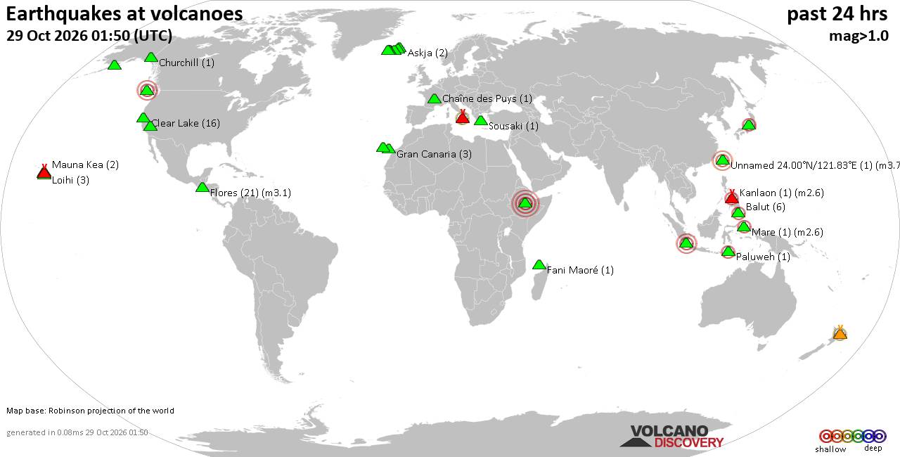
Volcano earthquake report for Thursday, 29 October 2026
• M 4.3 - 196 km WNW of Port-Olry, Vanuatu
• M 4.1 - 6 km NE of Pocrí, Panama
• M 2.7 - 2 km NE of Pacifica, CA
• M 1.8 - 26 km ESE of Fallon Station, Nevada
• M 2.3 - 14 km ESE of Pāhala, Hawaii
• M 1.8 - 13 km ESE of Naalehu, Hawaii
|
|
|
Joined: Feb 2001
Posts: 678,977
Launch Director
|
|
Launch Director
Joined: Feb 2001
Posts: 678,977 |
SPC Oct 29, 2026 0100 UTC Day 1 Convective OutlookSPC 0100Z Day 1 Outlook 
Day 1 Convective Outlook
NWS Storm Prediction Center Norman OK
0758 PM CDT Wed Oct 28 2026

Valid 290100Z - 291200Z

...THERE IS A MARGINAL RISK OF SEVERE THUNDERSTORMS ACROSS PARTS OF
THE UPPER MISSISSIPPI VALLEY...

...SUMMARY...
Thunderstorms with isolated severe gusts and hail will be possible
early this evening from parts of southeast Minnesota into western
and northern Wisconsin.

...Wisconsin/Far Southeast Minnesota...
On water vapor imagery, a subtle shortwave trough is currently
moving through the upper Mississippi Valley. At the surface, a 1009
mb low is analyzed across far northern Wisconsin with a cold front
extending southwestward into the mid Missouri Valley. A
southwest-to-northeast corridor of low-level moisture is located
ahead of the front, along which surface dewpoints are in the 50s to
near 60 F. Near this axis, the RAP has MLCAPE in the 500 to 1200
J/kg range. The instability, along with lift associated with a 40 to
50 knot low-level jet, and large-scale ascent ahead of the shortwave
trough will continue to be favorable for convective development this
evening. The low-level jet combined with 60 to 70 knots of mid-level
west-southwesterly flow is creating strong deep-layer shear, which
will support a localized severe threat early this evening. Cells
that exhibit rotation could be capable of isolated severe wind gusts
and hail. However, the mode has transitioned to mostly linear
suggesting that any threat will be marginal early this evening...see
MCD 2417.

..Broyles.. 10/29/2026
Read morehttps://www.spc.noaa.gov/products/outlook/day1otlk_0100.html
|
|



CMS The Best Conveyancing solicitors conveyancing quotes throughout the UK
For any webhosting enquiries please email webmaster@aus-city.com
|
|
Forums60
Topics899,787
Posts934,584
Members2,960
| |
Most Online102,106
Jul 10th, 2026
|
|
|
|
|

|









































