|
|
|
0 members (),
3,669
guests, and
19
robots. |
|
Key:
Admin,
Global Mod,
Mod
|
|
S |
M |
T |
W |
T |
F |
S |
|
1
|
2
|
3
|
4
|
5
|
6
|
7
|
|
8
|
9
|
10
|
11
|
12
|
13
|
14
|
|
15
|
16
|
17
|
18
|
19
|
20
|
21
|
|
22
|
23
|
24
|
25
|
26
|
27
|
28
|
|
29
|
30
|
|
|
|
|
|
|
There are no members with birthdays on this day. |
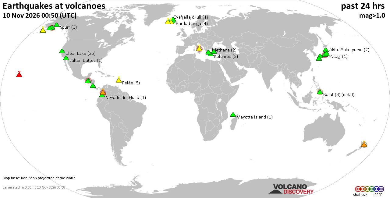
Volcano earthquake report for Tuesday, 10 November 2026
• M -0.6 - 63 km ENE of Pedro Bay, Alaska
• M 0.6 - 47 km ENE of Adak, Alaska
• M 2.3 - 54 km ENE of Susitna North, Alaska
• M 1.4 - 60 km WNW of Nikiski, Alaska
• M 1.1 - 109 km S of McCarthy, Alaska
|

#940202
Sat 31 Oct 2026 12:36:AM
|
Joined: Feb 2001
Posts: 800,656
Launch Director
|
|
Launch Director
Joined: Feb 2001
Posts: 800,656 |
SPC Oct 31, 2026 0100 UTC Day 1 Convective OutlookSPC 0100Z Day 1 Outlook 
Day 1 Convective Outlook
NWS Storm Prediction Center Norman OK
0733 PM CDT Fri Oct 30 2026

Valid 310100Z - 311200Z

...THERE IS A MARGINAL RISK OF SEVERE THUNDERSTORMS ACROSS PARTS OF
SOUTHERN AND CENTRAL ARIZONA...

...SUMMARY...
Thunderstorms with isolated severe wind gusts and hail will be
possible this evening in parts of southern and central Arizona.

...Arizona...
The latest water vapor imagery shows a shortwave trough over the
Desert Southwest with a notable dry slot extending from southern
California into western Arizona. At the surface, a 1004 mb low is
located in the Sierra Nevada of eastern California with a trough
extending southeastward into southwestern Arizona. Surface dewpoints
along the surface trough are in the upper 50s to mid 60s F.
Low-level convergence along the surface trough and large-scale
ascent associated with the upper-level system have contributed to
recent convective development across parts of western and central
Arizona. Cell initiation will continue to be possible near the
surface trough for much of the evening. In addition, the RAP has an
axis of instability extending from northern Mexico into central
Arizona, where MLCAPE is estimated in the 1000 to 1200 J/kg range.
The WSR-88D VWP at Phoenix is sampling the wind profile east of the
instability axis and has 0-6 km shear around 30 knots with gradually
veering winds with height in the low to mid-levels. This should
support an isolated severe threat with rotating cells. Isolated
severe wind gusts and hail will be the primary threats over the next
few hours.

..Broyles.. 10/31/2026
Read morehttps://www.spc.noaa.gov/products/outlook/day1otlk_0100.html
|
|



CMS The Best Conveyancing solicitors conveyancing quotes throughout the UK
For any webhosting enquiries please email webmaster@aus-city.com
|
|
Forums60
Topics919,598
Posts954,395
Members2,960
| |
Most Online102,106
Jul 10th, 2026
|
|
|
|
|

|









































