|
|
|
0 members (),
1,790
guests, and
44
robots. |
|
Key:
Admin,
Global Mod,
Mod
|
|
S |
M |
T |
W |
T |
F |
S |
|
1
|
2
|
3
|
4
|
5
|
6
|
7
|
|
8
|
9
|
10
|
11
|
12
|
13
|
14
|
|
15
|
16
|
17
|
18
|
19
|
20
|
21
|
|
22
|
23
|
24
|
25
|
26
|
27
|
28
|
|
29
|
30
|
|
|
|
|
|
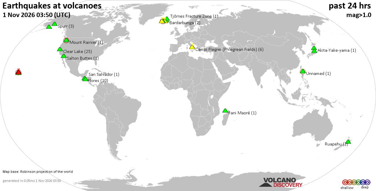
Volcano earthquake report for Sunday, 1 November 2026
• M 1.8 - 6 km S of Pāhala, Hawaii
• M 3.4 - 51 km SSW of Nikolski, Alaska
• M 2.5 - 27 km WSW of Westley, CA
• M 2.7 - 10 km WSW of Stanton, Texas
• M 0.6 - 72 km WNW of Beluga, Alaska
• M 0.7 - 3 km WNW of Julian, CA
|
|
|
Joined: Feb 2001
Posts: 678,977
Launch Director
|
|
Launch Director
Joined: Feb 2001
Posts: 678,977 |
SPC Nov 1, 2026 0600 UTC Day 2 Convective OutlookSPC 0600Z Day 2 Outlook 
Day 2 Convective Outlook
NWS Storm Prediction Center Norman OK
0102 AM CDT Sun Nov 01 2026

Valid 021200Z - 031200Z

...THERE IS A SLIGHT RISK OF SEVERE THUNDERSTORMS OVER MUCH OF
OKLAHOMA...NORTHERN TEXAS...AND SOUTH-CENTRAL AND EASTERN KANSAS...

...SUMMARY...
Scattered severe storms are expected across parts of the central and
southern Plains late Monday afternoon into the evening, with
damaging wind gusts and a few tornadoes the main threats.

...Synopsis...
A deep upper trough will move out of the Rockies and into the
Plains, with a leading speed max moving swiftly across western TX
and toward the MO Valley during the day. Meanwhile, a stronger speed
max will move across NM and into KS, OK, and northwest TX by late in
the day, and across the remainder of KS and OK overnight.

A surface low will deepen across central NE, with a cold front
moving into western NE and KS. A dryline will extend roughly from
central KS into western OK and west-central TX by 00Z, with mid 60s
F dewpoints across the warm sector. A 50-60 kt southerly low-level
jet will develop late in the day into the overnight period, also
aiding northward advection of moisture. At least a narrow zone of
supercell potential is evident near the dryline late in the day,
with a few tornadoes and damaging wind possible. The severe risk
should persist through the late evening with damaging winds and
possible QLCS storm mode, along with an isolated tornado risk.

...Parts of northern TX across OK and into eastern KS...
Capping due to relatively cool boundary-layer temperatures will
inhibit storms for much of the day, with a zone of steeper low-level
lapse rates near the dryline. Initial cell development is expected
there, from south-central KS into western OK and northwest TX after
21Z, with increasing coverage of storms through the evening as the
system continues eastward. Effective SRH of 200-300 m2/s2 will be
common, though effectiveness away from the dryline will depend on
how warm the boundary layer becomes. At the very least, initial
cells would appear to have a tornado risk, with sufficient
instability of 1000-1500 J/kg. A conditional risk of an EF2 tornado
exists due to favorable shear, and depending on destabilization.
Storms may become more linear with time as they move across OK,
north TX and eastern KS, with decreasing instability after 06Z.

..Jewell.. 11/01/2026
Read morehttps://www.spc.noaa.gov/products/outlook/day2otlk_0600.html
|
|



CMS The Best Conveyancing solicitors conveyancing quotes throughout the UK
For any webhosting enquiries please email webmaster@aus-city.com
|
|
Forums60
Topics904,994
Posts939,791
Members2,960
| |
Most Online102,106
Jul 10th, 2026
|
|
|
|
|

|









































