|
0 members (),
3,195
guests, and
16
robots. |
|
Key:
Admin,
Global Mod,
Mod
|
|
S |
M |
T |
W |
T |
F |
S |
|
1
|
2
|
3
|
4
|
5
|
6
|
7
|
|
8
|
9
|
10
|
11
|
12
|
13
|
14
|
|
15
|
16
|
17
|
18
|
19
|
20
|
21
|
|
22
|
23
|
24
|
25
|
26
|
27
|
28
|
|
29
|
30
|
|
|
|
|
|
|
There are no members with birthdays on this day. |
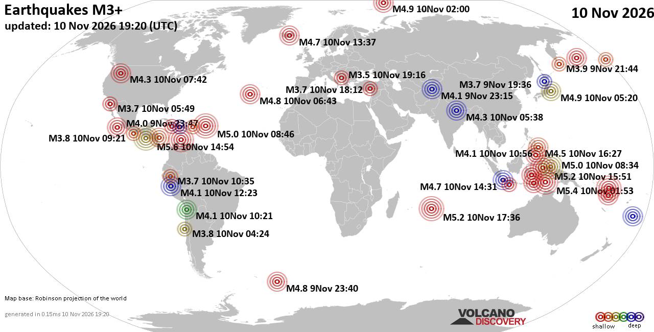
World Earthquake Report for Tuesday, 10 November 2026
• M 0.7 - 3 km SW of San Juan Bautista, CA
• Moderate mag. 4.1 earthquake - Philippine Sea, 52 km east of Siargao Island...
• M 1.3 - 15 km NNE of Milford, Utah
• M 2.0 - 37 km W of Petrolia, CA
• M 0.5 - 6 km SSW of Warner Springs, CA
• M 4.3 - 18 km SE of Joseph, Oregon
|

#944828
Tue 03 Nov 2026 12:00:AM
|
Joined: Feb 2001
Posts: 800,656
Launch Director
|
|
Launch Director
Joined: Feb 2001
Posts: 800,656 |
SPC MD 2435MD 2435 CONCERNING TORNADO WATCH 701... FOR NORTH-CENTRAL OKLAHOMA INTO SOUTH-CENTRAL/SOUTHEAST KANSAS 
Mesoscale Discussion 2435
NWS Storm Prediction Center Norman OK
0552 PM CST Mon Nov 02 2026

Areas affected...North-central Oklahoma into south-central/southeast
Kansas

Concerning...Tornado Watch 701...

Valid 022352Z - 030115Z

The severe weather threat for Tornado Watch 701 continues.

SUMMARY...Monitoring portions of north-central Oklahoma into
south-central/southeast Kansas for some increase in severe potential
during the next couple of hours -- within Tornado Watch #701.
Primary concerns are damaging winds and a couple of tornadoes.

DISCUSSION...A north/south-oriented line of thunderstorms is
tracking east-northeastward across much of central OK into far
south-central KS. In the near-term, an embedded cluster in the
northern portion of the line has shown signs of recent
intensification and will pose a risk of damaging wind gusts and
possibly sporadic hail over north-central OK.

High-resolution guidance suggests that a mesoscale low feature may
evolve eastward along the KS/OK border in response to strengthening
large-scale forcing for ascent overspreading the area. This,
combined with a gradually strengthening low-level jet and related
increase in hodograph size/curvature, may support a locally
favorable corridor for storm intensification during the next couple
of hours. The main uncertainties are the potential for a continued
messy mode evolution and increasing nocturnal static
stability/limited buoyancy. However, given the increasingly
favorable wind profile (see ICT VWP), any embedded
supercells/mesovorticies could pose a risk of damaging wind gusts, a
couple of tornadoes, and sporadic severe hail.

The overall threat will be maximized with any NNW/SSE-oriented
convective segments -- given southwesterly low/deep-layer shear
sampled by regional VWP.

..Weinman.. 11/02/2026

...Please see www.spc.noaa.gov for graphic product...

ATTN...WFO...ICT...OUN...

LAT...LON   36559809 37359788 37589772 37769734 37749695 37539675
            36969683 36599715 36379760 36369803 36559809

MOST PROBABLE PEAK TORNADO INTENSITY...100-125 MPH
MOST PROBABLE PEAK WIND GUST...55-70 MPH
MOST PROBABLE PEAK HAIL SIZE...UP TO 1.25 IN
Read morehttps://www.spc.noaa.gov/products/md/md2435.html
|
|



CMS The Best Conveyancing solicitors conveyancing quotes throughout the UK
For any webhosting enquiries please email webmaster@aus-city.com
|
|
Forums60
Topics920,725
Posts955,522
Members2,960
| |
Most Online102,106
Jul 10th, 2026
|
|
|









































